Category:French-language maps of Italy
Jump to navigation
Jump to search
Media in category "French-language maps of Italy"
The following 19 files are in this category, out of 19 total.
-
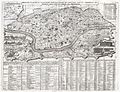 1721 Chatelain Plan or Map of Rome, Italy - Geographicus - Rome-chatelain-1720.jpg 3,500 × 2,687; 3.37 MB
-
 1832 Delamarche Map of Northern Italy and Corsica - Geographicus - ItalyN-d-32.jpg 3,000 × 2,116; 1.62 MB
-
 1839 Monin Map of Ancienne Italy Atlas Universel de Géographie Ancienne and Moderne.jpg 4,584 × 6,272; 7.37 MB
-

-
 Adriatic Sea map fr.png 441 × 600; 34 KB
-
 Adriatique Agathocle.jpg 2,249 × 2,999; 290 KB
-
 Arciamurra urbanisme.svg 1,052 × 744; 21 KB
-
 Carte climatique de l'Italie.PNG 541 × 632; 25 KB
-

-
 Central European Italy.png 662 × 783; 168 KB
-
 Interaction des plaques tectoniques en Italie.svg 810 × 784; 984 KB
-
 Italie - btv1b530211853.jpg 8,778 × 12,009; 20.84 MB
-
 Italie 1796.png 997 × 1,318; 221 KB
-
 1706 de la Feuille Map of Italy - Geographicus - Italy-lafeuille-1706.jpg 3,104 × 2,161; 1.44 MB
-
 Map of Italy (1402)-fr.png 3,321 × 3,837; 1.17 MB
-
 Propaganda nazi en Francia.JPG 2,304 × 3,072; 2.87 MB
-
 Villes Alpes.png 3,509 × 2,478; 676 KB
-
 Émigration italienne au Brésil (1876-1920).jpg 551 × 702; 173 KB
-
 Étrurie.png 1,500 × 1,821; 692 KB


.jpg)


-fr.png)


.jpg)
