Category:Friedhof (Dietkirchen)
Jump to navigation
Jump to search
| Object location | | View all coordinates using: OpenStreetMap |
|---|
Media in category "Friedhof (Dietkirchen)"
The following 3 files are in this category, out of 3 total.
-
 Dietkirchen, Friedhof, Kreuz.jpg 3,264 × 4,928; 7.77 MB
-
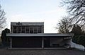 Dietkirchen, Friedhof, Trauerhalle.jpg 4,784 × 3,092; 6.06 MB
-
 Dietkirchen, Friedhof.jpg 4,928 × 3,264; 7.32 MB


