Category:Friedhofskapelle Werdau
Jump to navigation
Jump to search
| Object location | | View all coordinates using: OpenStreetMap |
|---|
cultural heritage monument in Saxony, cemetery in Werdau, Germany .jpg) | |||||
| Upload media | |||||
| Instance of | |||||
|---|---|---|---|---|---|
| Part of | |||||
| Location | Werdau, Zwickau, Saxony, Germany | ||||
| Street address |
| ||||
| Located on street | |||||
| Heritage designation | |||||
| Inception |
| ||||
 | |||||
| (Wikidata) |
Media in category "Friedhofskapelle Werdau"
The following 20 files are in this category, out of 20 total.
-
 Friedhof Werdau - Ansicht Friedhofskapelle von Westen.jpg 4,032 × 3,024; 8.2 MB
-
 Friedhof Werdau - Blick auf Friedhofskapelle von Westen.jpg 4,032 × 3,024; 7.84 MB
-
 Friedhof Werdau - Friedhofskapelle (Ansicht Nordost).jpg 4,032 × 3,024; 8.69 MB
-
 Friedhof Werdau - Friedhofskapelle (Ansicht Nordwest).jpg 4,032 × 3,024; 6.39 MB
-
 Friedhof Werdau - Friedhofskapelle (Ansicht Ost).jpg 4,032 × 3,024; 7.86 MB
-
 Friedhof Werdau - Friedhofskapelle (Ansicht Süd).jpg 4,032 × 3,024; 7.5 MB
-
 Friedhof Werdau - Friedhofskapelle (Ansicht Südwest).jpg 4,032 × 3,024; 6.72 MB
-
 Friedhof Werdau - Friedhofskapelle Ansicht Ostgiebel.jpg 3,024 × 4,032; 7.16 MB
-
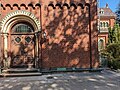
 Friedhof Werdau - Friedhofskapelle Detailansicht Hauptportal.jpg 3,024 × 4,032; 6.32 MB
-
 Friedhof Werdau - Friedhofskapelle Hauptportal ost.jpg 3,024 × 4,032; 6.12 MB
-
 Friedhof Werdau - Friedhofskapelle Nordportal.jpg 3,024 × 4,032; 5.77 MB
-
 Friedhof Werdau - Friedhofskapelle Seiteneingang Süd.jpg 4,032 × 3,024; 6.91 MB
-
 Friedhof Werdau - Friedhofskapelle Teilansicht Nordseite.jpg 3,024 × 4,032; 6.06 MB
-
 Friedhof Werdau - Friedhofskapelle Türen und Giebel im Osten.jpg 4,032 × 3,024; 6.15 MB
-
 Friedhof Werdau - südlicher Alleeweg mit Blick auf Friedhofskapelle.jpg 4,032 × 3,024; 9.78 MB
-
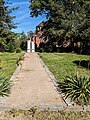
 Friedhof Werdau - südlicher Weg zur Friedhofskapelle.jpg 4,032 × 3,024; 7.51 MB
-
 Friedhof Werdau - Urnengrabstätte mit Blick auf Friedhofskapelle.jpg 3,024 × 4,032; 10.83 MB
-
 Friedhof Werdau - westlicher Vorplatz mit Blick auf Friedhofskapelle.jpg 4,032 × 2,268; 6 MB
-
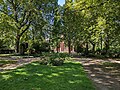 Friedhof Werdau - östliche Baumallee mit Blick auf Friedhofskapelle.jpg 4,032 × 3,024; 10.34 MB
-
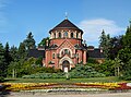 Werdau - Cemetery chapel (aka).jpg 6,000 × 4,434; 15.85 MB


.jpg)
.jpg)
.jpg)
.jpg)
.jpg)


