Category:Fuller projection
Jump to navigation
Jump to search
The Dymaxion map (Fuller projection ) is a projection onto the surface of a polyhedron, which can then be unfolded to a net in many different ways and flattened to form a two-dimensional map which retains most of the relative proportional integrity of the globe map.
- (en) Dymaxion map
- (es) Mapa Dymaxion
- (fr) Projection de Fuller
- (hu) Fuller-vetület
- (id) Peta Dymaxion
- (it) Proiezione di Fuller
- (pt) Mapa Dymaxi
- (ru) Проекция Димаксион
English: This map-projection-related category exists in the following hierarchy:
- Category:Map projections
- Category:Maps by projection
- Category:Fuller projection – media related to the Fuller projection other than maps
- Category:Maps with Fuller projection (“Category:Fuller projections”) – maps made using the Fuller projection
map projection  | |||||
| Upload media | |||||
| Instance of | |||||
|---|---|---|---|---|---|
| |||||
Subcategories
This category has the following 3 subcategories, out of 3 total.
F
- Maps with Fuller projection (21 F)
- Fuller projection lists (3 F)
Media in category "Fuller projection"
The following 31 files are in this category, out of 31 total.
-
 Based on Buckminster Fuller’s Dymaxion Airocean World.jpg 1,479 × 814; 384 KB
-
 Carte du monde de Fuller reconfigurée et redessinée.jpg 3,506 × 2,549; 448 KB
-
 Drawing lives and death Wikimania 2014 08.png 3,434 × 1,974; 776 KB
-
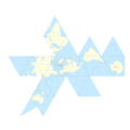
 Dymaxion 2003 animation small1.gif 364 × 235; 3.1 MB
-
Dymaxion 2003 animation small1.webm 17 s, 364 × 234; 394 KB
-
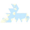
 Dymaxion map folded.png 343 × 345; 64 KB
-
 Dymaxion map ocean.png 668 × 465; 352 KB
-
 Dymaxion map ocean2.png 736 × 344; 319 KB
-
 Dymaxion Map of the World.png 8,792 × 4,231; 1.87 MB
-
 Dymaxion Projection Antarctic.png 2,560 × 2,560; 933 KB
-
 Dymaxion Projection Asia.png 2,560 × 2,560; 881 KB
-
 Dymaxion Projection Australia.png 2,560 × 2,560; 940 KB
-
 Dymaxion Projection Europe.png 2,560 × 2,560; 935 KB
-
 Dymaxion Projection North America.png 2,560 × 2,560; 688 KB
-
 Dymaxion Projection Oceania.png 2,560 × 2,560; 911 KB
-
 Dymaxion Projection South America.png 2,560 × 2,560; 940 KB
-
 Dymaxion projection.png 2,180 × 1,030; 1.26 MB
-
 Dymaxion with Tissot's Indicatrices of Distortion.svg 512 × 242; 321 KB
-
 Fuller projection rotated.svg 1,670 × 800; 573 KB
-
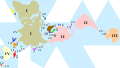
 Fuller Projection with Countries.svg 1,109 × 524; 301 KB
-
 Fuller projection with largest countries CIA.svg 512 × 288; 196 KB
-
 Fuller projection with largest countries.svg 512 × 341; 203 KB
-
 Fuller projection with largest islands.svg 512 × 288; 554 KB
-
 Fuller projection with largest lakes by area.svg 512 × 341; 553 KB
-
 Fuller projection with Tissot's indicatrix of deformation.png 3,638 × 1,734; 216 KB
-
 Fuller projection.svg 1,670 × 800; 736 KB
-
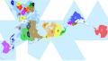
 Size of Empires (Fuller Projection).svg 1,848 × 3,624; 1.21 MB
-
 Spaceship Earth, 1982.jpg 3,786 × 2,492; 2.91 MB
-
 Subjectively constructed water-color.svg 512 × 341; 12 KB
-
 The Fuller projection with Tissot's indicatrix of deformation.svg 1,091 × 520; 300 KB
-
 Visionscarto-airocean.svg 700 × 475; 473 KB


.svg)


