Category:Gächliwil
Jump to navigation
Jump to search
| Object location | | View all coordinates using: OpenStreetMap |
|---|
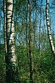
village and former municipality in Lüterswil-Gächliwil in the canton of Solothurn  | |||||
| Upload media | |||||
| Instance of |
| ||||
|---|---|---|---|---|---|
| Part of | |||||
| Location | Lüterswil-Gächliwil, Bucheggberg District, Bucheggberg-Wasseramt, Solothurn, Switzerland | ||||
| Elevation above sea level |
| ||||
| Replaced by | |||||
 | |||||
Subcategories
This category has only the following subcategory.
O
Media in category "Gächliwil"
The following 5 files are in this category, out of 5 total.
-
 Zentralbibliothek Solothurn Ernst Klöti 1473 Moos Gächliwil.jpg 4,184 × 6,400; 22.75 MB
-
 Zentralbibliothek Solothurn Ernst Klöti 1525 Westlich Gächliwil.jpg 6,415 × 4,184; 22.43 MB
-
 Zentralbibliothek Solothurn Ernst Klöti 1629 Moos.jpg 4,184 × 6,400; 18.02 MB
-
 Zentralbibliothek Solothurn Ernst Klöti 1702 Wohnwagen Gächliwil.jpg 6,415 × 4,184; 19.63 MB
-
 Zentralbibliothek Solothurn Ernst Klöti 2634 Gächliwil.jpg 6,415 × 4,184; 18.85 MB


