Category:Galicia (Spain) in the 18th century
Jump to navigation
Jump to search
Autonomous communities of Spain: Andalusia · Aragon · Asturias · Balearic Islands · Basque Autonomous Community · Canary Islands · Cantabria · Castile and León · Castile-La Mancha · Catalonia · Extremadura · Galicia · Community of Madrid · Region of Murcia · Navarre · La Rioja · Valencian Community · Autonomous cities: Ceuta · Melilla
Subcategories
This category has the following 11 subcategories, out of 11 total.
*
Media in category "Galicia (Spain) in the 18th century"
The following 15 files are in this category, out of 15 total.
-
 Fronteira de Portugal coa Galiza entre Montalegre e Castro Laboreiro (últ. terço séc. XVIII).jpg 3,461 × 5,137; 17.48 MB
-
 A Lanzada, Sarmiento.jpg 2,952 × 2,605; 1.28 MB
-

-

-

-

-
 Escudo da Galiza num armorial geral francês do século XVIII.jpg 270 × 276; 70 KB
-
 Ethalion with Thetis.jpeg 2,953 × 1,954; 1.72 MB
-
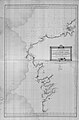
 Fronteira de Portugal coa Galiza entre Melgaço e Valença-Tui (últ. terço séc. XVIII).jpg 3,485 × 5,125; 17.11 MB
-
-
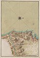
 Mapa Galicia Cartas Náuticas 1787.jpg 5,063 × 7,699; 4.49 MB
-
 Monograma de Galiza empregado pola estafeta de Ponte d'Eume.png 139 × 155; 9 KB
-
-
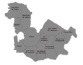 Vedra parroquias en 1753.svg 2,700 × 2,100; 59 KB
-
 Vista de Muros por Mariano Ramón Sánchez.png 1,074 × 610; 531 KB
.jpg)

.jpg)
.jpg)
.jpg)
.jpg)


.jpg)
.jpg)


.jpg)

