Category:Gar county
Jump to navigation
Jump to search
county in Tibet Autonomous Region, People's Republic of China  .png) | |||||
| Upload media | |||||
| Instance of |
| ||||
|---|---|---|---|---|---|
| Location | Ngari Prefecture, Tibet Autonomous Region, PRC | ||||
| Population |
| ||||
| Area |
| ||||
| official website | |||||
 | |||||
Subcategories
This category has only the following subcategory.
M
- Maps of the Demchok sector (27 F)
Media in category "Gar county"
The following 21 files are in this category, out of 21 total.
-
 Entering Gunsa Township from Shiquanhe Daban.jpg 800 × 533; 86 KB
-
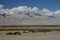 Gar Tsangpo near Ngari Gunsa Airport.jpg 800 × 533; 63 KB
-
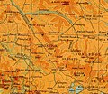
 GarCounty.png 584 × 586; 37 KB
-
 Gartok and vicinity - Survey of India 1936.jpg 1,385 × 1,197; 845 KB
-
 Map of Gar by Strachey 1851.jpg 2,877 × 3,177; 4.5 MB
-
 Milrepa in Thirtapuri.png 2,000 × 2,881; 9.96 MB
-
 Moincer, Tibet (IMG 3672).jpg 800 × 533; 66 KB
-
 Moincer, Tibet.jpg 800 × 533; 75 KB
-
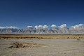
 Ngari Prefecture IMG 3552.jpg 800 × 533; 77 KB
-
 Ngari Prefecture IMG 3599.jpg 800 × 533; 57 KB
-
 Ngari Prefecture IMG 3637.jpg 800 × 533; 68 KB
-
 Ngari Prefecture IMG 3648.jpg 800 × 533; 84 KB
-
 Ngari Prefecture IMG 3655.jpg 533 × 800; 59 KB
-
 Ngari Prefecture IMG 3657.jpg 800 × 533; 81 KB
-
 Road fork Rutog Shiquanhe P8017941.jpg 3,024 × 4,032; 1.96 MB
-
 Sheet-62-manasarowar-1925.jpg 5,242 × 6,555; 3.46 MB
-
 Txu-pclmaps-oclc-181831961-manasarowar-62-f-1930.jpg 3,718 × 4,912; 1.82 MB
-
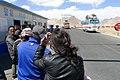
 Zoco - Zuozuo Township, Tibet Traffic Checkpoint.jpg 4,032 × 3,024; 2.12 MB
-
 噶尔县山上巨大的八一标志.jpg 1,920 × 1,281; 561 KB
-
 在噶尔县公安检查站等待登记的人2.jpg 1,920 × 1,281; 563 KB
-
 雅切拉达坂.jpg 800 × 533; 52 KB


.jpg)


