Category:Gare de Villers-Saint-Sépulcre
Jump to navigation
Jump to search
| Object location | | View all coordinates using: OpenStreetMap |
|---|
railway station  | |||||
| Upload media | |||||
| Instance of | |||||
|---|---|---|---|---|---|
| Location | Villers-Saint-Sépulcre, canton of Noailles | ||||
| Street address |
| ||||
| Transport network | |||||
| Owned by | |||||
| Operator | |||||
| Elevation above sea level |
| ||||
| Connecting line | |||||
| Adjacent station | |||||
 | |||||
Media in category "Gare de Villers-Saint-Sépulcre"
The following 7 files are in this category, out of 7 total.
-
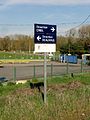
 Villers-Saint-Sépulcre (60), arrêt SNCF 1.jpg 3,648 × 2,736; 1.13 MB
-
 Villers-Saint-Sépulcre (60), arrêt SNCF 2.jpg 3,648 × 2,736; 1.28 MB
-
 Villers-Saint-Sépulcre (60), arrêt SNCF 3.jpg 2,736 × 3,648; 1.49 MB
-
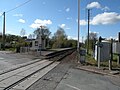
 Villers-Saint-Sépulcre (60), passage à niveau à côté du point d'arrêt 1.jpg 3,648 × 2,736; 1.21 MB
-
 Villers-Saint-Sépulcre (60), passage à niveau à côté du point d'arrêt 2.jpg 2,736 × 3,648; 1.35 MB
-
 Villers-Saint-Sépulcre gare 1.JPG 3,648 × 2,736; 1.75 MB
-
 Villers-Saint-Sépulcre gare 2.JPG 3,648 × 2,736; 1.8 MB
,_arr%C3%AAt_SNCF_1.jpg)
,_arr%C3%AAt_SNCF_2.jpg)
,_arr%C3%AAt_SNCF_3.jpg)
,_passage_%C3%A0_niveau_%C3%A0_c%C3%B4t%C3%A9_du_point_d%27arr%C3%AAt_1.jpg)
,_passage_%C3%A0_niveau_%C3%A0_c%C3%B4t%C3%A9_du_point_d%27arr%C3%AAt_2.jpg)
