Category:Garfield County, Colorado
Sari la navigare
Sari la căutare
Counties of Colorado: Adams · Alamosa · Arapahoe · Archuleta · Baca · Bent · Boulder · Chaffee · Cheyenne · Clear Creek · Conejos · Costilla · Crowley · Custer · Delta · Dolores · Douglas · Eagle · El Paso · Elbert · Fremont · Garfield · Gilpin · Grand · Gunnison · Hinsdale · Huerfano · Jackson · Jefferson · Kiowa · Kit Carson · Lake · La Plata · Larimer · Las Animas · Lincoln · Logan · Mesa · Mineral · Moffat · Montezuma · Montrose · Morgan · Otero · Ouray · Park · Phillips · Pitkin · Prowers · Pueblo · Rio Blanco · Rio Grande · Routt · Saguache · San Juan · San Miguel · Sedgwick · Summit · Teller · Washington · Weld · Yuma
City-counties: Broomfield · Denver
City-counties: Broomfield · Denver
comitat din Statele Unite ale Americii  .png)  | |||||
| Încarcă multimedia | |||||
| Este un/o | |||||
|---|---|---|---|---|---|
| Numit(ă) după | |||||
| Locul actual | Colorado, SUA | ||||
| Capitală | |||||
| Înființare |
| ||||
| Populație |
| ||||
| Suprafață |
| ||||
| site oficial | |||||
 | |||||
Images associated with Garfield County, Colorado in the United States.
Subcategorii
Această categorie conține următoarele 17 subcategorii, dintr-un total de 17.
G
- Garfield County Fair (Colorado) (20 F)
M
- Mandrel Rulison (16 F)
N
P
R
- Rifle Uranium and Vanadium Mills (24 F)
S
- South Canyon Fire (4 F)
V
- Valley Curtain (5 F)
Fișiere media din categoria „Garfield County, Colorado”
Următoarele 88 fișiere se află în această categorie, dintr-un total de 88.
-
 09 U.S. Route 6 in Colorado - Garfield County, US Highway System.jpg 3.030x2.020; 3,19 MB
-
 10 Garfield County, Colorado - US Route 6, US Highway System.jpg 2.020x2.020; 2,05 MB
-
 10 US Highway speed limit sign 55 MPH - Garfield County, Colorado.jpg 2.020x1.347; 1,56 MB
-
 4-H Garfield County.gif 388x581; 136 KB
-

-
 ALONG EAST RIFLE CREEK - NARA - 552696.jpg 3.000x2.013; 705 KB
-
 Battlement Mesa (Colorado) - 2005-08-17.jpg 1.280x879; 255 KB
-
 Bear River (Colorado) source.jpg 1.280x960; 587 KB
-

-

-

-
 Cake Decorating-552644.jpg 2.035x3.000; 1,04 MB
-
 Cake Decorating-552645.jpg 3.000x2.024; 1,38 MB
-
 Forest atlas of the national forests of the United States. Battlement folio (IA CAT31290533).pdf 1.831 × 2.131, 46 de pagini; 10,45 MB
-
 Colorado 1997 02.jpg 1.054x710; 1,01 MB
-
 Colorado National Guard (30286608768).jpg 3.024x4.032; 298 KB
-
 DeBeque Phacelia Habitat (5715873335).jpg 1.020x625; 327 KB
-
 DeBeque Phacelia Habitat (5716437006).jpg 800x600; 359 KB
-
 East of East Salt Creek - Flickr - aspidoscelis.jpg 3.600x2.400; 3,97 MB
-
 Flattops Flowers (6154273307).jpg 3.456x5.184; 3,47 MB
-
 Flattops Flowers (6154783250).jpg 5.184x3.456; 5,5 MB
-

-

-

-

-
 Garfield Co. Public Health, 2014 Blake Ave, Glenwood Springs, CO.jpg 2.560x1.536; 1,56 MB
-

-
 Hanging Lake Trail dyeclan.com - panoramio (1).jpg 3.000x4.000; 7,14 MB
-
 Hanging Lake Trail dyeclan.com - panoramio.jpg 4.000x3.000; 6,54 MB
-
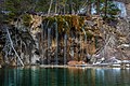 Hanging Lake, Glenwood Springs, United States (Unsplash).jpg 5.426x3.610; 14,16 MB
-
 Hardwick Bridge.jpg 499x332; 48 KB
-
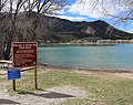 Harvey Gap State Park.JPG 5.037x4.000; 18,91 MB
-

-

-

-

-
 LABOR DAY BRINGS THE ANNUAL GARFIELD COUNTY FAIR PARADE - NARA - 552655.jpg 2.019x3.000; 618 KB
-

-

-
 Maroon Bells 7-4 (19056258753).jpg 5.760x3.840; 6,02 MB
-
 Meadow and mountain view east of Rifle in Garfield County, Colorado LCCN2015633535.tif 8.688x5.792; 287,97 MB
-
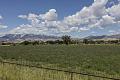 Meadow and mountain view east of Rifle in Garfield County, Colorado LCCN2015633536.tif 8.688x5.792; 287,97 MB
-
-
 Meadow and Rocky Mountain view in Gunnison County, Colorado LCCN2015633787.tif 8.217x5.478; 257,6 MB
-
 Meadow and Rocky Mountain view in Gunnison County, Colorado LCCN2015633788.tif 8.688x5.792; 287,97 MB
-
-
 Mt Sopris from Colorado State Highway 82.jpg 3.264x2.010; 4,12 MB
-

-
 Officers after work-552621.jpg 3.000x2.019; 1,82 MB
-

-
-

-
-

-
 Rd SR139 Cattle Guard - panoramio.jpg 858x643; 404 KB
-
-
 Rifle Creek above Rifle Falls - panoramio.jpg 1.296x972; 270 KB
-
 Rifle Creek bird-552696.jpg 3.000x2.013; 1,11 MB
-
 Rifle Gap Dam.JPG 5.574x3.557; 12,65 MB
-
 Rifle Gap State Park.JPG 6.000x4.000; 14,16 MB
-
 Rifle Gap.JPG 6.000x4.000; 15,05 MB
-
-

-
-

-
-

-

-

-
-

-

-
 Storm King Mountain Memorial Trail.JPG 5.331x4.000; 13,48 MB
-

-
 Sunlight Ski Area, Spring 1991.JPG 1.051x610; 62 KB
-

-

-
-
-
 USA Garfield County, Colorado age pyramid.svg 520x600; 7 KB
-
 View of Deep Creek, at the bottom of Deep Canyon (6154234499).jpg 5.184x3.456; 8,11 MB
-

-

-

-

-

-
 Window of the Silver Club Saloon in New Castle, Colorado LCCN2015633543.tif 5.603x4.598; 147,45 MB
-


_-_2005-08-17.jpg)
_source.jpg)
,_OIL_SHALE_ROCKS_IN_THE_PICEANCE_BASIN_OF_WESTERN_COLORADO._DEVELOPMENT_OF_AN..._-_NARA_-_552690.jpg)


.jpg)
.jpg)
.jpg)

.jpg)
.jpg)


.jpg)

.jpg)


.jpg)


_CLIFFS,_IS_THE_MAJOR_COMMUNITY..._-_NARA_-_552593.jpg)
_CLIFFS,_IS_THE_MAJOR_COMMUNITY..._-_NARA_-_552607.jpg)


_(29978675644).jpg)

.jpg)

