Category:Chaffee County, Colorado
Jump to navigation
Jump to search
Counties of Colorado: Adams · Alamosa · Arapahoe · Archuleta · Baca · Bent · Boulder · Chaffee · Cheyenne · Clear Creek · Conejos · Costilla · Crowley · Custer · Delta · Dolores · Douglas · Eagle · El Paso · Elbert · Fremont · Garfield · Gilpin · Grand · Gunnison · Hinsdale · Huerfano · Jackson · Jefferson · Kiowa · Kit Carson · Lake · La Plata · Larimer · Las Animas · Lincoln · Logan · Mesa · Mineral · Moffat · Montezuma · Montrose · Morgan · Otero · Ouray · Park · Phillips · Pitkin · Prowers · Pueblo · Rio Blanco · Rio Grande · Routt · Saguache · San Juan · San Miguel · Sedgwick · Summit · Teller · Washington · Weld · Yuma
City-counties: Broomfield · Denver
City-counties: Broomfield · Denver
county in Colorado, United States .JPG)  | |||||
| Upload media | |||||
| Instance of | |||||
|---|---|---|---|---|---|
| Named after | |||||
| Location | Colorado | ||||
| Capital | |||||
| Inception |
| ||||
| Highest point | |||||
| Population |
| ||||
| Area |
| ||||
| Different from | |||||
| official website | |||||
 | |||||
Images associated with Chaffee County, Colorado in the United States
Subcategories
This category has the following 15 subcategories, out of 15 total.
Media in category "Chaffee County, Colorado"
The following 138 files are in this category, out of 138 total.
-
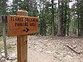 Blanks Trailhead parking area sign.jpg 2,848 × 2,136; 1.96 MB
-
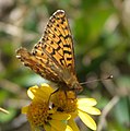 Boloria chariclea helena P1480443a.jpg 1,774 × 1,781; 377 KB
-
 Buena Vista, Colorado.jpg 583 × 389; 36 KB
-
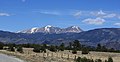 Buffalo Peaks outside of Buena Vista.jpg 3,456 × 1,778; 3.03 MB
-
 CampingAlongChalkCreek.jpg 680 × 600; 110 KB
-
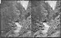
 Cascades in the canyon of La Plate Creek. Chaffee County, Colorado. - NARA - 517514.jpg 3,000 × 1,877; 1.92 MB
-
 Cascades in the canyon of La Plate Creek. Chaffee County, Colorado. - NARA - 517515.jpg 3,000 × 1,869; 1.81 MB
-
 Chaffee County, CO, USA - panoramio.jpg 3,872 × 2,592; 4.13 MB
-
 ChalkCreekWestofUS285toStElmo.JPG 800 × 600; 117 KB
-
 Clear Creek - Headwaters to the Arkansas - panoramio.jpg 480 × 640; 219 KB
-
 Colorado State Highway 291.JPG 5,184 × 2,625; 7.25 MB
-
 Colorado Trail, Mt Shavano Trail sign.jpg 2,848 × 2,136; 2.1 MB
-
 Decker Fire in Chaffee County, Colorado (MODIS 2019-10-05).jpg 2,127 × 1,810; 1.25 MB
-
-

-

-
-

-
-

-
 Great morain on the Arkansas, Clear Creek. Chaffee County, Colorado. - NARA - 516988.jpg 3,000 × 1,849; 988 KB
-

-

-

-

-

-
-

-

-

-

-
 Hancock Pass.JPG 2,643 × 3,406; 9.22 MB
-

-

-

-

-

-

-
-

-

-

-

-

-

-
-

-

-
-

-

-

-
-

-

-

-

-

-

-
-

-
 Marker for the South Cottonwood trailhead of the Colorado Trail, near Buena Vista.jpg 2,592 × 1,944; 1.93 MB
-

-

-

-
-

-
 O'Haver Lake.JPG 6,000 × 3,708; 15.51 MB
-

-

-

-

-

-
 Pm000550.gif 203 × 150; 7 KB
-

-

-

-

-

-

-

-

-

-

-

-

-
-

-

-

-

-
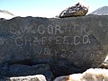 S.W. Corner Chaffee Co. rock.jpg 3,648 × 2,736; 4.52 MB
-
 Saint Elmo, United States (Unsplash).jpg 3,456 × 5,184; 9.71 MB
-

-

-

-

-
-

-

-
-

-

-
-

-

-

-
-

-

-
 Summit of Mt. Belford - panoramio.jpg 640 × 480; 210 KB
-
 Tlhope.JPG 3,072 × 2,304; 1.23 MB
-

-

-

-

-
 Troutcreeksign.JPG 1,920 × 2,560; 939 KB
-
 US 24 bridge, Trout Creek, Chaffee County, Colorado.jpg 2,560 × 1,536; 2.18 MB
-
 USA Chaffee County, Colorado age pyramid.svg 520 × 600; 7 KB
-

-

-
-
-

-
-
-

-
-

-

-

-

-

-

-
-

-
 Winfield Peak, Colorado.png 3,648 × 2,159; 10.09 MB
-


.jpg)
_(Cache_Creek,_near_Granite,_Chaffee_County,_Colorado,_USA)_1_(16884410748).jpg)
_(Cache_Creek,_near_Granite,_Chaffee_County,_Colorado,_USA)_2_(16885971039).jpg)
_(Cache_Creek,_near_Granite,_Chaffee_County,_Colorado,_USA)_3_(16884639690).jpg)


.jpg)
,_Chaffee_County,_CO_HABS_COLO,8-STEL,2-_(sheet_1_of_4).png)
,_Chaffee_County,_CO_HABS_COLO,8-STEL,2-_(sheet_2_of_4).png)
,_Chaffee_County,_CO_HABS_COLO,8-STEL,2-_(sheet_3_of_4).png)
,_Chaffee_County,_CO_HABS_COLO,8-STEL,2-_(sheet_4_of_4).png)
,_Chaffee_County,_CO_HABS_COLO,8-STEL,16-_(sheet_1_of_1).png)


,_Chaffee_County,_CO_HABS_COLO,8-STEL,15-_(sheet_1_of_1).png)


