Category:Gates in Kingston upon Hull
Jump to navigation
Jump to search
Subcategories
This category has the following 2 subcategories, out of 2 total.
L
P
Media in category "Gates in Kingston upon Hull"
The following 54 files are in this category, out of 54 total.
-
 A path leading to Beverley Road (geograph 3675914).jpg 800 × 600; 150 KB
-
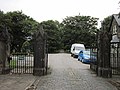
 A side entrance to East Park - geograph.org.uk - 3216408.jpg 800 × 600; 155 KB
-
 Bungalows on Wymersley Road, Hull (geograph 3315790).jpg 800 × 600; 174 KB
-
 Coronation Road South, Hull (geograph 3336965).jpg 800 × 600; 122 KB
-
 Coronation Road South, Hull (geograph 3336968).jpg 800 × 600; 114 KB
-
 East Park from Hurley Close, Hull - geograph.org.uk - 3287644.jpg 800 × 600; 89 KB
-
 Entrance to William Wilberforce House, Hull.jpg 4,160 × 3,120; 3.93 MB
-
 Field entrance off Wawne Road (geograph 4352682).jpg 640 × 400; 71 KB
-
 Footpath on modern housing estate, Hull (geograph 1796128).jpg 640 × 480; 68 KB
-
 Gate piers and flanking walls to Albany House. Hull.jpg 4,032 × 3,024; 5.03 MB
-
 Gate piers and flanking walls to Albany House.jpg 4,032 × 3,024; 5.48 MB
-

-

-
 Greenhow Close off Howdale Road, Hull (geograph 6828934).jpg 5,456 × 3,632; 2.62 MB
-
 Hedon Road Cemetery - geograph.org.uk - 3654608.jpg 800 × 600; 138 KB
-
 High Street, Kingston upon Hull - geograph.org.uk - 6133479.jpg 1,705 × 1,265; 1.11 MB
-
 Houses on Barmouth Close, Hull (geograph 6090139).jpg 800 × 551; 79 KB
-
 Houses on Greenhow Close, Hull (geograph 6345699).jpg 4,435 × 2,775; 2.31 MB
-
 Howdale Road, Hull (geograph 6345700).jpg 4,314 × 2,966; 2.65 MB
-
 Howdale Road, Hull (geograph 6828314).jpg 5,456 × 3,632; 2.3 MB
-
 Howdale Road, Hull (geograph 6828318).jpg 5,456 × 3,632; 2.45 MB
-
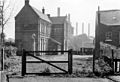 Hull Beverley Road Station site of 1795751 c810fec9.jpg 640 × 439; 142 KB
-
 Hull Fair 2023 Alleyway Restrictions.jpg 4,176 × 2,784; 3.45 MB
-
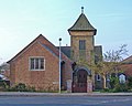 St Thomas Church, Hotham Road South - geograph.org.uk - 407702.jpg 640 × 510; 238 KB
-
 Ingleby Close off Dunvegan Road, Hull (geograph 6828289).jpg 5,456 × 3,632; 2.8 MB
-
 Ledbury Road off Priory Road, Hull (geograph 3339990).jpg 800 × 600; 111 KB
-
 Lunedale Close off Howdale Road, Hull (geograph 6829110).jpg 5,456 × 3,632; 3.37 MB
-
 Manor Road at Westlands Road, Hull (geograph 3305708).jpg 800 × 600; 63 KB
-
 Manor Road off Spring Bank West, Hull (geograph 3305711).jpg 800 × 600; 80 KB
-
 Ornamental Gates at Pickering Park - geograph.org.uk - 865783.jpg 640 × 449; 89 KB
-
 Philip Larkin -House in Hull 2.jpg 2,272 × 1,704; 1.52 MB
-
 Philip Larkin -house in Hull 3.jpg 2,272 × 1,704; 1.57 MB
-
 Reeth Walk off Bishop Alcock Road, Hull (geograph 6845072).jpg 5,456 × 3,632; 3.2 MB
-
 Ridgeway Road off Willerby Road, Hull (geograph 3309479).jpg 800 × 600; 88 KB
-
 Ridgeway Road off Willerby Road, Hull (geograph 3309481).jpg 800 × 600; 79 KB
-
 Runnymede Lane, Kingswood, Hull (geograph 5955422).jpg 1,600 × 1,064; 738 KB
-
 Side entrance to Pickering Park, Hull - geograph.org.uk - 3263004.jpg 800 × 600; 132 KB
-
 Smyths toy shop on Clough Road, Hull (geograph 3594172).jpg 1,024 × 768; 191 KB
-
 Spurn Lightship New Entrance Gate, Kingston upon Hull Mar24.jpg 4,176 × 2,784; 3.5 MB
-
 The entrance to Setting Dike School (geograph 3336865).jpg 800 × 600; 171 KB
-
 The Gates of Charterhouse Board School - geograph.org.uk - 761243.jpg 640 × 480; 142 KB
-
 The main entrance to East Park, Hull - geograph.org.uk - 3232835.jpg 800 × 600; 197 KB
-
 Tour of Sewell Group Craven Park North Away and The Well Gates.jpg 4,176 × 2,784; 3.48 MB
-
 Western Cemetery - geograph.org.uk - 3072434.jpg 1,024 × 767; 278 KB
-
 Western Cemetery - Spring Bank entrance (geograph 3256818).jpg 640 × 418; 235 KB
-
 Westlands Road, Hull (geograph 3309540).jpg 800 × 600; 94 KB
-
 Westlands Road, Hull (geograph 3309542).jpg 800 × 600; 99 KB
-
 Whitefriargate, Kingston upon Hull - geograph.org.uk - 3376732.jpg 1,631 × 2,625; 1.78 MB
-
 Wilberforce House, High Street, Kingston upon Hull - geograph.org.uk - 3297078.jpg 1,159 × 1,289; 444 KB
-
 Willerby Road, Hull (geograph 3309508).jpg 800 × 600; 133 KB
-
 Wold Road, Hull (geograph 3336875).jpg 800 × 600; 143 KB
-
 Woodlands Road towards Willerby Road, Hull (geograph 3303253).jpg 800 × 600; 86 KB
-
 No fat people - geograph.org.uk - 206037.jpg 640 × 472; 114 KB
-
 Puzzle - geograph.org.uk - 239907.jpg 640 × 505; 118 KB
.jpg)

.jpg)
.jpg)
.jpg)


.jpg)
.jpg)


.jpg)


.jpg)
.jpg)
.jpg)
.jpg)
.jpg)


.jpg)
.jpg)
.jpg)
.jpg)
.jpg)


.jpg)
.jpg)
.jpg)
.jpg)

.jpg)

.jpg)


.jpg)
.jpg)
.jpg)


.jpg)
.jpg)
.jpg)

