Category:Geography of County Sligo
Jump to navigation
Jump to search
Wikimedia category | |||||
| Upload media | |||||
| Instance of | |||||
|---|---|---|---|---|---|
| |||||
 | |||||


Subcategories
This category has the following 17 subcategories, out of 17 total.
B
- Beaches of County Sligo (48 F)
- Bogs in County Sligo (1 F)
C
I
L
M
- Moorlands in County Sligo (2 F)
P
R
S
- Streets in County Sligo (1 F)
T
W
Media in category "Geography of County Sligo"
The following 47 files are in this category, out of 47 total.
-
 1903 Kesh Caves.jpg 1,173 × 371; 98 KB
-
 Atlantic Ocean Sunset.JPG 2,442 × 1,832; 821 KB
-
 Ballysadare Bay with Knocknarea 2012 09 18.jpg 3,493 × 1,911; 3.05 MB
-
 Boggy land at Toomour - geograph.org.uk - 798179.jpg 640 × 480; 83 KB
-
 Bogland near Killerry wood - geograph.org.uk - 1638538.jpg 1,080 × 810; 506 KB
-
 Bogland near Sradoon - geograph.org.uk - 1638542.jpg 640 × 480; 49 KB
-
 Bromore Point - geograph.org.uk - 824634.jpg 640 × 479; 43 KB
-
 Bunduff Lough, Co. Sligo.jpg 4,032 × 3,024; 6.15 MB
-
 Bunduff Strand April 2020.jpg 4,032 × 3,024; 4.43 MB
-
 Cliffs of Annacoona Bundoran - geograph.org.uk - 1401024.jpg 640 × 480; 133 KB
-
 Coolera Peninsula.png 2,552 × 2,464; 243 KB
-
 Entrance to Killerry Wood - geograph.org.uk - 1638534.jpg 640 × 480; 84 KB
-
 Evening light & rainbow over Knocknahur from Grange North, Co Sligo (geograph 6330252).jpg 5,184 × 2,920; 4.72 MB
-
 Forest track, Inishfree - geograph.org.uk - 1637404.jpg 640 × 480; 106 KB
-
 Gortarowey Ben Bulben view.JPG 3,648 × 2,736; 2.65 MB
-
 Gortarowey entrance sign.JPG 3,648 × 2,736; 2.57 MB
-

-
 Karst surface 2 - geograph.org.uk - 2540077.jpg 640 × 480; 94 KB
-
 Kesh Corann - geograph.org.uk - 798196.jpg 640 × 480; 65 KB
-
 Keshcorran Caves 10816.jpg 725 × 544; 135 KB
-
 Kintogher - geograph.org.uk - 241193.jpg 640 × 427; 57 KB
-
 Knockarea sligo.jpg 1,600 × 1,192; 635 KB
-
 Knocklane Promontory Fort.JPG 3,488 × 2,616; 1.43 MB
-
 Knocknarea - geograph.org.uk - 2935589.jpg 2,592 × 1,944; 765 KB
-
 Knocknaree near Sligo - geograph.org.uk - 1653419.jpg 640 × 219; 51 KB
-
 Laghty Barr - geograph.org.uk - 1118297.jpg 640 × 479; 108 KB
-
 Looking across the Dernaskeagh Peatlands - geograph.org.uk - 1609435.jpg 640 × 480; 109 KB
-
 Looking east from Streedagh - geograph.org.uk - 2935577.jpg 1,600 × 1,200; 310 KB
-
 Marshy Ground close to Drumcliff Bay - geograph.org.uk - 241158.jpg 640 × 415; 47 KB
-
 Mullaghmore Peninsula Map.png 2,556 × 2,432; 240 KB
-
 Near Glencar Waterfall, Sligo - geograph.org.uk - 75467.jpg 600 × 387; 62 KB
-
 North Bank of Sligo Harbour - geograph.org.uk - 242877.jpg 640 × 357; 44 KB
-
 Ox Mts.jpg 1,265 × 790; 921 KB
-
 Raghly Peninsula.png 2,548 × 2,440; 243 KB
-
 Rosses Point Peninsula, County Sligo - geograph.org.uk - 6553713.jpg 2,592 × 1,936; 909 KB
-
 Rosses Point Peninsula.png 2,544 × 2,428; 240 KB
-
 Sligo 2.jpg 800 × 600; 71 KB
-
 Slipway, Sligo Harbour - geograph.org.uk - 242907.jpg 640 × 427; 64 KB
-
 South fosse of Knocklane Promontory Fort.JPG 1,832 × 2,442; 873 KB
-
 South Shore of Drumcliff Bay - geograph.org.uk - 241162.jpg 640 × 408; 66 KB
-
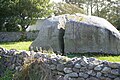 Split Rock (geograph 3651297).jpg 768 × 511; 196 KB
-
 Split Rock, Easky, beside R297 Co Sligo (geograph 6330453).jpg 5,184 × 2,920; 5.6 MB
-
 Streedagh Point - geograph.org.uk - 6217349.jpg 1,024 × 685; 516 KB
-
 The Glen, Sligo in the fog in winter.jpg 2,816 × 2,112; 4.98 MB
-
 The Glen, Sligo in the summer.jpg 2,048 × 1,536; 4.26 MB
-
 The Miners Way in the Arigna valley - geograph.org.uk - 1630978.jpg 640 × 480; 109 KB
-
 View of Knocknarea from the interior of Knocklane Promontory Fort.JPG 2,442 × 1,832; 722 KB


.jpg)


.jpg)
.jpg)


