<nowiki>Category:Geography of Hanyu, Saitama; Category:羽生市の地理; categoría de Wikimedia; Wikimedia category; категория на Уикимедия; categorie a unui proiect Wikimedia; 維基媒體分類; kategória projektov Wikimedia; категорія проєкту Вікімедіа; kawan Wikimèdia; 維基媒體分類; 维基媒体分类; Wikimedia-Kategorie; 위키미디어 분류; kategorio en Vikimedio; Викимедиина категорија; kategorija na Wikimediji; categoría de Wikimedia; উইকিমিডিয়া বিষয়শ্রেণী; page de catégorie de Wikimedia; kategorija na Wikimediji; 维基媒体分类; וויקימעדיע קאַטעגאָריע; thể loại Wikimedia; Wikimedia projekta kategorija; Wikimedia-kategorie; категорија на Викимедији; categoria de um projeto da Wikimedia; Wikimedia category; Wikimedia-Kategorie; Wikimedia-kategori; Wikimedia-kategori; پۆلی ویکیمیدیا; Wikimedia category; تصنيف ويكيميديا; pajenn rummata eus Wikimedia; 維基媒體分類; Wikimedia категориясы; વિકિપીડિયા શ્રેણી; Wikimediako kategoria; categoría de Wikimedia; Wikimedia-categorie; Викимедиа категорияһы; tudalen categori Wikimedia; катэгорыя ў праекце Вікімедыя; Վիքիմեդիայի նախագծի կատեգորիա; 维基媒体分类; Wikimedia-kategory; ウィキメディアのカテゴリ; Wikimedia-Kategorie; катэгорыя ў праекце Вікімэдыя; קטגוריה במיזמי ויקימדיה; κατηγορία εγχειρημάτων Wikimedia; Wikimedia-Kategorie; विकिमीडिया श्रेणी; categurìa 'e nu pruggette Wikimedia; Wikimedia-luokka; гурӯҳи Викимедиа; Wikimedia-categorie; kategorie na projektech Wikimedia; guruhi Vikimedia; categoria di un progetto Wikimedia; Wikimedia category; Wikimedia-kategori; Vikimedya kategorisi; 維基媒體分類; Wikimedia-categorie; ردهٔ ویکیپدیا; kategoria w projekcie Wikimedia; kategori e Wikimedias; ẹ̀ka Wikimedia; Wikimedia-Kategorie; categoria de um projeto da Wikimedia; Wikimedia-Kategorie; categoria de Wikimedia; tumbung Wikimedia; kategoria ti Wikimedia; kategorija Wikimedie; Wikimédia-kategória; категория в проекте Викимедиа; Wikimedia-kategoriija; kategori Wikimedia; jamii ya Wikimedia; Wikimedia-kategori; 維基媒體分類; kategori Wikimedia; Wikimedia kategooria; विकिपीडिया:श्रेणी; Wikimedia-Kategorie; categoría de Wikimedia; гурӯҳи Викимедиа; 维基媒体分类; 维基媒体分类</nowiki>
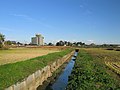 Hanyu Aino River 1.JPG 3,264 × 2,448; 2.08 MB
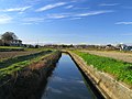 Hanyu Aino River 2.JPG 3,264 × 2,448; 1.93 MB
 Hanyu Aino River Ainokawa Weir 1.JPG 3,264 × 2,448; 2.43 MB
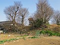 Hanyu Aino River Natural Levee 1.JPG 3,264 × 2,448; 3.98 MB
 Hanyu Aino River Starting Point Pt1 1.JPG 3,264 × 2,448; 2.16 MB
 Hanyu Aino River Starting Point Pt2 1.JPG 3,110 × 2,333; 2.58 MB
 Hanyu city center area Aerial photograph.2021.jpg 9,354 × 9,116; 57.96 MB
 Hanyu Kasai Canal 1.JPG 3,264 × 2,448; 1.94 MB
 Hanyu Saitama Canal 1.JPG 3,264 × 2,448; 2.38 MB
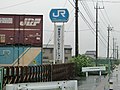 JR貨物 埼玉/羽生ORS----①.jpg 2,560 × 1,920; 2.38 MB
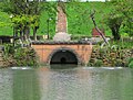 Kasai Canal Motoiri Remains 1.jpg 2,500 × 1,894; 2.26 MB
 Naka River Starting point 1.jpg 2,592 × 1,944; 2.73 MB
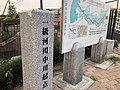 Nakagawa River Starting Point.jpg 4,032 × 3,024; 3.45 MB


