Category:Geography of Highland council area
Zur Navigation springen
Zur Suche springen
Council areas (municipalities) of Scotland: Aberdeen · Aberdeenshire · Angus · Argyll and Bute · Clackmannanshire · Dumfries and Galloway · Dundee · East Ayrshire · East Dunbartonshire · East Lothian · East Renfrewshire · Edinburgh · Falkirk · Fife · Glasgow · Highland · Inverclyde · Midlothian · Moray · North Ayrshire · North Lanarkshire · Outer Hebrides · Orkney Islands · Perth and Kinross · Renfrewshire · Scottish Borders · Shetland Islands · South Ayrshire · South Lanarkshire · Stirling · West Dunbartonshire · West Lothian
Former regions and island areas of Scotland: Dumfries and Galloway · Fife · Highland · Orkney Islands · Outer Hebrides · Scottish Borders · Shetland Islands ·
Wikimedia-Kategorie | |||||
| Medium hochladen | |||||
| Ist ein(e) | |||||
|---|---|---|---|---|---|
| Kategorie kombiniert die Themen | |||||
| Geographie | |||||
Wissenschaft, die sich mit der räumlichen Struktur und Entwicklung der Erdoberfläche befasst     | |||||
| Aussprache (Audiodatei) | |||||
| Ist ein(e) | |||||
| Verschieden von | |||||
| Teilweise übereinstimmend mit | |||||
| Highland | |||||
Verwaltungsdistrikt in Schottland   | |||||
| Ist ein(e) | |||||
| Ort | Highlands, Schottland | ||||
| Hauptstadt | |||||
| Datum der Gründung, Erstellung, Entstehung, Erbauung |
| ||||
| Einwohnerzahl |
| ||||
| Fläche |
| ||||
| Verschieden von | |||||
| offizielle Website | |||||
 | |||||

Unterkategorien
Es werden 29 von insgesamt 29 Unterkategorien in dieser Kategorie angezeigt:
In Klammern die Anzahl der enthaltenen Kategorien (K), Seiten (S), Dateien (D)
*
B
C
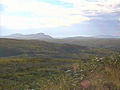
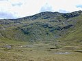
- Countryside in Highland council area (439 D)
D
E
F
G
I
K
L
M
N
P
- Pass of Drumochter (48 D)
- Ponds in Highland council area (38 D)
S
- Slochd Summit (19 D)
U
Medien in der Kategorie „Geography of Highland council area“
Folgende 49 Dateien sind in dieser Kategorie, von 49 insgesamt.
-
 "Billion year beach" - geograph.org.uk - 886542.jpg 640 × 480; 171 KB
-

-
 'Blue Haze' explained - geograph.org.uk - 1297643.jpg 640 × 480; 172 KB
-
 A captivating landscape - geograph.org.uk - 1803328.jpg 640 × 480; 70 KB
-

-
-
 A square kilometre of very little - geograph.org.uk - 1377509.jpg 640 × 480; 97 KB
-
 A wide boggy expanse - geograph.org.uk - 1347428.jpg 640 × 480; 106 KB
-
 Abhainn Braigh Horrisdale - geograph.org.uk - 53854.jpg 640 × 480; 111 KB
-
 Achnaha in volcanic ring.jpg 3.284 × 533; 249 KB
-
 Altass More.jpg 640 × 480; 277 KB
-
 Bealach Traligill - geograph.org.uk - 158717.jpg 640 × 447; 99 KB
-
 Beinn a ghlo 012.jpg 1.496 × 1.122; 329 KB
-
 Ca na Catanach Drove Road - geograph.org.uk - 1363297.jpg 640 × 480; 70 KB
-
 Cattle - panoramio (10).jpg 4.000 × 3.000; 5,45 MB
-
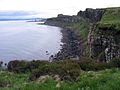
 Coast Below Big Sand.jpg 640 × 427; 74 KB
-
 Creag a Ghobhair - geograph.org.uk - 19110.jpg 451 × 291; 17 KB
-
 Durness - panoramio.jpg 3.548 × 918; 415 KB
-
 E Face of NNE ridge of Sgurr an Fhuarain - geograph.org.uk - 1356616.jpg 640 × 480; 248 KB
-
 East West Watershed - geograph.org.uk - 169098.jpg 640 × 474; 82 KB
-
 Fields - panoramio (26).jpg 4.000 × 3.000; 4,75 MB
-
 Gleann Beag - geograph.org.uk - 33483.jpg 640 × 403; 47 KB
-
 High up in Coire Lochan - geograph.org.uk - 121211.jpg 640 × 444; 53 KB
-
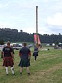
 Highland games bagpiper 2.JPG 3.488 × 2.616; 2,21 MB
-
 Highland games caber toss 1.JPG 2.616 × 3.488; 2,14 MB
-
 Highland games caber toss 2.JPG 2.616 × 3.488; 2,11 MB
-
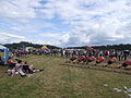 Highland games tug of war 1.JPG 3.488 × 2.616; 2,19 MB
-
 Highland games tug of war 2.JPG 3.488 × 2.616; 2,22 MB
-
 HIGHLAND-P.JPG 301 × 227; 17 KB
-
 Looking towards Dornoch - geograph.org.uk - 687335.jpg 640 × 458; 426 KB
-
 Near An Sluggan - geograph.org.uk - 493999.jpg 640 × 480; 44 KB
-
 Nigg Hill, looking towards Dornoch - geograph.org.uk - 706970.jpg 640 × 480; 415 KB
-
 Northern slopes of Carn na Farraidh - geograph.org.uk - 1246707.jpg 640 × 427; 282 KB
-

-
 Péninsule de Trotternish (Skye).jpg 1.600 × 1.200; 375 KB
-
 Péninsule de Trotternish Kilt rock (Skye).jpg 1.200 × 1.600; 917 KB
-
 Remote Coire - geograph.org.uk - 158712.jpg 640 × 466; 142 KB
-
 Rock art at the Loch Loyne viewpoint - geograph.org.uk - 516145.jpg 640 × 480; 294 KB
-
 Tarbat ness lighthouse OS map 25inch Rosshire XXX.7 1880.jpeg 8.050 × 5.800; 3,2 MB
-
 The glen of An Caorann Beag - geograph.org.uk - 481770.jpg 640 × 480; 82 KB
-
 The head of Coire an Lochain Sgeirich - geograph.org.uk - 485869.jpg 800 × 600; 238 KB
-
 The head of Gleann Leac na Muidhe - geograph.org.uk - 497771.jpg 640 × 480; 79 KB
-
 The head of Gleann na Squaib - geograph.org.uk - 488008.jpg 800 × 600; 295 KB
-
 The Lobster's Claw - geograph.org.uk - 861703.jpg 1.024 × 823; 1,16 MB
-
 The Scavaig River meets the sea - geograph.org.uk - 833115.jpg 640 × 406; 79 KB
-
-

-

-
 Bog leading down to Loch Tholldaire - geograph.org.uk - 39428.jpg 640 × 480; 86 KB


.jpg)


.jpg)


_(14544053407).jpg)
.jpg)
.jpg)


