Category:Easter Ross
Jump to navigation
Jump to search
Traditional districts (lordships, provinces etc) of Scotland: The Aird · Annandale · Atholl · Boyne · Buchan · Badenoch · Breadalbane · Carrick · Clydesdale / Lanark · Cowal · Cunninghame · Eskdale · Fothriff · Galloway · Garioch · Garmoran · The Glenkens · Gowrie · Kintyre · Knapdale · Kyle · Lauderdale · Lennox · Liddesdale · Lochaber · Lorn · Lothian · Mar · Mearns · Menteith · Merse · Nithsdale · The Rhinns · Ross (Easter · Wester) · Stormont · Strathavon · Strathbogie · Strathearn · Strathgryfe · Strathnaver · Strathspey · Teviotdale · Tweeddale ·
Norsk bokmål: Easter Ross er et område i den østlige delen av stattholderskapet Ross and Cromarty i Skottland. Det har ikke klart definerte grenser, men defineres løselig ut fra tradisjoner.
territorial entity in Highland, Scotland, UK | |||||
| Upload media | |||||
| Instance of | |||||
|---|---|---|---|---|---|
| Location | Highland, Scottish Highlands, Scotland | ||||
 | |||||
Subcategories
This category has the following 9 subcategories, out of 9 total.
A
B
C
- River Carron, Easter Ross (47 F)
K
N
- Novar House (4 F)
- Novar Wind Farm (15 F)
P
T
- Tarbat House (12 F)
Media in category "Easter Ross"
The following 19 files are in this category, out of 19 total.
-
 A Mill in Strath Rusdale - geograph.org.uk - 75174.jpg 640 × 480; 256 KB
-
 Ballchraggan Wood - Flickr - S. Rae (1).jpg 5,472 × 3,648; 9.68 MB
-
 Ballchraggan Wood - Flickr - S. Rae.jpg 5,472 × 3,648; 7.63 MB
-
 Carn Chuinneag and Glen Diebidale, Ross-shire (geograph 6263616).jpg 2,400 × 1,590; 1.18 MB
-
 Easter Ross (IA easterross00pols).pdf 812 × 1,270, 118 pages; 5.07 MB
-
 Granite erratics, Strath Rusdale - geograph.org.uk - 903098.jpg 640 × 480; 102 KB
-
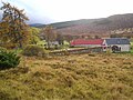
 Jamestown, Easter Ross.jpg 1,600 × 900; 583 KB
-
 Loch Slin Castle.png 537 × 678; 319 KB
-
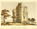 Lochslyn Castle (2).png 701 × 557; 510 KB
-
 Mountain walker approaching summit of Carn Chuinneag (geograph 3446321).jpg 1,500 × 1,125; 1.28 MB
-
 Outcrop on Diebidale Ridge, Scottish Highlands (geograph 6263207).jpg 2,400 × 1,590; 1.3 MB
-
 Ptarmigan in Winter Coats (geograph 5280155).jpg 3,438 × 2,292; 3.63 MB
-
 Rosskeen Cemetery (to the south west) - geograph.org.uk - 380017.jpg 640 × 480; 73 KB
-
 Rosskeen Cemetery (to the south) - geograph.org.uk - 380023.jpg 640 × 480; 93 KB
-
 Rubh'na h-Innse Moire.jpg 640 × 480; 101 KB
-
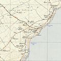 Seaboard villages OS map 1950.jpeg 2,056 × 2,056; 655 KB
-
 Tarbat ness lighthouse OS map 25inch Rosshire XXX.7 1880.jpeg 8,050 × 5,800; 3.2 MB
-
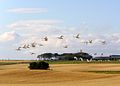 Whooper swans, Tarbat peninsula - geograph.org.uk - 591366.jpg 640 × 458; 85 KB
-
 Bridge over the Salachie Burn - geograph.org.uk - 448593.jpg 640 × 480; 152 KB

.jpg)

.jpg)


.png)
.jpg)
.jpg)
.jpg)
_-_geograph.org.uk_-_380017.jpg)
_-_geograph.org.uk_-_380023.jpg)


