Category:Geography of Madurai district
Jump to navigation
Jump to search
Subcategories
This category has the following 8 subcategories, out of 8 total.
- Geography of Arittapatti (121 F)
K
- Kutladampatti Falls (10 F)
M
S
- Sathuragiri Hills (25 F)
T
- Thiruvathavur (2 F)
Y
Media in category "Geography of Madurai district"
The following 21 files are in this category, out of 21 total.
-
 AvaniapuramReservoir.JPG 4,752 × 3,168; 2.64 MB
-
 Azhagar Koil 2.JPG 2,288 × 1,712; 751 KB
-
 Breezee clouds.jpg 4,608 × 2,592; 3.81 MB
-
 CLEAR VIEW.jpg 4,160 × 2,340; 3.33 MB
-
 Cliffs, theni, tamil nadu - panoramio.jpg 3,248 × 1,515; 2.4 MB
-
 Coconut trees near the Avaniapuram Water Reservoir, India.jpg 4,223 × 2,821; 2.62 MB
-
 Elumalai.jpg 960 × 720; 102 KB
-
 Kadumittanpatti Dam.jpg 3,072 × 4,096; 5 MB
-
 MOUNTAIN VIEW 1.jpg 4,160 × 2,340; 3.1 MB
-
 MOUNTAIN.jpg 4,160 × 2,340; 3.81 MB
-
 Nagamalai-puthukkottai-Pillar-rock-Madurai-TamilNadu.jpg 1,152 × 2,048; 951 KB
-
 Nature's Reflection.jpg 1,158 × 614; 75 KB
-
 On the train to Madurai.jpg 2,504 × 1,894; 2.12 MB
-
 RESORT.jpg 4,160 × 2,340; 3.57 MB
-
 Rock cliffs, theni - madurai road - panoramio.jpg 3,080 × 1,234; 2.11 MB
-
 Saptur R.F., Tamil Nadu, India - panoramio (3).jpg 4,608 × 3,456; 5.76 MB
-
 Saptur R.F., Tamil Nadu, India - panoramio (6).jpg 4,608 × 3,456; 5.83 MB
-
 VAIGAI RIVER. BORDER OF SHOLAVANDAN WESTERN SIDE.jpg 5,400 × 3,600; 7.24 MB
-
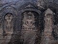 கீழக்குயில்குடி சமணர் படுக்கை.JPG 4,000 × 3,000; 5.01 MB
-
 சரவணப் பொய்கை.jpg 2,304 × 3,072; 1.17 MB
-
 தலை வடிவில் மலை.jpg 2,592 × 1,728; 1.6 MB


.jpg)
.jpg)


