Category:Geography of Northern Ireland
Jump to navigation
Jump to search
| Upload media | |||||
| Instance of |
| ||||
|---|---|---|---|---|---|
| Part of | |||||
| Facet of | |||||
| |||||
Subcategories
This category has the following 24 subcategories, out of 24 total.
Media in category "Geography of Northern Ireland"
The following 10 files are in this category, out of 10 total.
-
 Ameracam Lane seen across Cranfield Bay - geograph.org.uk - 2303896.jpg 1,024 × 359; 41 KB
-
 Approaching Glasdrumman Port from the south - geograph.org.uk - 2379001.jpg 1,024 × 768; 305 KB
-

-

-
 Near Crockandun - geograph.org.uk - 539492.jpg 640 × 479; 56 KB
-
 Near Crockandun - geograph.org.uk - 539497.jpg 640 × 479; 55 KB
-
 NIsat.jpg 1,010 × 796; 607 KB
-
 Raised beach south of Glasdrumman Port - geograph.org.uk - 2378965.jpg 1,024 × 768; 286 KB
-
 Scotland and Northern Ireland.jpg 2,155 × 2,730; 4.61 MB
-
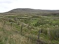
 View from Ballyhacket (2) - geograph.org.uk - 584014.jpg 640 × 480; 73 KB


_-_geograph.org.uk_-_584014.jpg)