<nowiki>Category:Geography of Obu; Category:大府市の地理; विकिमिडिया श्रेणी; categoria de Wikimedia; κατηγορία εγχειρημάτων Wikimedia; Wikimedia-kategorie; Wikimedia:Klassys; kategorija na Wikimediji; Викимедиина категорија; Wikimedia category; kategori Wikimedia; categurìa 'e nu pruggette Wikimedia; Wikimedia-categorie; Wikimedia:Ronnaghys; Wikimedia category; د ويکيمېډيا وېشنيزه; Уикимедия категория; kategoria w projekcie Wikimedia; Vikimedya kategorisi; ویکیمیڈیا زمرہ; หน้าหมวดหมู่วิกิมีเดีย; categoría de Wikimedia; Wikimedia-kategori; Wikimedia-Kategorie; категорія проєкту Вікімедіа; kawan Wikimèdia; 維基媒體專案分類; 维基媒体分类; Wikimedia-Kategorie; 위키미디어 분류; Wikimedia-bólkur; kategorio en Vikimedio; kategorie na projektech Wikimedia; Wikimedia-Kategorie; विकिपीडिया:श्रेणी; উইকিমিডিয়া বিষয়শ্রেণী; page de catégorie d'un projet Wikimedia; kategori Wikimedia; kategorija na Wikimediji; kategorya ng Wikimedia; 维基媒体分类; катэгорыя ў праекце Вікімедыя; 維基媒體分類; विकिपीडिया वर्ग; kategorija w projektach Wikimedije; thể loại Wikimedia; 维基媒体项目分类; Wikimedia projekta kategorija; kategoria ti Wikimedia; категорија на Викимедији; гурӯҳи Викимедиа; Wikimedia категориясы; categoria de um projeto da Wikimedia; 维基媒体分类; категорияд Ангилал; Wikimedia-kategori; Wikimedia-kategori; kategori Wikimédia; kategori Wikimedia; Wikimedia-Kategorie; kategori Wikimedia; پۆلی ویکیمیدیا; Wikimedia category; تصنيف ويكيميديا; Vikimédia ñemohenda; pajenn rummata eus Wikimedia; Wikimedia:ကဏ္ဍခွဲခြင်း; 維基媒體分類; Wikimédia-kategória; વિકિપીડિયા શ્રેણી; Wikimedia-kategoriija; Wikimediako kategoria; 維基媒體分類; categoría de Wikimedia; категория в проекте Викимедиа; Wikimedia-Kategorie; Wikimedia-Kategorie; kategori e Wikimedias; Viciméid catagóir; ردهٔ ویکیپدیا; Wikimedia-kategorie; Wîkîmediya:Kategorî; विकिमिडिया श्रेणी; ウィキメディアのカテゴリ; categoria Wikimedia; tudalen categori Wikimedia; تصنيف بتاع ويكيميديا; Wikimedia kategooria; විකිමීඩියා ප්රභේද පිටුව; Викимедиа проектындагы төркем; катэгорыя ў праекце Вікімэдыя; विकिमीडिया श्रेणी; kategória projektov Wikimedia; Wikimedia-luokka; гурӯҳ дар лоиҳаи Викимедиа; Wikimedia-categorie; Wikimedia-categorie; விக்கிமீடியப் பகுப்பு; categoria di un progetto Wikimedia; gurühi Vikimedia; Vikipidiya:Shopni; Wikimedia category; 維基媒體分類; categorie în cadrul unui proiect Wikimedia; Викимедиа проектындагы төркем; categoria Vicimediorum; קטגוריה בוויקיפדיה; ẹ̀ka Wikimedia; catigurìa di nu pruggettu Wikimedia; categoria de um projeto da Wikimedia; ვიკიპედია:კატეგორიზაცია; Wikimedia-kategory; tumbung Wikimedia; Վիքիմեդիայի նախագծի կատեգորիա; kategorija Wikimedie; Wikimedia proyektındağı törkem; Викимедиа категорияһы; categoría de Wikimedia; kategori Wikimedia; jamii ya Wikimedia; വിക്കിമീഡിയ വർഗ്ഗം; Wikimedia:Kategorija; kategori Wikimedia; Kategoriya ning Wikimedia; زمرو:وڪيپيڊيا زمرا بندي; Wikimedia-Kategorie; categoría de Wikimedia; Wikimedia-kategori; 维基媒体项目分类; Wikimedia-Kategorie</nowiki>
Category:Geography of Obu Wikimedia category |
| Upload media |
|
| Instance of | |
|---|
|
 |
日本語: 愛知県大府市の地理。
Subcategories
This category has the following 5 subcategories, out of 5 total.

 Aichi obu it.png 1,181 × 901; 71 KB
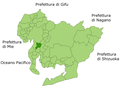
 Obu in Aichi Prefecture Ja.svg 539 × 484; 21 KB
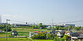 1004 shokki nagakusa.jpg 1,500 × 750; 920 KB
 20171027 NagoyaHwy 0978 (37828692665).jpg 5,760 × 3,840; 4.62 MB
 Aichi Minase river1.JPG 4,288 × 3,216; 2.96 MB
 Aichi-obu-city.svg 561 × 506; 26 KB
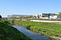 Kuranagase river and Toyota Industries Obu plant.JPG 6,016 × 4,000; 5.87 MB
 Kuranagase river Obu city2.JPG 6,016 × 4,000; 5.82 MB
 Kuranagase river Obu citya.JPG 6,016 × 4,000; 5.83 MB
 NCGG 2013.jpg 1,200 × 969; 871 KB
 Ngks mitsubishi rr ato.jpg 768 × 1,147; 992 KB
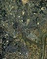 Obu city center area Aerial photograph.1987.jpg 5,083 × 6,360; 20.29 MB
 Obu city center area Aerial photograph.2020.jpg 8,621 × 10,379; 64.79 MB
 Obu Ekimae.JPG 3,072 × 2,304; 783 KB
 Obu Honmachi Street 1958.jpg 1,333 × 958; 375 KB
 Obu Station Ekimae Street ac.jpg 5,396 × 3,587; 2.89 MB
 Ohbu aerodrome 87 k.jpg 1,140 × 720; 1.03 MB
 Tihoku heiwa park 0001.JPG 4,288 × 2,848; 3.51 MB
 地図-愛知県大府市-2006.png 300 × 205; 6 KB
 基礎自治体位置図 23223-2.svg 539 × 484; 13 KB


.jpg)


