Category:Geography of Saba
Jump to navigation
Jump to search
Provinces of the Netherlands: Drenthe · Flevoland · Friesland · Gelderland · Groningen · Limburg · North Brabant · North Holland · Overijssel · South Holland · Utrecht · Zeeland
| Upload media | |||||
| Instance of |
| ||||
|---|---|---|---|---|---|
| |||||
Subcategories
This category has the following 7 subcategories, out of 7 total.
*
B
- Beaches of Saba (6 F)
C
- Corner Point, Saba (2 F)
F
- Fort Bay (38 F)
L
M
S
- Satellite pictures of Saba (4 F)
Media in category "Geography of Saba"
The following 2 files are in this category, out of 2 total.
-
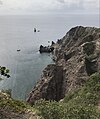 View of Wells Bay, Saba, from Mary’s Point Trail.jpg 2,894 × 3,453; 3.3 MB
-
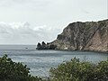 Wells Bay, Saba, with Torrens Point in the distance.jpg 3,939 × 2,954; 2.69 MB

