<nowiki>Category:Geography of Tsuyama; Category:津山市の地理; विकिमिडिया श्रेणी; Wikimedia-categorie; 维基媒体分类; categoria de Wikimedia; Wikimedia:Klassys; kategorija na Wikimediji; Kategoriya ning Wikimedia; 維基媒體分類; kategori Wikimedia; pajenn rummata eus Wikimedia; 維基媒體分類; categoría de Wikimedia; Wikimedia category; د ويکيمېډيا وېشنيزه; Уикимедия категория; kategoria w projekcie Wikimedia; Vikimedya kategorisi; ویکیمیڈیا زمرہ; หน้าหมวดหมู่วิกิมีเดีย; Wikimedia-Kategorie; kategória projektov Wikimedia; Wikimedia-Kategorie; категорія проєкту Вікімедіа; kawan Wikimèdia; 維基媒體分類; 维基媒体分类; Wikimedia-Kategorie; 위키미디어 분류; Wikimedia-bólkur; kategorio en Vikimedio; kategorie na projektech Wikimedia; Wikimedia-Kategorie; categoría de Wikimedia; উইকিমিডিয়া বিষয়শ্রেণী; page de catégorie d'un projet Wikimedia; kategori Wikimedia; kategorija na Wikimediji; kategorya ng Wikimedia; 维基媒体分类; катэгорыя ў праекце Вікімедыя; Викимедиина категорија; विकिपीडिया वर्ग; kategorija w projektach Wikimedije; thể loại Wikimedia; 维基媒体分类; Wikimedia projekta kategorija; kategoria ti Wikimedia; категорија на Викимедији; Wikimedia-kategory; विकिपीडिया:श्रेणी; categoria de um projeto da Wikimedia; 维基媒体分类; категорияд Ангилал; Wikimedia-kategori; Wikimedia-kategori; kategori Wikimédia; kategori Wikimedia; Wikimedia-Kategorie; kategori Wikimedia; پۆلی ویکیمیدیا; Wikimedia category; تصنيف ويكيميديا; Vikimédia ñemohenda; Wikimedia:Ronnaghys; Wikimedia:ကဏ္ဍခွဲခြင်း; 維基媒體分類; Wikimédia-kategória; વિકિપીડિયા શ્રેણી; categorie în cadrul unui proiect Wikimedia; Wikimediako kategoria; гурӯҳи Викимедиа; categoría de Wikimedia; категория в проекте Викимедиа; Викимедиа категорияһы; tudalen categori Wikimedia; kategori e Wikimedias; Viciméid catagóir; Վիքիմեդիայի նախագծի կատեգորիա; Wikimedia-kategorie; Wîkîmediya:Kategorî; विकिमिडिया श्रेणी; ウィキメディアのカテゴリ; categoria Wikimedia; Wikimedia категориясы; تصنيف بتاع ويكيميديا; катэгорыя ў праекце Вікімэдыя; විකිමීඩියා ප්රභේද පිටුව; Викимедиа проектындагы төркем; Wikimedia-kategoriija; विकिमीडिया श्रेणी; Wikimedia-kategori; Wikimedia-luokka; гурӯҳ дар лоиҳаи Викимедиа; Wikimedia-categorie; Wikimedia-categorie; விக்கிமீடியப் பகுப்பு; categoria di un progetto Wikimedia; gurühi Vikimedia; Vikipidiya:Shopni; Wikimedia category; 維基媒體分類; Wikimedia kategooria; Викимедиа проектындагы төркем; categoria Vicimediorum; דף קטגוריה; ẹ̀ka Wikimedia; catigurìa di nu pruggettu Wikimedia; categoria de um projeto da Wikimedia; ვიკიპედია:კატეგორიზაცია; Wikimedia-kategori; tumbung Wikimedia; ردهٔ ویکیپدیا; kategorija Wikimedie; Wikimedia proyektındağı törkem; Wikimedia category; Wikimedia-Kategorie; kategori Wikimedia; jamii ya Wikimedia; വിക്കിമീഡിയ വർഗ്ഗം; Wikimedia:Kategorija; kategori Wikimedia; categurìa 'e nu pruggette Wikimedia; زمرو:وڪيپيڊيا زمرا بندي; Wikimedia-Kategorie; categoría de Wikimedia; Wikimedia-Kategorie; κατηγορία εγχειρημάτων Wikimedia; Wikimedia-kategorie</nowiki>
日本語: 岡山県津山市の地理。
Subcategories
This category has the following 8 subcategories, out of 8 total.

 Kumearea Tsuyamacity Okayamapref background.JPG 1,898 × 1,024; 671 KB
 Map Tsuyama en.png 1,281 × 901; 35 KB
 Nondaki.JPG 2,000 × 3,008; 2.93 MB
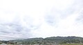
 Population distribution of Tsuyama, Okayama, Japan.svg 512 × 256; 22 KB
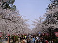 Tsuyama Cherry Blossom Festival.JPG 2,304 × 1,728; 898 KB
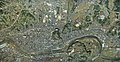 Tsuyama city center area Aerial photograph.1976.jpg 6,749 × 3,503; 8.25 MB
 Tsuyama cstl stereo 1976.jpg 1,064 × 842; 781 KB
 Tsuyama in Okayama Prefecture Ja.svg 456 × 536; 10 KB
 Tsuyama Momiji.JPG 2,560 × 1,920; 2.69 MB
 Tsuyama Okayama pref02s5s4272.jpg 2,848 × 4,272; 3.48 MB
 Tsuyama Okayama pref03n3200.jpg 3,200 × 2,133; 2.08 MB
 TsuyamaShiKennai.png 210 × 200; 6 KB
 Yasumidawa -02.jpg 2,592 × 1,944; 2 MB
 作州絣工芸館.jpg 960 × 720; 98 KB
 加茂地域上空(ドローン) (50153802676).jpg 4,000 × 3,000; 5.4 MB
 吉井川 by takeokahp - panoramio (1).jpg 5,184 × 3,456; 8.38 MB
 塩手池(ドローン) (50154177517).jpg 4,000 × 3,000; 5.27 MB
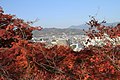 津山の街 by takeokahp - panoramio (1).jpg 5,184 × 3,456; 8.65 MB
 津山市 吉井川の風景 (31703740277).jpg 1,024 × 681; 444 KB


.jpg)
.jpg)
.jpg)
.jpg)
.jpg)