Category:Geological maps of Massachusetts
Jump to navigation
Jump to search
States of the United States: Alabama · Alaska · Arizona · Arkansas · California · Colorado · Connecticut · Delaware · Florida · Georgia · Hawaii · Idaho · Illinois · Indiana · Iowa · Kansas · Kentucky · Louisiana · Maine · Maryland · Massachusetts · Michigan · Minnesota · Mississippi · Missouri · Montana · Nebraska · Nevada · New Hampshire · New Jersey · New Mexico · New York · North Carolina · North Dakota · Ohio · Oklahoma · Oregon · Pennsylvania · Rhode Island · South Carolina · South Dakota · Tennessee · Texas · Utah · Vermont · Virginia · Washington · West Virginia · Wisconsin · Wyoming
Puerto Rico
Puerto Rico
Subcategories
This category has only the following subcategory.
R
Media in category "Geological maps of Massachusetts"
The following 32 files are in this category, out of 32 total.
-
Bulletin of the Geological Society of America (1904) (20441146492).jpg 2,150 × 1,760; 980 KB
-
Geologic Map of Cape Ann, Mass., Showing Distribution of Dikes, etc., 1887.jpg 8,171 × 7,979; 93.52 MB
-
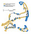
Cape Cod Glacial Erosion and Deposition.jpg 799 × 501; 54 KB
-
Coastal landforms of Massachusetts.png 376 × 376; 41 KB
-
Deposition erosion.jpg 900 × 989; 113 KB
-
Geologic Map of Cape Cod.jpg 1,200 × 687; 103 KB
-
Geological map of Essex County, Massachusetts (2674368799).jpg 2,000 × 1,648; 3.42 MB
-
Geological map of Massachusetts (2674139357).jpg 2,000 × 1,315; 2.25 MB
-
Hartford-Deerfield Basin geological map.jpg 2,535 × 7,870; 19.62 MB
-
Holyoke.jpg 744 × 520; 560 KB
-
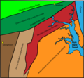
Hornfels Map.png 1,157 × 727; 2.1 MB
-
Hydrologic unit map, Massachusetts LOC 81693477.jpg 5,076 × 3,306; 1.98 MB
-
Hydrologic unit map, Massachusetts LOC 81693477.tif 5,076 × 3,306; 48.01 MB
-
Hydrologic unit map-1988, states of Massachusetts, Rhode Island, and Connecticut LOC 89693472.jpg 11,593 × 6,830; 10.75 MB
-
Hydrologic unit map-1988, states of Massachusetts, Rhode Island, and Connecticut LOC 89693472.tif 11,593 × 6,830; 226.54 MB
-
Massachusetts geological map.jpg 900 × 600; 220 KB
-
Massachusetts Köppen.png 6,000 × 5,700; 331 KB
-
Massachusetts Köppen.svg 1,017 × 945; 585 KB
-
Massachusetts Relief 1.jpg 18,500 × 12,658; 49.2 MB
-
Massachusetts wind resource map 50m 800.jpg 1,100 × 850; 557 KB
-
NVC.png 2,547 × 2,359; 362 KB
-
Occasional papers of the Boston Society of Natural History BHL36198889.jpg 4,369 × 3,227; 2 MB
-
Occasional papers of the Boston Society of Natural History BHL36198890.jpg 4,809 × 3,254; 1.44 MB
-
Occasional papers of the Boston Society of Natural History BHL36198891.jpg 4,865 × 3,282; 2.39 MB
-
Occasional papers of the Boston Society of Natural History BHL36198892.jpg 4,763 × 3,229; 1.87 MB
-
Pocumtuck.gif 421 × 583; 155 KB
-
The American journal of science, and c (1819) (14778882075).jpg 3,192 × 1,856; 642 KB


