Category:Geological maps of Virgin Islands National Park
Jump to navigation
Jump to search
United States national parks: Acadia · American Samoa · Badlands · Bryce Canyon · Canyonlands · Capitol Reef · Carlsbad Caverns · Congaree · Crater Lake · Cuyahoga Valley · Denali · Dry Tortugas · Everglades · Glacier · Glacier Bay · Grand Canyon · Grand Teton · Great Basin · Great Smoky Mountains · Guadalupe Mountains · Haleakalā · Hawaii Volcanoes · Hot Springs · Indiana Dunes · Isle Royale · Joshua Tree · Lake Clark · Lassen Volcanic · Mammoth Cave · Mesa Verde · Mount Rainier · Petrified Forest · Rocky Mountain · Saguaro · Shenandoah · Theodore Roosevelt · Virgin Islands · Voyageurs · White Sands · Wind Cave · Wrangell-St. Elias · Yellowstone · Yosemite · Zion
Media in category "Geological maps of Virgin Islands National Park"
The following 3 files are in this category, out of 3 total.
-
 NPS buck-island-geologic-map.jpg 3,257 × 1,749; 987 KB
-
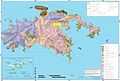 NPS virgin-islands-geologic-map.jpg 4,264 × 2,866; 1.5 MB
-
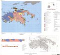 St. John, USVI, geologic map.pdf 6,564 × 5,991; 2.53 MB

