Category:Geology of Dorset
Jump to navigation
Jump to search
Ceremonial counties of England: Bedfordshire · Berkshire · Buckinghamshire · Cambridgeshire · Cheshire · Cornwall · Cumbria · Derbyshire · Devon · Dorset · Durham · East Riding of Yorkshire · East Sussex · Essex · Gloucestershire · Greater Manchester · Hampshire · Herefordshire · Hertfordshire · Isle of Wight · Kent · Lancashire · Leicestershire · Lincolnshire · Merseyside · North Yorkshire · Northamptonshire · Northumberland · Nottinghamshire · Oxfordshire · Shropshire · Somerset · South Yorkshire · Staffordshire · Suffolk · Surrey · Warwickshire · West Midlands · West Sussex · West Yorkshire · Wiltshire · Worcestershire
City-counties:
Former historic counties: Yorkshire
Other former counties:
City-counties:
Former historic counties: Yorkshire
Other former counties:
Geological overview of the English county of Dorset | |||||
| Upload media | |||||
| Subclass of | |||||
|---|---|---|---|---|---|
| Location |
| ||||
| |||||
Subcategories
This category has the following 22 subcategories, out of 22 total.
+
- Geological maps of Dorset (4 F)
B
D
E
F
G
J
M
P
R
- Ringstead Coral Bed (1 F)
S
- Sandrock Formation (1 F)
W
- Wheldon Beds (1 F)
Media in category "Geology of Dorset"
The following 56 files are in this category, out of 56 total.
-
 2010-11-16 Brandy Bay geol jpg 1.jpg 945 × 262; 32 KB
-
 2010-11-16-Worbarrow geol jpg 1.JPG 967 × 263; 39 KB
-
 Beccles Pit ILN 1857.jpg 595 × 469; 179 KB
-
 Belemnite pavement, Seatown, Dorset - geograph.org.uk - 654466.jpg 640 × 427; 77 KB
-
 Blue lias, cliff erosion - geograph.org.uk - 432935.jpg 640 × 480; 88 KB
-
 Chalk & greensand at Lulworth.jpg 3,072 × 1,528; 1.39 MB
-
 Charmouth lias and beach - geograph.org.uk - 432931.jpg 640 × 480; 77 KB
-

-
 Cracked dolomite bed, The Flats - geograph.org.uk - 695313.jpg 480 × 640; 156 KB
-
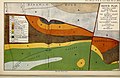
 Cropped version of Geological map of Dorset.png 2,601 × 1,303; 946 KB
-

-
 Dorset Geology.png 1,156 × 801; 360 KB
-
 East Beach 2 2006.JPG 2,560 × 1,920; 1.99 MB
-

-

-
 GreensandSample.jpg 1,845 × 1,487; 1.45 MB
-
 Holes and barrows on Bronkham Hill - geograph.org.uk - 298163.jpg 640 × 480; 118 KB
-
 Kimmeridge Bay - geograph.org.uk - 428271.jpg 480 × 640; 103 KB
-
 Kimmeridge Bay - geograph.org.uk - 428281.jpg 640 × 480; 121 KB
-
 Kimmeridge Ledges - geograph.org.uk - 378983.jpg 3,264 × 2,448; 3.29 MB
-
 King Barrow Quarry, Portland, Dorset.JPG 768 × 576; 129 KB
-
 King Barrow Quarry, Portland.JPG 768 × 576; 168 KB
-
 Layers of rock, Lyme Regis - geograph.org.uk - 221931.jpg 640 × 480; 122 KB
-
 Lias stone ledges, Charmouth - geograph.org.uk - 816647.jpg 640 × 426; 48 KB
-
 Moss Growing on Bridport Sands - geograph.org.uk - 765242.jpg 640 × 426; 107 KB
-
 Mudflow - geograph.org.uk - 484052.jpg 480 × 640; 118 KB
-

-
 Nicodemus Knob.jpg 1,024 × 627; 514 KB
-
 Notched barrow with Shakehole - geograph.org.uk - 1022757.jpg 640 × 428; 61 KB
-

-

-
 Portland Limestone - Purbeck quarry - Southern England.jpg 2,304 × 1,536; 2.35 MB
-
 Portland Stone.JPG 800 × 578; 117 KB
-
 Proceedings - Dorset Natural History and Archaeological Society (1889) (14768593745).jpg 4,032 × 2,633; 3.4 MB
-
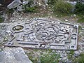
 PurbeckFormationPortland.jpg 2,592 × 1,944; 2.83 MB
-
 Representation of a Baroque garden by Shelagh Wakely.jpg 768 × 576; 291 KB
-
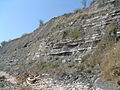
 Rock Strata, Durdle Door - geograph.org.uk - 274762.jpg 640 × 427; 273 KB
-
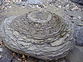
 Septarian Nodule on Ringstead Beach in England.jpg 640 × 480; 119 KB
-

-
 Shakeholes, Bronkham Hill - geograph.org.uk - 1022674.jpg 640 × 428; 81 KB
-
 Slipped stone, Southwell Landslip - geograph.org.uk - 1030802.jpg 480 × 640; 107 KB
-
 Stack and Raised Beach - geograph.org.uk - 109893.jpg 640 × 480; 179 KB
-
 Stair Hole.JPG 640 × 480; 180 KB
-
 Stone Sculpting Teaching Area, Tout Quarry.jpg 640 × 480; 386 KB
-
 Studland Beach , Redend Point - geograph.org.uk - 1711508.jpg 3,264 × 2,448; 3.89 MB
-
 The Corner - geograph.org.uk - 1226824.jpg 428 × 640; 107 KB
-

-
 The Flats, Kimmeridge Bay - geograph.org.uk - 695436.jpg 427 × 640; 102 KB
-
 The Flats, Kimmeridge Bay - geograph.org.uk - 696254.jpg 427 × 640; 107 KB
-
 The rim of Culpeppers Dish, Affpuddle and Turnerspuddle, Dorset.jpg 640 × 480; 133 KB
-

-
 Twisted Strata at Lulworth Cove - panoramio.jpg 3,264 × 4,928; 7.34 MB
-
 Weymouth Anticline.png 1,142 × 585; 146 KB
-
 Worbarrow Tout, Shoreline rocks - geograph.org.uk - 1408064.jpg 640 × 480; 187 KB
-

-
 The Ballard Fault - geograph.org.uk - 399974.jpg 640 × 480; 96 KB


_(14768593745).jpg)


_(Jurassic;_Weymouth,_England)_(35396422650).jpg)


