Category:Georgia State Route 1
Jump to navigation
Jump to search
 | number: | (one) |
|---|---|---|
| State highways in Georgia (U.S. state): | 1 · 2 · 3 · 4 · 5 · 6 · 7 · 8 · 9 · 10 · 11 · 12 · 13 · 14 · 15 · 16 · 17 · 18 · 19 · 20 · 21 |
English: U.S. Route 27 (US 27) runs south-to-north through the U.S. state of Georgia near its western border with Alabama. The whole route is Governor's Road Improvement Program (GRIP) corridor EDS-27, providing the bulk of the Tallahassee - Chattanooga corridor. All of US 27 in Georgia is designated State Route 1 (SR 1) and is also designated as the Martha Berry Highway.
road in Georgia, United States  | |||||
| Upload media | |||||
| Instance of | |||||
|---|---|---|---|---|---|
| Location | Georgia | ||||
| Transport network | |||||
| Owned by | |||||
| Maintained by | |||||
| Inception |
| ||||
| |||||
Subcategories
This category has the following 2 subcategories, out of 2 total.
Media in category "Georgia State Route 1"
The following 13 files are in this category, out of 13 total.
-
 Georgia 1 Spur.svg 600 × 600; 9 KB
-
 Bishop's Travel Center, Decatur County.JPG 4,320 × 3,240; 4.52 MB
-
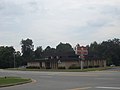
 Bluffton Welcome, US27 Northbound.JPG 4,320 × 3,240; 4.57 MB
-
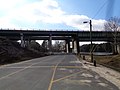
 East end of US-84 bridge over Flint River viewed from north.jpg 2,272 × 1,704; 655 KB
-
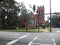 First Presbyterian Church, Bainbridge.JPG 4,320 × 3,240; 4.5 MB
-
 GA green route concurrency.png 318 × 335; 140 KB
-
 Georgia 1.svg 600 × 600; 3 KB
-
 Georgia State Line, Decatur County, US27NB.JPG 4,320 × 3,240; 4.41 MB
-
 Georgia state route 1 map.png 3,033 × 1,791; 553 KB
-
 Int185sRoad-Exit1AB-US27nsGA1nsUS280ewGA520ew (32754674602).jpg 2,400 × 1,600; 1.45 MB
-
 People's South Bank, Colquitt.JPG 4,320 × 3,240; 4.42 MB
-
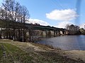 US84 bridge over Flint River, Bainbridge.JPG 2,592 × 1,944; 2.95 MB
-
 US84 bridge over Hatcher Rd, Flint River, Bainbridge.JPG 2,592 × 1,944; 2.99 MB


.jpg)


