Category:Gerard Street, Ashton-in-Makerfield
Jump to navigation
Jump to search
| Object location | | View all coordinates using: OpenStreetMap |
|---|
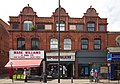
Gerard Street is the main thoroughfare and shopping street in Ashton-in-Makerfield and forms most of the northern part of the Ashton Conservation Area. It is fairly short, but has a dogleg at its southern end.
Subcategories
This category has the following 5 subcategories, out of 5 total.
Media in category "Gerard Street, Ashton-in-Makerfield"
The following 12 files are in this category, out of 12 total.
-
 A busy Gerard Street in Ashton In Makerfield - geograph.org.uk - 2059788.jpg 1,600 × 1,260; 409 KB
-
 Central Buildings, Ashton-in-Makerfield.jpg 4,340 × 3,041; 14.45 MB
-
 Gerard Street - Ashton-in-Makerfield - geograph.org.uk - 3542717.jpg 4,608 × 2,856; 2.53 MB
-
 Gerard Street, Ashton-in-Makerfield (1).jpg 4,320 × 3,240; 2.68 MB
-
 Gerard Street, Ashton-in-Makerfield (2).jpg 4,320 × 3,240; 3.17 MB
-
 Gerard Street, Ashton-in-Makerfield 1.jpg 4,911 × 3,204; 20.78 MB
-
 Gerard Street, Ashton-in-Makerfield 2.jpg 4,916 × 3,137; 16.9 MB
-
 Gerard Street, Ashton-in-Makerfield 3.jpg 4,729 × 2,937; 15.07 MB
-
 Ghost sign on Gerard Street, Ashton-in-Makerfield.jpg 2,775 × 5,129; 16.05 MB
-
 Passage to A Court, Ashton-in-Makerfield.jpg 3,444 × 4,913; 18.72 MB
-
 Shops on Gerard Street, Ashton-in-Makerfield.jpg 4,320 × 3,240; 2.66 MB
-
 The Gerard Centre - geograph.org.uk - 922261.jpg 640 × 425; 173 KB


.jpg)
.jpg)


