Category:Geratal
Jump to navigation
Jump to search
municipality in Thuringia, Germany   | |||||
| Upload media | |||||
| Instance of |
| ||||
|---|---|---|---|---|---|
| Location | Ilm-Kreis, Thuringia, Germany | ||||
| Head of government |
| ||||
| Inception |
| ||||
| Population |
| ||||
| Area |
| ||||
| Elevation above sea level |
| ||||
| official website | |||||
 | |||||
Ilm-Kreis  Alkersleben · Amt Wachsenburg · Arnstadt · Bösleben-Wüllersleben · Dornheim · Elgersburg · Elleben · Elxleben · Geratal · Großbreitenbach · Ilmenau · Martinroda · Osthausen-Wülfershausen · Plaue · Stadtilm · Witzleben ·
Subcategories
This category has the following 8 subcategories, out of 8 total.
F
G
L
Media in category "Geratal"
The following 3 files are in this category, out of 3 total.
-
 Wappen Landgemeinde Geratal.png 714 × 794; 115 KB
-
 Geratal in IK.svg 1,063 × 1,063; 153 KB
-
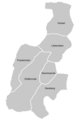 Ortseile von Geratal.png 450 × 639; 26 KB
