Category:Gerbisdorfer Sandgruben
Jump to navigation
Jump to search
| Object location | | View all coordinates using: OpenStreetMap |
|---|
natural monument area in Schkeuditz Municipality, Saxony, Germany  | |||||
| Upload media | |||||
| Instance of | |||||
|---|---|---|---|---|---|
| Part of |
| ||||
| Location | Gerbisdorf, Schkeuditz, Nordsachsen, Saxony, Germany | ||||
| Heritage designation |
| ||||
| Inception |
| ||||
| Area |
| ||||
 | |||||
Media in category "Gerbisdorfer Sandgruben"
The following 13 files are in this category, out of 13 total.
-
 Gerbisdorfer Sandgruben - Auwald im Nordteil 01.jpg 4,032 × 3,024; 5.96 MB
-
 Gerbisdorfer Sandgruben - Auwald im Nordteil 02.jpg 4,032 × 3,024; 5.36 MB
-
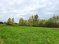
 Gerbisdorfer Sandgruben - Auwiesen im Nordteil 01.jpg 4,032 × 3,024; 3.79 MB
-
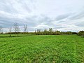
 Gerbisdorfer Sandgruben - Auwiesen im Nordteil 02.jpg 4,032 × 3,024; 4.79 MB
-
 Gerbisdorfer Sandgruben - Auwiesen im Nordteil 03.jpg 4,608 × 3,456; 7.65 MB
-
 Gerbisdorfer Sandgruben - Auwiesen im Nordteil 04.jpg 4,608 × 3,456; 6.11 MB
-
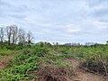
 Gerbisdorfer Sandgruben - Bruchwald im Nordteil 01.jpg 3,456 × 4,608; 8.52 MB
-
 Gerbisdorfer Sandgruben - Bruchwald im Nordteil 02.jpg 4,032 × 3,024; 5.46 MB
-
 Gerbisdorfer Sandgruben - Bruchwald im Nordteil 03.jpg 4,608 × 3,456; 6.86 MB
-
 Gerbisdorfer Sandgruben - Feuchtgebiet im Nordteil.jpg 3,024 × 4,032; 10.57 MB
-
 Gerbisdorfer Sandgruben - Findlingsgruppe im Nordteil.jpg 4,032 × 3,024; 9.61 MB
-
 Gerbisdorfer Sandgruben - Südteil auf dem Nordfeld Flughafen.jpg 4,032 × 3,024; 5.05 MB
-
 Gerbisdorfer Sandgruben - Südteil auf Flughafengelände.jpg 4,556 × 2,665; 2.67 MB


