Category:Gerecse
Salti al navigilo
Salti al serĉilo
| Pozicio de la objekto | | Mapo de cxiuj koordinatoj per: OpenStreetMap |
|---|
mountain range  Kilátás a mogyorósbányai Kőszikla-hegy platójáról  Gerecse-vidék kistáj elhelyezkedése | |||||
| Alŝuti plurmedion | |||||
| Estas |
| ||||
|---|---|---|---|---|---|
| Parto de |
| ||||
| Uzita materialo | |||||
| Loko | Komárom-Esztergom, Hungario | ||||
| Montaro | |||||
| Areo |
| ||||
| Supermara alteco |
| ||||
 | |||||
English: Mountain Gerecse. Gerecse Peak (634m asl). Part of Dunazug mountains. Enclosed to the north by the river Danube, to the east by the basin of Zsámbék, to the south-west the basin of Tata, while to the west, the territory of Kisalföld (the “small flatlands”). Protected Landscape Area of Gerecse (Est. 1977) located in Middle Gerecse[1]
Magyar: Gerecse. Dunazug-hegység része. Északon a Duna folyama, keleten a Zsámbéki-medence, délnyugaton a Tatai-medence, míg nyugaton a Kisalföld határolja. A Központi-Gerecsében található a Gerecsei Tájvédelmi Körzet (Alapítás 1977).[2]
Subkategorioj
Ĉi tiu kategorio havas la 11 jenajn subkategoriojn, el 11 entute.
Dosieroj en kategorio “Gerecse”
La jenaj 37 dosieroj estas en ĉi tiu kategorio, el 37 entute.
-
 A Római út emléktáblája.jpg 1 600 × 1 200; 855 KB
-
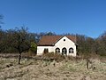
 A Szent Péter templom a Gerecsében.jpg 2 048 × 1 536; 2,21 MB
-
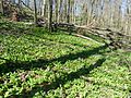 Allium ursinum in Gerecse 2.jpg 2 560 × 1 920; 3,4 MB
-
 Allium ursinum in Gerecse.jpg 1 000 × 667; 1,07 MB
-
 Babál-hegy Sárisáp.jpg 4 160 × 3 120; 4,06 MB
-
-
 Bánhída Reformed church and sunflower field from Síkvölgy cemetery, 2017 Tatabánya.jpg 2 272 × 1 704; 1,02 MB
-
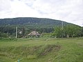
 Bányahegy forester's house.jpg 4 000 × 3 000; 6,63 MB
-
 Csabdi-halastó és a Középhegy, 2017 Bicske.jpg 1 600 × 1 200; 537 KB
-
 Dunagerecsearboretum.jpg 1 024 × 768; 211 KB
-
 Farkasvölgy.jpg 640 × 475; 132 KB
-
 Forest in Gerecse Mountains.jpg 2 048 × 1 536; 1,35 MB
-
 Forest path in Gerecse.jpg 4 000 × 3 000; 7,26 MB
-
 Gerecse business house, Kond vezér Street, 2017 Tatabánya.jpg 2 272 × 1 704; 964 KB
-
 Gerecse Hill.jpg 3 005 × 1 102; 2,47 MB
-
 Gerecse látképe.jpg 1 600 × 1 200; 555 KB
-
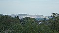
 Gerecse Mountains.jpg 800 × 600; 411 KB
-
 Gerecse pelifoldszentkeresztnel.JPG 2 288 × 1 712; 794 KB
-
 Gerecse.jpg 3 024 × 4 032; 6,52 MB
-
 HU subregion 5.3.1. Gerecse-vidék.png 2 009 × 1 282; 56 KB
-
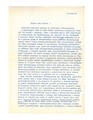 Janisch Miklos lettre to Sághy Antal.pdf 1 275 × 1 650, 2 paĝoj; 1,58 MB
-
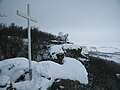 Kereszt a mogyorósbányai Kőszikla-hegyen.JPG 3 648 × 2 736; 1,76 MB
-
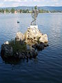 Keresztelő Szent János szobra. - Tata, Eszterházy sétány.JPG 1 704 × 2 272; 945 KB
-
 Komfortos magasles a Gerecsében.jpg 1 280 × 960; 946 KB
-
 Kőszikla-hegy.JPG 3 648 × 2 736; 2,53 MB
-
 M1, Tatabánya - Mapillary (TeBQWU9-J5xuLFgHvBAxwA).jpg 1 969 × 1 477; 355 KB
-
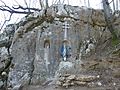 Mary statue in Gerecse.jpg 2 560 × 1 920; 3,34 MB
-
 Rocket Base Zsámbék concrete fence with view.jpg 3 730 × 2 497; 6,54 MB
-
 Saint Michael church and sunflower field from Síkvölgy cemetery, 2017 Tatabánya.jpg 2 272 × 1 704; 1 004 KB
-
 Saint Michael church tower, electric pylon and Csúcsos Hill, 2017 Tatabánya.jpg 1 704 × 2 272; 1 016 KB
-
 Tata - Öreg-tó a várból - 1159.jpg 2 144 × 1 608; 822 KB
-
 View of Hegyes-kő and Nagy-Gete.jpg 4 000 × 3 000; 5,91 MB
-
 Vértestolna13.JPG 1 600 × 1 200; 392 KB
-
 Öreg-tó délkeleti része és a Gerecse. - Tata.JPG 2 272 × 1 704; 955 KB
-
 Öreg-tó keleti partja és a Gerecse. - Tata.JPG 2 272 × 1 704; 1,05 MB
-
 Öreg-tó. Yachtkikötő. - Tata.JPG 2 272 × 1 704; 995 KB
-
 Úny Stream.jpg 4 000 × 3 000; 6,7 MB


.jpg)


