Category:Gestüt Lehn
Jump to navigation
Jump to search
| Object location | | View all coordinates using: OpenStreetMap |
|---|
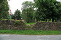
bridge in Germany  | |||||
| Upload media | |||||
| Instance of | |||||
|---|---|---|---|---|---|
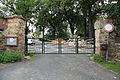
| Location | Hochkirch, Bautzen District, Saxony, Germany | ||||
| Street address |
| ||||
| Heritage designation | |||||
| Inception |
| ||||
 | |||||
Media in category "Gestüt Lehn"
The following 13 files are in this category, out of 13 total.
-
 Hochkirch - Lehn - Gestüt 01 ies.jpg 5,616 × 3,744; 5.56 MB
-
 Hochkirch - Lehn - Gestüt 02 ies.jpg 5,616 × 3,744; 14.18 MB
-
 Hochkirch - Lehn - Gestüt 03 ies.jpg 3,744 × 5,616; 9.53 MB
-
 Hochkirch - Lehn - Gestüt 04 ies.jpg 5,616 × 3,744; 9.79 MB
-
 Hochkirch - Lehn - Gestüt 05 ies.jpg 5,616 × 3,744; 10.27 MB
-
 Hochkirch - Lehn - Gestüt 06 ies.jpg 5,616 × 3,744; 5.32 MB
-
 Hochkirch - Lehn - Gestüt 07 ies.jpg 5,616 × 3,744; 12.23 MB
-
 Hochkirch - Lehn - Gestüt 08 ies.jpg 5,616 × 3,744; 13.97 MB
-
 Hochkirch - Lehn - Gestüt 09 ies.jpg 5,616 × 3,744; 13.99 MB
-
 Hochkirch - Lehn - Gestüt 10 ies.jpg 5,616 × 3,744; 12.89 MB
-
 Hochkirch - Lehn - Gestüt 11 ies.jpg 5,616 × 3,744; 6.06 MB
-
 Lejno – mosćik při ryćerkuble.jpg 3,500 × 2,333; 2 MB
-
 Lejno – ryćerkubło.jpg 3,500 × 2,333; 1.52 MB


