Category:Geyer Valley (Indiana)
Jump to navigation
Jump to search
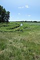
Geyer Ditch is a north branch of the Kankakee River in St. Joseph County.
- Source
| Object location | | View all coordinates using: OpenStreetMap |
|---|
- 14.79 miles (23.80 km): Source at Galien Township, Berrien County, Michgan
- 12.24 miles (19.70 km): Indiana/Michigan State Line
- 11.85 miles (19.07 km): Chicago Road aka Sauk Trail and I-80/90 the Indiana Toll Road.
- 7.91 miles (12.73 km): U.S. 20 - Lincoln Highway
- 5.04 miles (8.11 km): Indiana 2 - Western Ave
- 0.0 miles (0 km): Kankakee River, 861.0 kilometres (535.0 mi) west of Crumstown Road bridge.
- Outlet
| Object location | | View all coordinates using: OpenStreetMap |
|---|
Subcategories
This category has only the following subcategory.
U
- U.S. 20 (Geyer Valley, Ind) (7 F)
Media in category "Geyer Valley (Indiana)"
The following 5 files are in this category, out of 5 total.
-
 Geyer Ditch Valley 00.jpg 6,508 × 1,981; 2.57 MB
-
 Lwr Geyer Ditch 7131.jpg 4,608 × 3,072; 3.9 MB
-
 Lwr Geyer Ditch 7132.jpg 3,072 × 4,608; 4.22 MB
-
 Lwr Geyer North 5234.jpg 3,072 × 4,608; 5.14 MB
-
 Southview 5226.jpg 3,072 × 4,608; 4.8 MB


