Category:Geysir Geothermal Field
Aller à la navigation
Aller à la recherche
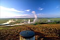
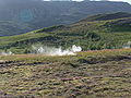
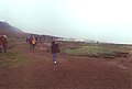
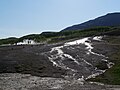
Deutsch: Das Geothermalfeld am Großen Geysir befindet sich im Haukadalur, im Süden von Island über einer Magmakammer. Allerdings konnten Geologen bisher keine Eruptionen des Vulkansystems nachweisen. Das Hochtemperaturgebiet besteht aus zwei größeren Geysiren, dem Großen Geysir und dem Strokkur sowie zahlreichen weiteren heißen Quellen. Das Heißquellengebiet gehört zu den beliebtesten Sehenswürdigkeiten Islands und zum Golden Circle.
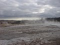
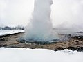
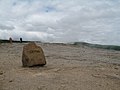
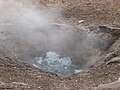
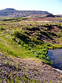
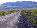
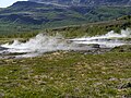
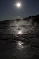
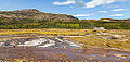
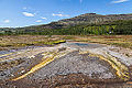
English: The Geysir Geothermal Field is situated in the valley of w:Haukadalur in the south of Iceland above a magma reservoir, but no eruptions are known from this volcano. The hot springs area consists of two bigger geysers, the w:Great Geysir and w:Strokkur as well as many other smaller springs. As part of the Golden Circle, the geothermal field is one of the most popular visitor attractions of Iceland.
Français : Le champ géothermique de Geysir est un ensemble de sources chaudes, d'un dôme et d'un cône volcanique qui constituent les restes d'un ancien volcan d'Islande. Il constitue l'un des sites géothermiques et touristiques les plus importants du pays, notamment grâce à ces geysers comme Geysir et Strokkur, normalement le seul encore actif.
Íslenska: Geysissvæði er eitt frægasta goshverasvæði heimsins og dregir sem hlut Gullna Hringsins ár fyrir ári marga túrista að sér.

ensemble géothermique en Islande .jpg) | |||||
| Téléverser des médias | |||||
| Nature de l’élément | |||||
|---|---|---|---|---|---|
| Partie de | |||||
| Matériau | |||||
| Lieu | Bláskógabyggð, Suðurland, Islande | ||||
| Chaîne de montagnes | |||||
| Point culminant |
| ||||
| Altitude |
| ||||
 | |||||
Sous-catégories
Cette catégorie comprend 13 sous-catégories, dont les 13 ci-dessous.
+
H
I
L
T
Pages dans la catégorie « Geysir Geothermal Field »
Cette catégorie comprend seulement la page ci-dessous.
Média dans la catégorie « Geysir Geothermal Field »
Cette catégorie comprend 80 fichiers, dont les 80 ci-dessous.
-
Is-Geysir pronunciation.ogg 0,7 s ; 5 kio
-
 111 - Zona Gayser.jpg 2 592 × 1 944 ; 2,42 Mio
-
 80 to 100 degrees celsius.jpg 3 200 × 2 400 ; 2,66 Mio
-
 Cooking in Blesi. (4558240999).jpg 1 536 × 1 100 ; 278 kio
-
 Danger Danger Will Robinson! (3015982659).jpg 2 000 × 1 500 ; 1,26 Mio
-
 DSCN3657.JPG 2 048 × 1 536 ; 569 kio
-
 Extreme Iceland KU Z02 (28004527952).jpg 1 760 × 1 173 ; 1,63 Mio
-
 Geyser area - panoramio - Michal Huniewicz (1).jpg 1 504 × 1 000 ; 819 kio
-
 Geyser landscape.jpg 3 200 × 2 400 ; 2,69 Mio
-
 Geysir (14).JPG 1 600 × 1 200 ; 198 kio
-
 Geysir (15894372777).jpg 2 048 × 1 536 ; 755 kio
-
 Geysir (16).JPG 1 600 × 1 200 ; 182 kio
-
 Geysir (16079431222).jpg 2 048 × 1 459 ; 767 kio
-
 Geysir (19).JPG 1 024 × 768 ; 132 kio
-
 Geysir (6).JPG 1 200 × 1 600 ; 113 kio
-
 Geysir 04 (1416647573).jpg 2 048 × 1 536 ; 1 006 kio
-
 Geysir from Haukadalur. (4558247117).jpg 1 536 × 1 111 ; 237 kio
-
 Geysir Geothermal Field Iceland hdsr 2019 10 17 9999 146.jpg 5 184 × 3 456 ; 6,26 Mio
-
 Geysir Geothermal Field Iceland hdsr 2019 10 17 9999 147.jpg 5 184 × 3 456 ; 10,84 Mio
-
 Geysir Geothermal Field Iceland hdsr 2019 10 17 9999 148.jpg 5 184 × 3 456 ; 10,73 Mio
-
 Geysir Geothermal Field Iceland hdsr 2019 10 17 9999 154.jpg 5 184 × 3 456 ; 10,32 Mio
-
 Geysir Geothermal Field Iceland hdsr 2019 10 17 9999 158.jpg 5 184 × 3 456 ; 9,55 Mio
-
 Geysir Geothermal Field Iceland hdsr 2019 10 17 9999 182.jpg 5 184 × 3 456 ; 9,63 Mio
-
 Geysir Geothermal Field Iceland hdsr 2019 10 17 9999 235.jpg 5 184 × 3 456 ; 10,62 Mio
-
 Geysir Geothermal Field Iceland hdsr 2019 10 17 9999 238.jpg 5 184 × 3 456 ; 9,98 Mio
-
 Geysir Geothermal Field Iceland hdsr 2019 10 17 9999 239.jpg 5 184 × 3 456 ; 10,14 Mio
-
 Geysir Geothermal Field Iceland hdsr 2019 10 17 9999 299.jpg 4 852 × 3 235 ; 7,04 Mio
-
 Geysir Geyser. - panoramio.jpg 1 024 × 768 ; 133 kio
-
 Geysir Iceland 012.JPG 2 048 × 1 536 ; 616 kio
-
 Geysir mound and Blesi deposit. (4558220293).jpg 1 536 × 1 102 ; 264 kio
-
 Geysir the geyser in Iceland (26153581239).jpg 3 264 × 1 836 ; 2,02 Mio
-
 Geysir, with Haukadalur (to the left). (4558851712).jpg 1 536 × 1 100 ; 320 kio
-
 Geysir-02-grosse Quelle-1980-gje.jpg 2 717 × 1 803 ; 3,29 Mio
-
 Geysir-04-Ablagerungen-1980-gje.jpg 1 769 × 2 371 ; 1,79 Mio
-
 Geysir-06-Ablagerungen-1980-gje.jpg 2 717 × 1 803 ; 1,96 Mio
-
 Geysir-08-aktiver Geysir-Abfluss-1980-gje.jpg 1 777 × 2 497 ; 2,77 Mio
-
 Geysir-12-grosser Geysir-1980-gje.jpg 2 717 × 1 803 ; 3,47 Mio
-
 Geysir-14-kleiner Geysir-1980-gje.jpg 2 717 × 1 803 ; 1,81 Mio
-
 Geysir-32-2018-gje.jpg 5 184 × 3 456 ; 4,91 Mio
-
 Geysir-34-2018-gje.jpg 5 184 × 3 456 ; 4,84 Mio
-
 Geysir-38-2018-gje.jpg 5 184 × 3 456 ; 4,49 Mio
-
 Geysir.JPG 1 024 × 768 ; 151 kio
-
 Geysir02.jpg 1 728 × 2 304 ; 2,11 Mio
-
 Geysir04.jpg 2 304 × 1 728 ; 1,72 Mio
-
 Haukadalur Geothermal Area (6969773676).jpg 4 000 × 3 000 ; 1,88 Mio
-
 Haukadalur Geothermal Area (7115856827).jpg 4 000 × 3 000 ; 3,24 Mio
-
 Haukadalur Geothermal Area (7115857947).jpg 4 000 × 3 000 ; 2,56 Mio
-
 Haukadalur geyser area, Iceland - Eric Marchese.jpg 3 264 × 2 448 ; 3,15 Mio
-
 Haukadalur. Lower set, hot springs, below Strokkur. (4558933458).jpg 1 536 × 1 108 ; 247 kio
-
 Haukadalur.jpg 1 536 × 1 024 ; 229 kio
-
 HaukadalurOverview.jpg 2 980 × 1 995 ; 721 kio
-
 Heiðmerkurvegur, Garðabær, Iceland - panoramio (1).jpg 3 872 × 2 592 ; 23,09 Mio
-
 Hey! There's a Geyser! (3016819356).jpg 2 000 × 1 500 ; 956 kio
-
 Hot Pool (25443331605).jpg 4 648 × 2 690 ; 9,33 Mio
-
 Hot Pool 2 (25350415961).jpg 4 641 × 3 106 ; 9,91 Mio
-
 Hot water springs and vapor plumes in Geysir geothermal field.jpg 3 568 × 2 368 ; 1,95 Mio
-
 Hótel Geysir - panoramio.jpg 3 072 × 2 304 ; 645 kio
-
 I Thought it Looked like a Map of Australia (3016824408).jpg 2 000 × 1 500 ; 1,54 Mio
-
 Iceland (12704671714).jpg 2 640 × 1 760 ; 1,08 Mio
-
 Iceland (134207473).jpeg 2 048 × 1 365 ; 1 015 kio
-
 Iceland (20046692571).jpg 3 264 × 2 448 ; 1,77 Mio
-
 Iceland (30987638007).gif 972 × 730 ; 4,01 Mio
-
 Iceland - Black And White - Golden Circle - Haukadalur - Road Trip (4890510714).jpg 2 814 × 1 530 ; 1,9 Mio
-
 Iceland Geysir 4392.JPG 3 264 × 2 448 ; 3,66 Mio
-
 Iceland-Geysir3-July 2000.jpg 1 755 × 1 184 ; 238 kio
-
 Island Geothermalfeld.JPG 3 444 × 2 586 ; 2,37 Mio
-
 Island Konungshver Geysir Haukadalur 2019-3.jpg 4 000 × 2 248 ; 1,45 Mio
-
Island Konungshver Geysir Haukadalur.ogg 47 s, 1 920 × 1 080 ; 5,07 Mio
-
 Island Schlammlöcher 1.JPG 3 444 × 2 586 ; 2,7 Mio
-
 Island Schlammlöcher 2.JPG 3 444 × 2 586 ; 2,99 Mio
-
 Island Schlammlöcher 3.JPG 3 444 × 2 586 ; 3,1 Mio
-
 NF-37(Iceland).jpg 3 264 × 2 448 ; 1,97 Mio
-
 NF-39(Iceland).jpg 3 264 × 2 448 ; 1,75 Mio
-
 UK5A4117 (8601671238).jpg 1 267 × 1 900 ; 1,24 Mio
-
 Valley of Geysirs - panoramio.jpg 1 600 × 900 ; 329 kio
-
 Warning sign in the geyser area.jpg 3 200 × 2 400 ; 1,94 Mio
-
 Área geotérmica de Geysir, Suðurland, Islandia, 2014-08-16, DD 077.JPG 5 616 × 2 665 ; 7,75 Mio
-
 Área geotérmica de Geysir, Suðurland, Islandia, 2014-08-16, DD 078.JPG 5 608 × 3 739 ; 8,53 Mio
-
 Área geotérmica de Geysir, Suðurland, Islandia, 2014-08-16, DD 095.JPG 5 175 × 3 450 ; 9,39 Mio
-
 Área geotérmica de Geysir, Suðurland, Islandia, 2014-08-16, DD 104.JPG 5 616 × 3 744 ; 8,2 Mio


.jpg)
.jpg)

.jpg)
.jpg)

.JPG)
.jpg)
.JPG)
.jpg)
.JPG)
.JPG)
.jpg)
.jpg)


.jpg)
.jpg)
._(4558851712).jpg)


.jpg)
.jpg)
.jpg)

.jpg)


.jpg)
.jpg)
.jpg)
.jpg)


.jpg)
.jpg)
.jpeg)
.jpg)
.gif)
.jpg)


.jpg)
.jpg)
.jpg)


