Category:Gierstraat 62, Haarlem
Jump to navigation
Jump to search
| Object location | | View all coordinates using: OpenStreetMap |
|---|
 | |||||
| Upload media | |||||
| Instance of |
| ||||
|---|---|---|---|---|---|
| Location | Haarlem, North Holland, Netherlands | ||||
| Street address |
| ||||
| Located on street | |||||
| Heritage designation |
| ||||
 | |||||
|
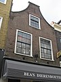
This is a category about rijksmonument number 19174
|
| Address |
|
Media in category "Gierstraat 62, Haarlem"
The following 5 files are in this category, out of 5 total.
-

-
 Gevels - Haarlem - 20097008 - RCE.jpg 959 × 1,200; 254 KB
-
 Haarlem - Gierstraat 62.jpg 1,944 × 2,592; 1.31 MB
-
 Overzicht - Haarlem - 20097009 - RCE.jpg 959 × 1,200; 226 KB
-
 WLM-Haarlem 113.JPG 2,736 × 3,648; 1.97 MB
_krijgt_dieren_van_circus_Boltini_op_bezoek._NL-HlmNHA_54004439.JPG)


