Category:Glacier County, Montana
Sari la navigare
Sari la căutare
Counties of Montana: Beaverhead · Big Horn · Blaine · Broadwater · Carbon · Carter · Cascade · Chouteau · Custer · Daniels · Dawson · Deer Lodge · Fallon · Fergus · Flathead · Gallatin · Garfield · Glacier · Golden Valley · Granite · Hill · Jefferson · Judith Basin · Lake · Lewis and Clark · Liberty · Lincoln · Madison · McCone · Meagher · Mineral · Missoula · Musselshell · Park · Petroleum · Phillips · Pondera · Powder River · Powell · Prairie · Ravalli · Richland · Roosevelt · Rosebud · Sanders · Sheridan · Silver Bow · Stillwater · Sweet Grass · Teton · Toole · Treasure · Valley · Wheatland · Wibaux · Yellowstone
comitat din Statele Unite ale Americii   | |||||
| Încarcă multimedia | |||||
| Este un/o | |||||
|---|---|---|---|---|---|
| Numit(ă) după | |||||
| Locul actual | Montana, SUA | ||||
| Capitală | |||||
| Înființare |
| ||||
| Populație |
| ||||
| Suprafață |
| ||||
| site oficial | |||||
 | |||||
Subcategorii
Această categorie conține următoarele 13 subcategorii, dintr-un total de 13.
Fișiere media din categoria „Glacier County, Montana”
Următoarele 122 fișiere se află în această categorie, dintr-un total de 122.
-
 "Red bus company" Jammer @ Marias Pass MT. - panoramio.jpg 2.237x1.475; 681 KB
-
 ( On Two Medicine Trestle East Glacier MT. ) - panoramio.jpg 2.177x1.471; 452 KB
-

-
 4449 10 17 2009x3 033x - Flickr - drewj1946.jpg 1.006x668; 616 KB
-
 5404 NRCS projects (25120962627).jpg 4.082x6.123; 2,41 MB
-
 A Breathtaking View - panoramio.jpg 3.072x1.728; 2,83 MB
-
 Alien Mothership at Glacier park MT. - panoramio.jpg 2.757x1.918; 920 KB
-
 Babb-01.jpg 2.742x792; 314 KB
-

-
 Camouflage - panoramio.jpg 1.921x1.206; 707 KB
-
 Clear lake in the mountains (Unsplash).jpg 4.000x5.696; 13,49 MB
-
 Cliff Diving Anyone - panoramio.jpg 2.592x1.936; 2,11 MB
-
 Climbing Creek Toward Mt Wynn - panoramio.jpg 1.536x2.048; 1,77 MB
-

-
 Cosley Lake 2.jpg 640x480; 57 KB
-
 CrackerLakeMineEquipment.jpg 3.072x2.048; 1,26 MB
-
 CrackerLakeMineEquipmentCloseup.jpg 3.072x2.048; 3,84 MB
-
 Cutbank Valley with Indian scouts. 29B.jpg 1.536x1.246; 274 KB
-
 DelbonitaUSA.jpg 1.024x628; 91 KB
-

-
 East Glacier Park Village MT - panoramio.jpg 1.486x1.480; 913 KB
-
 East Glacier Railroad trestle view - panoramio.jpg 2.208x2.208; 858 KB
-
 Eastbound empire builder @ East Glacier park. - panoramio.jpg 2.046x2.981; 1,26 MB
-
 For Purple Mountain Magesties (85750037).jpeg 2.048x1.152; 638 KB
-
 From Dawson Pass to the South - panoramio.jpg 2.592x1.936; 2,25 MB
-
 Glacial Cascade (85749857).jpeg 2.048x1.366; 1,45 MB
-
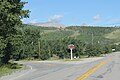
 Glacier County Montana Sign Looking East US2.jpg 2.160x1.483; 1,2 MB
-
 Glacier County, MT, USA - panoramio.jpg 4.288x2.848; 400 KB
-
 Glacier flora1.jpg 2.025x2.808; 4,88 MB
-
 Glacier flora10.jpg 2.592x3.162; 5,74 MB
-
 Glacier flora2.jpg 2.133x3.594; 9,41 MB
-
 Glacier flora3.jpg 2.157x2.166; 4,64 MB
-
 Glacier flora4.jpg 3.198x2.108; 5,07 MB
-
 Glacier flora5.jpg 2.271x3.477; 6,28 MB
-
 Glacier flora6.jpg 2.154x1.692; 2,83 MB
-
 Glacier flora7.jpg 2.316x2.364; 4,82 MB
-
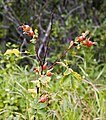 Glacier flora8.jpg 2.520x2.853; 5,61 MB
-
 Glacier flora9.jpg 1.839x3.375; 4,85 MB
-
 Glacier Sunrise (Unsplash).jpg 4.000x6.000; 8,37 MB
-
 Glenns Lake (85746253).jpeg 2.048x1.366; 1,32 MB
-
 Glenns Lake.jpg 2.048x1.536; 1,56 MB
-
 Grinnell Glacier Trail (85746255).jpeg 2.048x1.366; 1.009 KB
-
 Hanging Gardens - panoramio.jpg 2.848x4.288; 1,32 MB
-
 Heaven through earth - panoramio.jpg 1.536x2.048; 1,29 MB
-
 Hike up to the remains of Siyeh Glacier - panoramio.jpg 1.536x2.048; 1,78 MB
-
 Hypacrosaurus stebingeri holotype.jpg 3.000x1.987; 4,95 MB
-
 Iceberg Lake Glacier National Park USA.jpg 1.500x1.000; 910 KB
-

-

-
 Kayak on a mountain lake (Unsplash).jpg 4.000x3.072; 8,2 MB
-
 Kiowa Montana MT49 North Terminus.jpg 2.592x1.728; 2,5 MB
-
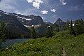 Lake Janet.jpg 1.440x957; 626 KB
-

-
 LocMap Blackfeet Indian Reservation.png 280x183; 23 KB
-
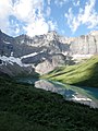
 Lower Saint Mary Lake MT1.jpg 3.888x2.592; 5,35 MB
-
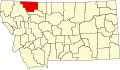 Map of Montana highlighting Glacier County.svg 2.043x1.178; 100 KB
-
 Marias Pass Monuments.JPG 1.600x1.200; 371 KB
-
 Moonrise over Mt Merritt - panoramio.jpg 3.072x1.728; 1,86 MB
-
 Mountain Goat on Mount Brown.jpg 4.032x3.024; 2,94 MB
-
 Mt. Grinnell and Swiftcurrent Lake - panoramio.jpg 4.242x2.795; 922 KB
-
 MTMap-doton-Browning.PNG 300x175; 12 KB
-
 MTMap-doton-CutBank.PNG 300x175; 12 KB
-
 MTMap-doton-EastGlacierPark.PNG 300x175; 12 KB
-
 MTMap-doton-NorthBrowning.PNG 300x175; 12 KB
-
 MTMap-doton-SouthBrowning.PNG 300x175; 12 KB
-
 Natures Garden ...East Glacier Park in Montana - panoramio.jpg 2.260x3.276; 756 KB
-
 Photo from East Glacier park in Montana - panoramio.jpg 2.071x2.994; 1,24 MB
-
 Piegan Summit Pano - panoramio.jpg 3.808x880; 2,02 MB
-
 Pitamakan Lake - panoramio.jpg 2.592x1.936; 1,83 MB
-
 Pitamakin Lake from Pitanakin Pass - panoramio.jpg 2.592x1.936; 1,69 MB
-
 Red Eagle Lake - panoramio.jpg 3.072x1.728; 1,53 MB
-
 Red Eagle Meadow - panoramio.jpg 10.682x2.818; 3,9 MB
-
 Red Eagle Mt surrounded by Clouds - panoramio.jpg 2.592x1.936; 1,87 MB
-
 Reenacting the Lion King (Cautiously) - panoramio.jpg 1.094x821; 418 KB
-
 River through a Burnt Forest - panoramio.jpg 3.072x1.728; 2,34 MB
-
 Rocks and Lake St. Mary - panoramio.jpg 4.288x2.848; 964 KB
-
 Small icy lake (Unsplash).jpg 4.000x2.667; 9,26 MB
-
 Small man in a large world - panoramio.jpg 1.536x2.048; 1,55 MB
-
 South Cracker Mine - panoramio (1).jpg 1.536x2.048; 784 KB
-
 South Cracker Mine - panoramio.jpg 2.048x1.536; 1,34 MB
-
 Southern Pacific 4449 at summit of Marias Pass.jpg 664x999; 539 KB
-
 Southern Pacific 4449 coming out of snowshed in Marias Pass.jpg 1.006x686; 638 KB
-
 Spraying noxious weeds. In Glacier National Park MT - panoramio.jpg 3.872x2.592; 4,68 MB
-
 St. Mary Lake from the East - panoramio.jpg 3.756x1.000; 1,3 MB
-
 St. Mary Lake from the Narrows - panoramio.jpg 8.051x1.000; 2,27 MB
-

-
 Stoney Indian Pass.jpg 3.063x2.156; 8,17 MB
-
 That Bear was Just on that Log - panoramio.jpg 3.072x1.728; 2,9 MB
-
 The Big Rock Candy Mountain - panoramio.jpg 2.191x3.088; 733 KB
-
 The Crown of the Continent - panoramio.jpg 2.592x1.936; 1,83 MB
-
 The Divide through a chimney - panoramio.jpg 1.936x2.592; 1,45 MB
-
 The Eye of Soron - panoramio.jpg 1.936x2.592; 2,24 MB
-
 The last breakfast, Camp Disappointment.jpg 1.794x1.080; 580 KB
-
 The Plains from Scenic Point - panoramio.jpg 2.592x1.936; 1,69 MB
-
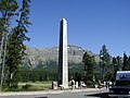
 Theodore Roosevelt Memorial monument @ Marias Pass - panoramio.jpg 1.839x1.397; 744 KB
-
 There were two of them - panoramio.jpg 1.536x2.048; 541 KB
-

-
 Two medicine general store - panoramio.jpg 3.872x2.592; 4,62 MB
-
 Two Medicine Lake , Glacier National Park, Montana, ... - panoramio.jpg 2.851x1.969; 1,02 MB
-
 Two Medicine Lake Montana - panoramio.jpg 3.872x2.592; 4,65 MB
-
 USA Glacier County, Montana age pyramid.svg 520x600; 8 KB
-

-

-

-

-

-

-

-

-

-

-

-

-

-

-

-

-

-

-

-

-
 West Lake St. Mary - panoramio.jpg 4.288x2.848; 1,01 MB

_-_panoramio.jpg)
.jpg)

.jpg)


.jpeg)

.jpeg)


.jpg)
.jpeg)

.jpeg)


.jpg)


_Bus_tours_while_visiting_East_Glacier_Park_in_Montana_Part_of_the_hidden_lake_tour_took_us_to_a_trail_that_led_to_this_waterfall_.Running_Eagle_Falls_is_like_two_waterfalls_in_o_-_panoramio.jpg)


_-_panoramio.jpg)


.jpg)

.jpg)


.jpg)