Glacier National Park
Jump to navigation
Jump to search
English: Glacier National Park is an American national park in Montana, established on May 11, 1910 by an act of the United States Congress. The park contains almost 1,584 mi² (4101 km²) of forest, mountains, glaciers and lakes.
Deutsch: Der Glacier-Nationalpark (USA) befindet sich in Montana und wurde am 11. Mai 1910 eingerichtet. Der Park ist 4.047 km² groß und schützt eine Gebirgs-, Wald-, und Seenlandschaft. Im Norden grenzt auf kanadischer Seite der Waterton-Lakes-Nationalpark an den Park.
日本語: グレイシャー国立公園 (Glacier National Park) は、アメリカ合衆国モンタナ州北部にある国立公園である。ここはアメリカ合衆国議会の承認によって1910年5月11日に設立される
Maps and aerial images[edit]
-
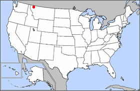 Location in the United States
 -
 Map of Glacier National Park
 -
 Going-to-the-Sun Road terrain map
 -
 Geologic map
 -
 Vegetation map
 -
 Mountains from the south
 -
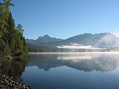
 St. Mary Lake
 -
 NASA Landsat image of the park


.jpg)


Lake McDonald Region[edit]
See: Lake McDonald
Logan Pass Region[edit]
-
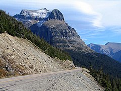
 View from Going-to-the-Sun Road
 -
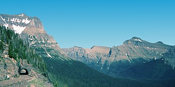 Going-to-the-Sun Road with tunnel, 1996
 -
 Going-to-the-Sun Road with Going-to-the-Sun Mountain, 2004
 -
 Going-to-the-Sun Road during construction in 1932
 -

-
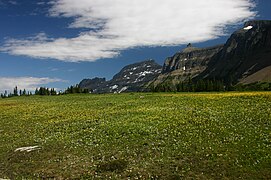 Wildflower at Logan Pass
 -
 The north view from the summit of Triple Divide Peak
 -
 Hidden Lake, Bearhat Mountain (right) and Reynolds Mountain (left)
 -
 Along the Hidden Lake nature trail
 -
 Hidden Lake
 -
 Winter snows at Big Drift
 -
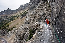
 Highline Trail carved out along the side of the Garden Wall
 -
 Highline Trail
 -

-

-

-

-

-
 Along Going-to-the-Sun Road east of Logan Pass
 -
 Along Going-to-the-Sun Road west of Logan Pass
 -
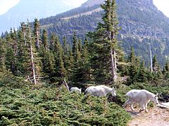 Mountain goats at Logan Pass
 -
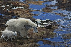 Baby mountain goat at Hidden Lake
 -
 Hikers and mountain goats
 -
 Waterfall under Going-to-the-Sun Road
 -
 Summer skiing on the snows of Logan Pass


_8633.jpg)


.jpg)


St. Mary Lake Region[edit]
-

-
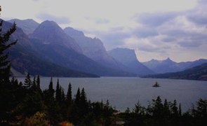
 St. Mary Lake
 -
 Wild Goose Island
 -
 St. Mary Lake as seen from Sun Point
 -
 Cracker Lake
 -
 Jammer bus at St. Mary Lake
 -
 Between Jackson Glacier overlook and Sunrift Gorge


.jpg)


Many Glacier Region[edit]
-
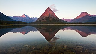
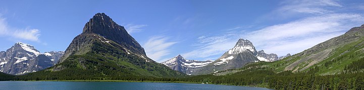
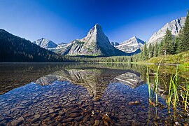
 Many Glacier from Red Rock Pass
 -
-
 Swiftcurrent Lake
 -
 Ptarmigan Ridge at sunset
 -

-
-
 Piegan Pass
 -
 Piegan Pass
 -
 River flowing from Iceberg Lake in early summer
 -
 Glenns Lake
 -
 Mount Grinnell at sunrise
 -
 Grinnell Glacier Trail
 -
 Grinnell Lake from Grinnell Glacier trail
 -
 Grinnell Lake
 -
 Grinnell Glacier 1938
 -
 Grinnell Glacier 1981, showing retreat since 1850
 -
 Grinnell Glacier 1981, without arrows
 -
 Grinnell Glacier 1998
 -
 Grinnell Glacier 2005
 -
 Grinnell Glacier 2009
 -
 Grinnell Glacier 2012

.jpg)
.jpg)


.jpg)

.jpg)


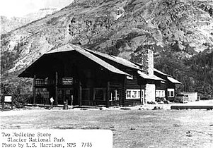
Two Medicine Region[edit]
-
-
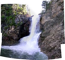 Running Eagle Falls, at Two Medicine
 -

-


_-_Flickr_-_Loco_Steve.jpg)
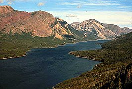
North and northwest[edit]
-

-

-
-
-

-
 Bowman Lake and canoe
 -


Miscellaneous[edit]
-
 Winter on the Flathead River
 -
 Wildfire in 2003

