Category:Gladows Loch
Jump to navigation
Jump to search
|
Gladows Loch has an entry on OpenStreetMap (show). |
Quarry pond  Strand im Winter | |||||
| Upload media | |||||
| Instance of | |||||
|---|---|---|---|---|---|
| Location | Elbe-Parey, Jerichower Land, Saxony-Anhalt, Germany | ||||
| Has use |
| ||||
| Width |
| ||||
| Length |
| ||||
| Area |
| ||||
| Elevation above sea level |
| ||||
 | |||||
Media in category "Gladows Loch"
The following 12 files are in this category, out of 12 total.
-
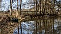
 Gladows Loch, Herbst.jpg 810 × 567; 160 KB
-
 Gladows Loch, Westufer 01.jpg 1,095 × 567; 242 KB
-
 Gladows Loch, Westufer 02.jpg 1,008 × 567; 202 KB
-
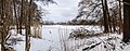
 Gladows Loch, Winter 01.jpg 1,505 × 567; 203 KB
-
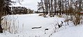
 Gladows Loch, Winter 02.jpg 1,450 × 567; 211 KB
-
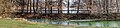
 Gladows Loch, Winter 03.jpg 1,259 × 567; 193 KB
-
 Gladows Loch, Winter 04.jpg 854 × 567; 181 KB
-
 Gladows Loch, Winter 05.jpg 1,248 × 567; 201 KB
-
 Gladows Loch, Winter 06.jpg 1,969 × 567; 290 KB
-
 See MTS nord, Gladows Loch 01.jpg 1,931 × 567; 236 KB
-
 See MTS nord, Gladows Loch 02.jpg 2,461 × 567; 309 KB
-
 See MTS nord, Gladows Loch 03.jpg 854 × 567; 167 KB


