Category:Glasbury
Jump to navigation
Jump to search
village in the county of Powys, Wales  Eglwys Sant Cynidr | |||||
| Upload media | |||||
| Instance of | |||||
|---|---|---|---|---|---|
| Location | Powys, Wales | ||||
| Population |
| ||||
| Area |
| ||||
 | |||||
Cymraeg: Pentref a chymuned ym Mhowys, yw Y Clas-ar-Wy (Saesneg: Glasbury). Saif ar lan ogleddol Afon Gwy, gyferbyn ag Aberllynfi, ac i'r de-orllewin o'r Gelli Gandryll, ger y briffordd A438. Saif ar groesfan bwysig ar Afon Gwy, ger y fan lle mae Afon Llynfi yn ymuno a hi, o fewn Parc Cenedlaethol Bannau Brycheiniog.
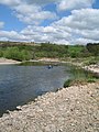
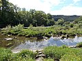
English: Glasbury , also known as Glasbury-on-Wye, is a village in Powys, Wales which lies at an important crossing point on the River Wye, connecting the former counties of Brecknockshire and Radnorshire. The village is just outside the Brecon Beacons National Park, north of the Black Mountains. The nearest town is Hay-on-Wye, some 4 miles (6 km) to the east. The nearest city is Hereford in England, some 25 miles (40 km) to the east. Glasbury is a popular location for river fishing, canoeing and kayaking.
Subcategories
This category has the following 7 subcategories, out of 7 total.
B
- Glasbury Bridge (8 F)
G
- Glasbury war memorial (5 F)
M
- The Maesllwch Arms Hotel (3 F)
O
- Old Vicarage, Glasbury (1 F)
S
- St Peter's Church, Glasbury (21 F)
Media in category "Glasbury"
The following 200 files are in this category, out of 369 total.
(previous page) (next page)-

-
 A forest track leaves the A438 - geograph.org.uk - 2946930.jpg 2,592 × 1,944; 2.74 MB
-
 A Line of Pines - geograph.org.uk - 5864393.jpg 5,184 × 3,456; 3.73 MB
-
 A solid built church at Llanstephan - geograph.org.uk - 4951218.jpg 1,600 × 1,200; 544 KB
-
 A weak bridge on the road from Erwood to Llanstephan - geograph.org.uk - 2946729.jpg 2,592 × 1,944; 2.74 MB
-
 A well in Llanstephan Churchyard - geograph.org.uk - 4951207.jpg 1,200 × 1,600; 852 KB
-
 Across Boughrood Bridge - geograph.org.uk - 3506713.jpg 800 × 640; 156 KB
-
 Across Boughrood Bridge to Llyswen - geograph.org.uk - 3506836.jpg 800 × 785; 195 KB
-
 All Saints Church, Cwm-bach - geograph.org.uk - 2738486.jpg 640 × 480; 93 KB
-
 All Saints Church, Cwmbach - geograph.org.uk - 2473378.jpg 1,280 × 960; 505 KB
-
 Along a hedge to the Wye, Boughrood - geograph.org.uk - 3536904.jpg 800 × 600; 155 KB
-
 Approaching Glasbury - geograph.org.uk - 2946883.jpg 2,592 × 1,944; 1.51 MB
-
 Approaching Penisarplwyf - geograph.org.uk - 695290.jpg 639 × 479; 205 KB
-
 Approaching Pistyll - geograph.org.uk - 4814194.jpg 1,600 × 901; 692 KB
-
 B4350 passes Box Bridge Boughrood - geograph.org.uk - 3521865.jpg 800 × 514; 133 KB
-
 Bench on The Begwns - geograph.org.uk - 2415475.jpg 640 × 480; 88 KB
-
 Bochrwyd - Boughrood - geograph.org.uk - 5716667.jpg 640 × 480; 70 KB
-
 Boughrood - geograph.org.uk - 4814644.jpg 1,600 × 901; 653 KB
-
 Boughrood across the Wye from Llyswen - geograph.org.uk - 3506754.jpg 800 × 561; 111 KB
-
 Boughrood Bridge - geograph.org.uk - 3496569.jpg 800 × 600; 122 KB
-
 Boughrood Church - geograph.org.uk - 2473351.jpg 1,280 × 960; 246 KB
-
 Boughrood Court - geograph.org.uk - 3321901.jpg 2,288 × 1,712; 801 KB
-
 Boughrood Stores - geograph.org.uk - 3506866.jpg 800 × 514; 118 KB
-
 Bridge at Glasbury (1293564).jpg 1,000 × 707; 61 KB
-
 Bridge at Glasbury (1293992).jpg 1,000 × 714; 63 KB
-
 Bridge at Glasbury (1294076).jpg 1,000 × 711; 94 KB
-
 Bridge at Glasbury (1294310).jpg 1,000 × 714; 72 KB
-
 Bridge at Glasbury (1294379).jpg 1,000 × 711; 77 KB
-
 Bridge at Glasbury (1295139).jpg 1,000 × 709; 100 KB
-
 Bridleway and the Cilgwyn Brook - geograph.org.uk - 4814186.jpg 1,600 × 901; 689 KB
-
 Bridleway near Fferm-wen - geograph.org.uk - 2944754.jpg 2,592 × 1,944; 1.7 MB
-
 Bridleway, Boughrood Brest - geograph.org.uk - 2473371.jpg 1,280 × 960; 444 KB
-
 Brook, Cwm-bach - geograph.org.uk - 2738554.jpg 640 × 480; 144 KB
-
 Brook, Cwmbach, 1 - geograph.org.uk - 4333260.jpg 800 × 451; 199 KB
-
 Brook, Cwmbach, 2 - geograph.org.uk - 4333262.jpg 800 × 451; 190 KB
-
 Building site, Boughrood - geograph.org.uk - 3522009.jpg 800 × 521; 136 KB
-
 Bungalows, Trem y Coed, Boughrood - geograph.org.uk - 3522036.jpg 800 × 641; 159 KB
-
 Burial cairn near The Begwns - geograph.org.uk - 2415434.jpg 640 × 480; 86 KB
-

-
 Camouflage near Cwmbach - geograph.org.uk - 4333267.jpg 800 × 452; 216 KB
-
 Camping field. - geograph.org.uk - 3545480.jpg 640 × 480; 50 KB
-

-

-
 Chapel at Glasbury - geograph.org.uk - 540422.jpg 640 × 480; 142 KB
-
 Chapel for sale, Glasbury - geograph.org.uk - 3651688.jpg 4,320 × 3,240; 2.82 MB
-
 Church Close houses, Boughrood - geograph.org.uk - 3536893.jpg 800 × 594; 146 KB
-
 Clearfell area, Trewern Hill - geograph.org.uk - 4236827.jpg 1,600 × 1,200; 812 KB
-
 Coed-y-Marchog - geograph.org.uk - 4333312.jpg 800 × 451; 219 KB
-

-

-
 Country lane near Tyle-mawr - geograph.org.uk - 2944758.jpg 2,592 × 1,944; 1.95 MB
-
 Courtyard at Glan-hen Wye - geograph.org.uk - 3124157.jpg 640 × 480; 97 KB
-
 Dead end lane - geograph.org.uk - 4819029.jpg 1,600 × 901; 701 KB
-
 Descending the Wye - geograph.org.uk - 410971.jpg 480 × 640; 86 KB
-
 Discretion vs Valour... - geograph.org.uk - 412537.jpg 600 × 450; 97 KB
-
 Distances from Boughrood - geograph.org.uk - 3536881.jpg 800 × 751; 183 KB
-
 Dol-meudwy, Llanstephan - geograph.org.uk - 3567148.jpg 800 × 641; 165 KB
-

-
 Eastern boundary of Llanstephan - geograph.org.uk - 3567163.jpg 800 × 799; 162 KB
-

-
 Edge of Ffynnon Gynydd Common - geograph.org.uk - 4333307.jpg 800 × 451; 203 KB
-
 End of the 30mph speed limit, Boughrood - geograph.org.uk - 3521935.jpg 800 × 677; 201 KB
-
 Entrance to Glasbury House, Glasbury - geograph.org.uk - 2737660.jpg 640 × 528; 117 KB
-

-

-
 Farmland near Lloyney - geograph.org.uk - 4819067.jpg 1,600 × 901; 634 KB
-
 Farmland north of Boughrood - geograph.org.uk - 2944749.jpg 2,592 × 1,944; 1.59 MB
-
 Farmland west of Upper Rhydness - geograph.org.uk - 4819060.jpg 1,600 × 901; 657 KB
-
 Felled woodland - geograph.org.uk - 695330.jpg 639 × 479; 204 KB
-
 Ffynnon Gynydd - geograph.org.uk - 4333327.jpg 800 × 451; 178 KB
-
 Ffynnon Gynydd Common - geograph.org.uk - 4333301.jpg 800 × 451; 189 KB
-
 Ffynnon Gynydd Primary School - geograph.org.uk - 4333318.jpg 800 × 451; 173 KB
-
 Field and woods north of Glasbury - geograph.org.uk - 2946900.jpg 2,592 × 1,944; 1.74 MB
-

-
 Field corner - geograph.org.uk - 4820011.jpg 1,600 × 901; 675 KB
-

-

-

-
 Fields above Llowes - geograph.org.uk - 535705.jpg 640 × 480; 133 KB
-
 Fields near Droellen - geograph.org.uk - 2944743.jpg 2,592 × 1,944; 1.81 MB
-
 Fields near Llwynpenderi - geograph.org.uk - 2944763.jpg 2,592 × 1,944; 1.45 MB
-
 Fields south of Llowes - geograph.org.uk - 2946923.jpg 2,592 × 1,944; 1.7 MB
-
 Fly fishing at Glasbury - geograph.org.uk - 540416.jpg 480 × 640; 113 KB
-
 Footbridge and cottage, Cwmbach - geograph.org.uk - 4333254.jpg 800 × 451; 192 KB
-
 Foothills of the Black Mountains - geograph.org.uk - 318075.jpg 640 × 480; 82 KB
-
 Footpath and Dutch barn - geograph.org.uk - 4819007.jpg 1,600 × 901; 778 KB
-
 Footpath to Cilcenni Dingle - geograph.org.uk - 4333337.jpg 800 × 451; 213 KB
-
 Footpath to Llowes - geograph.org.uk - 4236792.jpg 1,600 × 1,200; 724 KB
-
 Forest ride, Llanogen Wood - geograph.org.uk - 4818999.jpg 1,600 × 901; 728 KB
-
 Forestry track, Trewern Hill - geograph.org.uk - 4236836.jpg 1,600 × 1,200; 975 KB
-
 Fork in the road, Llanstephan - geograph.org.uk - 3567213.jpg 800 × 600; 167 KB
-
 Former chapel, Glasbury - geograph.org.uk - 3202694.jpg 640 × 616; 115 KB
-
 Former railway bridge near Llanstephan - geograph.org.uk - 3565518.jpg 800 × 600; 220 KB
-
 Former tea rooms, Glasbury - geograph.org.uk - 2737708.jpg 640 × 480; 97 KB
-
 Former village pound, Llanstephan - geograph.org.uk - 3569234.jpg 800 × 600; 229 KB
-

-
 Glasbury on Wye from station (1293653).jpg 1,000 × 706; 92 KB
-
 Glasbury Play Area - geograph.org.uk - 2737740.jpg 640 × 480; 121 KB
-
 Glasbury railway station (1294603).jpg 1,000 × 709; 99 KB
-
 Glasbury Village Hall - geograph.org.uk - 2737633.jpg 640 × 377; 60 KB
-
 Glasbury, the Chapel (after renovation) - geograph.org.uk - 1506737.jpg 640 × 480; 105 KB
-
 Glimpse of the stream - geograph.org.uk - 4333297.jpg 600 × 800; 289 KB
-

-
 Grassy hillside - geograph.org.uk - 4814232.jpg 1,600 × 901; 709 KB
-
 Harolds Field, Boughrood - geograph.org.uk - 3521851.jpg 800 × 526; 111 KB
-
 Harrow Lodge, Glasbury - geograph.org.uk - 2738397.jpg 640 × 467; 106 KB
-

-
 Hazel catkins, Ffynnon Gynydd Common - geograph.org.uk - 4333305.jpg 800 × 800; 345 KB
-
 Heathland on The Begwns - geograph.org.uk - 2415547.jpg 640 × 480; 85 KB
-

-
 Hillside above Llanstephan - geograph.org.uk - 4818972.jpg 1,600 × 901; 725 KB
-
 Hillside at Gogia - geograph.org.uk - 5864503.jpg 5,184 × 3,456; 3.6 MB
-
 House in Glasbury - geograph.org.uk - 6235606.jpg 1,600 × 900; 342 KB
-
 Hut by the River Wye - geograph.org.uk - 4236809.jpg 1,600 × 1,200; 1.18 MB
-
 Island in the Wye, Boughrood - geograph.org.uk - 3521976.jpg 800 × 600; 193 KB
-
 Islands in the Wye, Glasbury - geograph.org.uk - 2737553.jpg 640 × 446; 70 KB
-
 Junction in Llanstephan - geograph.org.uk - 3569215.jpg 800 × 557; 166 KB
-
 Just below the ford SW of the Roundabout - geograph.org.uk - 2986285.jpg 2,560 × 1,920; 1.13 MB
-
 Kayaking on the Wye, Glasbury - geograph.org.uk - 3202940.jpg 618 × 640; 137 KB
-
 Keep dogs on a lead ahead, Glasbury - geograph.org.uk - 3202721.jpg 640 × 480; 101 KB
-
 Lake at The Begwns - geograph.org.uk - 2415449.jpg 640 × 480; 55 KB
-
 Lake at The Begwns - geograph.org.uk - 2415459.jpg 640 × 480; 57 KB
-
 Lane at Llan-Marchell - geograph.org.uk - 4819091.jpg 1,600 × 901; 685 KB
-
 Lane at Upper Rhydness - geograph.org.uk - 4819075.jpg 1,600 × 901; 647 KB
-

-

-
 Lane to Ffawydd, Llanstephan - geograph.org.uk - 3567306.jpg 800 × 600; 203 KB
-
 Lane to Great House Farm, Llanstephan - geograph.org.uk - 3569224.jpg 800 × 600; 157 KB
-
 Lane to Llanogen Cottage, Llanstephan - geograph.org.uk - 3569227.jpg 800 × 500; 129 KB
-
 Lane to Maesyronnen - geograph.org.uk - 4333342.jpg 800 × 372; 132 KB
-
 Little Mountain - geograph.org.uk - 2944757.jpg 2,592 × 1,944; 1.48 MB
-
 Little Mountain Common - geograph.org.uk - 4819217.jpg 1,600 × 901; 743 KB
-
 Llanstaphan Church gatehouse, Powys - geograph.org.uk - 4951225.jpg 1,600 × 1,200; 718 KB
-
 Llanstephan Bridge, 2 - geograph.org.uk - 4818949.jpg 1,600 × 901; 703 KB
-
 Llanstephan Church - geograph.org.uk - 3909200.jpg 2,288 × 1,712; 792 KB
-
 Llanstephan Church viewed from the south - geograph.org.uk - 3569263.jpg 800 × 600; 180 KB
-
 Llanstephan Church, Powys from near the well - geograph.org.uk - 4951200.jpg 1,600 × 1,200; 521 KB
-
 Llanstephan Estate fire notice - geograph.org.uk - 3565542.jpg 351 × 800; 126 KB
-
 Llanstephan, Summer grassland by the River Wye - geograph.org.uk - 1921284.jpg 1,280 × 960; 468 KB
-
 Llowes - geograph.org.uk - 3655519.jpg 4,320 × 3,240; 2.74 MB
-
 Llowes village - geograph.org.uk - 2608638.jpg 3,456 × 2,592; 4.82 MB
-
 Looking across the valley from Llanstephan Churchyard - geograph.org.uk - 4951237.jpg 1,600 × 1,200; 665 KB
-
 Lower and Upper Skynlais - geograph.org.uk - 4814179.jpg 1,600 × 901; 715 KB
-
 Maesllwch Castle - geograph.org.uk - 2608627.jpg 3,231 × 2,031; 4.62 MB
-
 Maesllwch Castle and estate - geograph.org.uk - 2946887.jpg 2,592 × 1,944; 1.85 MB
-
 Maesyronnen - geograph.org.uk - 4333348.jpg 800 × 451; 188 KB
-

-
 Minor lane at Cornhill - geograph.org.uk - 2944783.jpg 2,592 × 1,944; 2 MB
-
 Minor road north of Boughrood - geograph.org.uk - 2944752.jpg 2,592 × 1,944; 1.59 MB
-
 Minor road T junction near Llanstephan - geograph.org.uk - 3565548.jpg 800 × 600; 196 KB
-
 Moity chapel stone inscription - geograph.org.uk - 535736.jpg 640 × 480; 159 KB
-
 Moorland near Begwyns Roundabout - geograph.org.uk - 3784292.jpg 1,024 × 683; 641 KB
-
 NE end of Llanstephan suspension bridge - geograph.org.uk - 3565470.jpg 800 × 737; 223 KB
-
 NW boundary of Boughrood - geograph.org.uk - 3536868.jpg 800 × 606; 148 KB
-
 NW corner of The Green, Glasbury - geograph.org.uk - 3202744.jpg 640 × 403; 70 KB
-
 Oak tree in the Wye valley - geograph.org.uk - 4814221.jpg 1,600 × 901; 714 KB
-
 Old bridge near Llanstephan - geograph.org.uk - 3939878.jpg 2,902 × 1,706; 3.64 MB
-
 Old Building with a Chimney - geograph.org.uk - 5864486.jpg 1,600 × 1,096; 929 KB
-
 Old chapel in Glasbury - geograph.org.uk - 3169955.jpg 640 × 480; 81 KB
-

-

-
 Old Milestone by the B4350, Glasbury - geograph.org.uk - 6072024.jpg 1,283 × 2,037; 471 KB
-
 Old Post in the Bracken - geograph.org.uk - 5864445.jpg 1,600 × 1,067; 612 KB
-
 Old toll-house on Boughrood Bridge - geograph.org.uk - 2903455.jpg 640 × 480; 64 KB
-
 Old toll-house on Boughrood Bridge - geograph.org.uk - 2903466.jpg 640 × 480; 83 KB
-
 Old trackbed, Llanstephan - 2 - geograph.org.uk - 3920272.jpg 4,000 × 3,000; 6.37 MB
-
 Old trackbed, Llanstephan - 3 - geograph.org.uk - 3920306.jpg 4,000 × 3,000; 5.75 MB
-
 Old trackbed, Llanstephan - geograph.org.uk - 3919907.jpg 2,533 × 1,860; 3.16 MB
-

-
 On the Begwns Common, 1 - geograph.org.uk - 4819244.jpg 1,600 × 901; 692 KB
-
 On the Begwns Common, 2 - geograph.org.uk - 4820006.jpg 1,600 × 901; 626 KB
-
 Ordnance Survey Cut Mark - geograph.org.uk - 4500717.jpg 480 × 640; 139 KB
-
 Ordnance Survey Cut Mark - geograph.org.uk - 4759212.jpg 640 × 480; 102 KB
-
 Pasture land, Boughrood - geograph.org.uk - 2473357.jpg 1,280 × 960; 362 KB
-
 Pastures and woodland - geograph.org.uk - 4814634.jpg 1,600 × 901; 639 KB
-
 Path by the Bachawy - geograph.org.uk - 4820014.jpg 1,600 × 901; 703 KB
-
 Path through steep woodland - geograph.org.uk - 4333293.jpg 600 × 800; 312 KB
-
 Path to the River Wye - geograph.org.uk - 4236822.jpg 1,600 × 1,200; 912 KB
-
 Path with a great view - geograph.org.uk - 4819023.jpg 1,600 × 901; 725 KB
-
 Penylan in the snow - geograph.org.uk - 594088.jpg 640 × 480; 139 KB
-
 Phonebox and postbox, Glasbury - geograph.org.uk - 3202811.jpg 640 × 515; 86 KB
-
 Poles Cottage, Llanstephan - geograph.org.uk - 3567128.jpg 800 × 620; 184 KB
-
 Postbox and noticeboard, Llanstephan - geograph.org.uk - 3567153.jpg 800 × 600; 192 KB
-

-
 Potato crops, Boughrood Brest - geograph.org.uk - 2473365.jpg 1,280 × 960; 409 KB
-
 Powys Council Highways Depot - geograph.org.uk - 4814636.jpg 1,600 × 901; 740 KB
-

-
 Radnorshire border, Glasbury - geograph.org.uk - 2713422.jpg 640 × 486; 98 KB
-
 Restored Pound, Llanstephan - geograph.org.uk - 3909191.jpg 2,288 × 1,712; 805 KB
-
 River Wye at Llanstephan Bridge - geograph.org.uk - 4818919.jpg 1,600 × 901; 720 KB
-
 River Wye below Boughrood bridge - geograph.org.uk - 4814649.jpg 1,600 × 901; 742 KB
-

-

-
 River Wye shingle, Glasbury - geograph.org.uk - 2737588.jpg 640 × 480; 104 KB
-
 River Wye viewed from Glasbury Bridge - geograph.org.uk - 2737540.jpg 640 × 559; 104 KB
-
 River Wye, Boughrood - geograph.org.uk - 3521981.jpg 800 × 783; 230 KB
-
 River Wye, Glasbury (1293847).jpg 1,000 × 716; 84 KB
-
 River Wye, Glasbury (1294963).jpg 1,000 × 709; 71 KB
-
 River Wye, Glasbury (1295028).jpg 1,000 × 712; 78 KB
-
 River Wye, the full width with high water levels - geograph.org.uk - 2474526.jpg 1,280 × 960; 587 KB


.jpg)
.jpg)
.jpg)
.jpg)
.jpg)
.jpg)


.jpg)

.jpg)

_-_geograph.org.uk_-_1506737.jpg)


.jpg)
.jpg)
.jpg)
