Category:Glendevon (civil parish)
Jump to navigation
Jump to search
Scottish parish in Perth and Kinross, Scotland, UK | |||||
| Upload media | |||||
| Instance of | |||||
|---|---|---|---|---|---|
| Part of |
| ||||
| Location |
| ||||
| Population |
| ||||
| Area |
| ||||
 | |||||
Media in category "Glendevon (civil parish)"
The following 200 files are in this category, out of 462 total.
(previous page) (next page)-
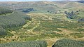
 "The Worst Bog in the Ochils" - geograph.org.uk - 2131710.jpg 640 × 480; 120 KB
-
 A bank of broom, Glendevon - geograph.org.uk - 3008385.jpg 640 × 480; 301 KB
-
 A field above Castlehill Reservoir - geograph.org.uk - 3008400.jpg 640 × 480; 241 KB
-
 A823 at Blacklinn Bridge, Glen Devon - geograph.org.uk - 3215996.jpg 640 × 480; 551 KB
-
 A823 Glen Devon - geograph.org.uk - 3007420.jpg 640 × 480; 276 KB
-
 A823 In Glen Devon - geograph.org.uk - 2410062.jpg 1,600 × 1,067; 679 KB
-
 A823, Glendevon - geograph.org.uk - 3008388.jpg 640 × 480; 357 KB
-
 Abandoned Sheepfold - geograph.org.uk - 4360987.jpg 640 × 425; 100 KB
-
 Abandoned vehicle on Green Law - geograph.org.uk - 3231570.jpg 640 × 428; 107 KB
-
 Abandoned vehicle, Sim's Hill - geograph.org.uk - 4996166.jpg 1,024 × 683; 455 KB
-

-
 Aligned turbines, Green Knowe - geograph.org.uk - 2228879.jpg 640 × 853; 103 KB
-
 Anglers in Glensherup Reservoir - geograph.org.uk - 1948120.jpg 640 × 480; 105 KB
-
 Approach to Myerhaugh in Glen Dunning - geograph.org.uk - 3509448.jpg 1,821 × 1,095; 427 KB
-
 Approaching Innerdownie Summit - geograph.org.uk - 2208089.jpg 1,600 × 1,200; 347 KB
-
 Approaching the summit of Innerdownie - geograph.org.uk - 4764831.jpg 4,608 × 3,456; 5.23 MB
-

-
 Auchlinsky Hill - geograph.org.uk - 3664897.jpg 640 × 360; 267 KB
-
 Auchlinsky Hill and Innerdownie - geograph.org.uk - 3664891.jpg 640 × 360; 223 KB
-
 Auchterarder Path - geograph.org.uk - 2327580.jpg 1,600 × 1,200; 560 KB
-
 B934 and South Quaich Water - geograph.org.uk - 2236103.jpg 640 × 480; 252 KB
-
 B934 at Myrehaugh and Earnieside - geograph.org.uk - 4601518.jpg 640 × 481; 65 KB
-
 B934 bridge over the River Devon - geograph.org.uk - 3509407.jpg 3,648 × 2,736; 2.49 MB
-
 B934 heading north towards Dunning - geograph.org.uk - 4601449.jpg 640 × 481; 105 KB
-
 B934 near Glendevon - geograph.org.uk - 1897051.jpg 800 × 531; 223 KB
-
 B934 near Glendevon - geograph.org.uk - 1897060.jpg 800 × 531; 189 KB
-
 Backhill - geograph.org.uk - 4202458.jpg 800 × 600; 462 KB
-
 Bald Hill - geograph.org.uk - 1169538.jpg 480 × 640; 78 KB
-
 Bald Hill - geograph.org.uk - 1169563.jpg 640 × 480; 90 KB
-
 Bald Hill - geograph.org.uk - 1169639.jpg 640 × 480; 62 KB
-
 Bald Hill - geograph.org.uk - 1169648.jpg 640 × 480; 34 KB
-
 Bald Hill - geograph.org.uk - 1169688.jpg 640 × 480; 62 KB
-
 Beech Tree, Glen Devon - geograph.org.uk - 3216049.jpg 640 × 480; 776 KB
-
 Ben Shee - geograph.org.uk - 1760728.jpg 640 × 480; 43 KB
-
 Ben Shee - geograph.org.uk - 1947906.jpg 1,600 × 1,200; 283 KB
-
 Ben Shee summit - geograph.org.uk - 2141668.jpg 640 × 480; 91 KB
-
 Ben Thrush - geograph.org.uk - 4608441.jpg 2,560 × 1,920; 2.35 MB
-
 Ben Thrush and White Creich Hill - geograph.org.uk - 4360966.jpg 640 × 425; 100 KB
-
 Ben Thrush from White Creich Hill - geograph.org.uk - 2327696.jpg 1,600 × 1,200; 278 KB
-
 Beneath a sky full of stars - geograph.org.uk - 4293818.jpg 640 × 427; 327 KB
-
 Bentie Knowe - geograph.org.uk - 4765519.jpg 4,608 × 3,456; 4.67 MB
-
 Beside the B934 - geograph.org.uk - 5864374.jpg 1,600 × 1,063; 373 KB
-
 Black Creich Fence line - geograph.org.uk - 2327655.jpg 1,600 × 1,200; 337 KB
-
 Black Creich Hill - geograph.org.uk - 4996157.jpg 1,024 × 683; 289 KB
-
 Black Creich Hill - geograph.org.uk - 4997097.jpg 1,024 × 683; 464 KB
-
 Black hole in the water - geograph.org.uk - 3350988.jpg 2,048 × 1,536; 1.52 MB
-
 Blacklinn Bridge, Glendevon - geograph.org.uk - 5600579.jpg 640 × 480; 130 KB
-
 Bog at the head of Glen Sherup - geograph.org.uk - 2133448.jpg 640 × 480; 107 KB
-
 Bog below Mailer's Knowe - geograph.org.uk - 2133470.jpg 640 × 480; 85 KB
-
 Borland Glen - geograph.org.uk - 4996160.jpg 1,024 × 683; 258 KB
-
 Bridge in Glen Devon - geograph.org.uk - 5600591.jpg 640 × 480; 135 KB
-
 Bridge over the River Devon - geograph.org.uk - 5344123.jpg 3,264 × 2,448; 5.73 MB
-
 Burn in Glen Quey - geograph.org.uk - 2293034.jpg 452 × 640; 125 KB
-
 Burn, Myrehaugh - geograph.org.uk - 4315935.jpg 800 × 533; 122 KB
-
 Cadgyer's Yett - geograph.org.uk - 4764816.jpg 4,608 × 3,456; 5.14 MB
-
 Cairnmorris Hill - geograph.org.uk - 2133430.jpg 640 × 480; 111 KB
-
 Car park Green Knowes Windfarm - geograph.org.uk - 1555578.jpg 640 × 428; 67 KB
-
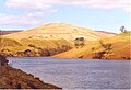
 Castlehill Reservoir - geograph.org.uk - 1630912.jpg 640 × 480; 64 KB
-
 Castlehill Reservoir - geograph.org.uk - 1990604.jpg 588 × 783; 97 KB
-
 Castlehill Reservoir - geograph.org.uk - 1993222.jpg 1,024 × 768; 154 KB
-
 Castlehill Reservoir - geograph.org.uk - 2057721.jpg 640 × 480; 88 KB
-
 Castlehill Reservoir - geograph.org.uk - 2409230.jpg 1,600 × 1,000; 634 KB
-
 Castlehill Reservoir - geograph.org.uk - 2409295.jpg 1,600 × 1,067; 682 KB
-
 Castlehill Reservoir - geograph.org.uk - 3008405.jpg 640 × 480; 247 KB
-
 Castlehill Reservoir - geograph.org.uk - 3154256.jpg 4,608 × 3,456; 6.33 MB
-
 Castlehill Reservoir - geograph.org.uk - 3307484.jpg 640 × 472; 310 KB
-
 Castlehill Reservoir - geograph.org.uk - 850010.jpg 640 × 480; 144 KB
-
 Castlehill Reservoir from Innerdownie (611m) - geograph.org.uk - 2345519.jpg 2,762 × 1,841; 1.49 MB
-
 Castlehill Reservoir Overflowing - geograph.org.uk - 1883918.jpg 2,736 × 3,648; 3.18 MB
-
 Castlehill Reservoir, Glen Devon - geograph.org.uk - 4009182.jpg 640 × 365; 76 KB
-
 Castlehill Reservoir, Glen Devon - geograph.org.uk - 5971542.jpg 2,592 × 1,944; 1.09 MB
-
 Castlehill Reservoir, Glendevon - geograph.org.uk - 1993228.jpg 1,024 × 768; 136 KB
-
 Cattle and Scots Pines on Down Hill - geograph.org.uk - 3154306.jpg 4,608 × 3,456; 6.33 MB
-
 Clear felled area, Glen Sherup - geograph.org.uk - 2133418.jpg 640 × 480; 109 KB
-
 Cleuch Hill - geograph.org.uk - 2223160.jpg 640 × 359; 206 KB
-
 Col at the head of Glen Sherup - geograph.org.uk - 2133435.jpg 640 × 480; 82 KB
-

-
 Confluence of the Devon Burn with the River Devon - geograph.org.uk - 3509388.jpg 1,368 × 1,824; 850 KB
-
 Conifer plantation - geograph.org.uk - 1186242.jpg 640 × 480; 69 KB
-
 Cottongrass on Tarmangie Hill - geograph.org.uk - 1947920.jpg 1,600 × 1,212; 630 KB
-
 Coulsknowe and Myrehaugh - geograph.org.uk - 5761015.jpg 4,608 × 3,456; 5.51 MB
-
 Course of the Creich Burn - geograph.org.uk - 2434415.jpg 640 × 480; 150 KB
-
 Crossing the dam at Castlehill Reservoir - geograph.org.uk - 3154218.jpg 4,608 × 3,456; 6.38 MB
-
 Dam wall - geograph.org.uk - 1186297.jpg 640 × 480; 67 KB
-
 Dam wall - geograph.org.uk - 3350966.jpg 2,048 × 1,536; 802 KB
-
 Dam, Castlehill Reservoir - geograph.org.uk - 3664912.jpg 640 × 360; 266 KB
-
 Dam, Glendevon Reservoir - geograph.org.uk - 4651882.jpg 800 × 600; 451 KB
-

-
 Damp reentrant, Glenquey Hill - geograph.org.uk - 2130421.jpg 640 × 480; 125 KB
-
 Deer fencing on Bentie Knowe - geograph.org.uk - 2747396.jpg 640 × 427; 52 KB
-
 Descending from Whitewhisp Hill - geograph.org.uk - 2747338.jpg 640 × 480; 53 KB
-
 Dow Burn - geograph.org.uk - 4209958.jpg 800 × 600; 403 KB
-
 Down Hill - geograph.org.uk - 3008392.jpg 640 × 480; 320 KB
-
 Down Hill - geograph.org.uk - 3664877.jpg 640 × 394; 243 KB
-
 Down Hill - geograph.org.uk - 3719767.jpg 640 × 480; 254 KB
-

-
 Downstream River Devon - geograph.org.uk - 3509411.jpg 3,648 × 2,736; 2.27 MB
-
 Dreich day on Skythorn Hill - geograph.org.uk - 4739384.jpg 4,318 × 3,454; 3.88 MB
-
 Dunning Glen - geograph.org.uk - 5620878.jpg 1,024 × 683; 413 KB
-
 Dunning Glen road at Earnieside - geograph.org.uk - 5761021.jpg 4,608 × 3,456; 5.35 MB
-
 Dunning Road, Lamb Linn - geograph.org.uk - 5572740.jpg 1,024 × 683; 350 KB
-
 Dusk on Innerdownie - geograph.org.uk - 4742214.jpg 837 × 1,200; 684 KB
-
 Dyke and deer fence on Innerdownie - geograph.org.uk - 2131685.jpg 640 × 480; 89 KB
-
 Dyke, Green Knowes - geograph.org.uk - 2223430.jpg 640 × 480; 208 KB
-
 Dyke, Green Knowes - geograph.org.uk - 2228837.jpg 640 × 480; 71 KB
-
 Dyke, Innerdownie - geograph.org.uk - 2131672.jpg 640 × 480; 114 KB
-
 Dykes in Glen Devon - geograph.org.uk - 3007429.jpg 640 × 480; 249 KB
-
 Earnieside - geograph.org.uk - 5572742.jpg 640 × 427; 52 KB
-
-
 Easter Downhill and Castlehill Reservoir - geograph.org.uk - 5637399.jpg 1,024 × 678; 129 KB
-

-
 Entry to the Glen Sherup Walking Trails and Parking Area - geograph.org.uk - 5564527.jpg 4,000 × 3,000; 4.12 MB
-
 Extraction lane - geograph.org.uk - 4997136.jpg 800 × 534; 305 KB
-
 Extraction lane - geograph.org.uk - 4997172.jpg 800 × 534; 247 KB
-
 Extraction lanes, Burnt Hill - geograph.org.uk - 4997173.jpg 800 × 534; 293 KB
-
 Fanny Burn - geograph.org.uk - 4997177.jpg 800 × 534; 182 KB
-
 Fanny Burn - geograph.org.uk - 4997183.jpg 800 × 534; 178 KB
-
 Fanny Hill - geograph.org.uk - 4995978.jpg 1,024 × 683; 287 KB
-
 Fence crossing - geograph.org.uk - 2131694.jpg 640 × 480; 84 KB
-
 Fence on Bald Hill - geograph.org.uk - 1184401.jpg 640 × 480; 86 KB
-

-

-
 Fenceline on Skythorn Hill - geograph.org.uk - 4739390.jpg 4,606 × 3,290; 4.08 MB
-
 Fencing on Rowantree Craig - geograph.org.uk - 4328879.jpg 640 × 427; 406 KB
-
 Field and gate - geograph.org.uk - 801891.jpg 640 × 480; 90 KB
-

-
 Forest edge, Glen Devon - geograph.org.uk - 2130220.jpg 640 × 359; 101 KB
-
 Forest Path On Black Hill - geograph.org.uk - 2409701.jpg 1,067 × 1,600; 715 KB
-
 Forest track near Lamb Hill - geograph.org.uk - 4275500.jpg 480 × 640; 369 KB
-
 Forest, Glen Sherup - geograph.org.uk - 2141687.jpg 640 × 480; 119 KB
-
 Forest, Glen Sherup - geograph.org.uk - 2141693.jpg 640 × 480; 110 KB
-
 Forestry east of Black Hill - geograph.org.uk - 4742228.jpg 1,200 × 900; 1.3 MB
-
 Forestry in Glen Sherup - geograph.org.uk - 2189377.jpg 640 × 480; 83 KB
-
 Forestry near Glen Sherup - geograph.org.uk - 4293802.jpg 640 × 415; 403 KB
-
 Frandy road end - geograph.org.uk - 3764159.jpg 4,608 × 3,456; 5.52 MB
-
 Frozen reservoir in Glen Sherup - geograph.org.uk - 1947647.jpg 2,592 × 1,944; 2.38 MB
-

-
 Gate and Footbridge - geograph.org.uk - 4359715.jpg 640 × 425; 100 KB
-
 Gate below Whitewisp Hill - geograph.org.uk - 4764856.jpg 4,608 × 3,456; 5.06 MB
-
 Gate near the summit of Tarmangie Hill - geograph.org.uk - 6156970.jpg 1,024 × 768; 293 KB
-

-
-
 Glen Devon - geograph.org.uk - 2228782.jpg 640 × 359; 84 KB
-
 Glen Devon - geograph.org.uk - 3664886.jpg 640 × 360; 241 KB
-
 Glen Devon - geograph.org.uk - 4202496.jpg 800 × 600; 394 KB
-
 Glen Devon - geograph.org.uk - 5600610.jpg 640 × 480; 96 KB
-
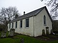 Glen Devon Church - geograph.org.uk - 4265473.jpg 640 × 480; 74 KB
-
 Glen Devon from Common Hill - geograph.org.uk - 1248198.jpg 640 × 427; 65 KB
-
 Glen Devon Park - geograph.org.uk - 2223155.jpg 640 × 359; 207 KB
-
 Glen Devon Res. - geograph.org.uk - 1924307.jpg 640 × 361; 70 KB
-
 Glen Devon reservoir - geograph.org.uk - 2119283.jpg 640 × 437; 73 KB
-
 Glen Devon seen from Cleuch Hill - geograph.org.uk - 2223477.jpg 640 × 480; 272 KB
-
 Glen Quay - geograph.org.uk - 4018190.jpg 640 × 436; 65 KB
-
 Glen Quey - geograph.org.uk - 2271041.jpg 640 × 480; 124 KB
-
 Glen Quey native woodland - geograph.org.uk - 6156962.jpg 1,024 × 768; 340 KB
-
 Glen Sherup - geograph.org.uk - 1924249.jpg 640 × 360; 47 KB
-
 Glen Sherup - geograph.org.uk - 1924322.jpg 361 × 640; 64 KB
-
 Glen Sherup - geograph.org.uk - 2133415.jpg 640 × 480; 101 KB
-
 Glen Sherup from Tarmangie - geograph.org.uk - 1948147.jpg 640 × 480; 104 KB
-
 Glendevon - geograph.org.uk - 4360938.jpg 640 × 425; 100 KB
-
 Glendevon and Burnfoot - geograph.org.uk - 2208079.jpg 1,600 × 1,200; 429 KB
-
 Glendevon Church - geograph.org.uk - 2702653.jpg 640 × 480; 84 KB
-
 Glendevon Footbridge - geograph.org.uk - 4360954.jpg 640 × 425; 100 KB
-
 Glendevon Hill Path - geograph.org.uk - 4360904.jpg 640 × 425; 100 KB
-
 Glendevon Youth Hostel - geograph.org.uk - 5991456.jpg 1,600 × 1,141; 460 KB
-
 Glendevon's village inn - geograph.org.uk - 3351181.jpg 2,048 × 1,536; 821 KB
-
 Glendey Burn - geograph.org.uk - 2236800.jpg 640 × 480; 291 KB
-
 Glendunning House - geograph.org.uk - 2151468.jpg 2,000 × 1,123; 2 MB
-
 Glendunning House - geograph.org.uk - 3509426.jpg 1,767 × 1,303; 656 KB
-
 Glenhead - geograph.org.uk - 956500.jpg 640 × 359; 98 KB
-
 Glenquey - geograph.org.uk - 2979138.jpg 640 × 480; 324 KB
-
 Glenquey Burn, Ochil Hills - geograph.org.uk - 4195007.jpg 640 × 480; 120 KB
-
 Glenquey Farm - geograph.org.uk - 4360883.jpg 640 × 425; 100 KB
-
 Glenquey Hill - geograph.org.uk - 4360896.jpg 640 × 425; 100 KB
-
 Glenquey Outlook - geograph.org.uk - 4359711.jpg 640 × 425; 100 KB
-
 Glenquey reservoir - geograph.org.uk - 2271012.jpg 640 × 476; 96 KB
-
 Glenquey Reservoir - geograph.org.uk - 4764822.jpg 4,608 × 3,456; 5.16 MB
-
 Glenquey Reservoir and Dam - geograph.org.uk - 1757671.jpg 640 × 480; 97 KB
-
 Glenquey Reservoir dam - geograph.org.uk - 4359737.jpg 640 × 425; 100 KB
-
 Glenquey Reservoir Road - geograph.org.uk - 2208073.jpg 1,600 × 1,200; 304 KB
-
 Glensherup Burn - geograph.org.uk - 2409639.jpg 1,067 × 1,600; 962 KB
-
 Glensherup dam - geograph.org.uk - 2130381.jpg 640 × 480; 126 KB
-
 Glensherup Dam - geograph.org.uk - 2409732.jpg 1,067 × 1,600; 789 KB
-
 Glensherup dam - geograph.org.uk - 5249147.jpg 640 × 427; 213 KB
-
 Glensherup Farm - geograph.org.uk - 2409899.jpg 1,600 × 1,067; 939 KB
-
 Glensherup Reservoir - geograph.org.uk - 1947253.jpg 1,600 × 1,200; 508 KB
-
 Glensherup Reservoir - geograph.org.uk - 2130399.jpg 640 × 480; 123 KB
-
 Glensherup Reservoir - geograph.org.uk - 2409815.jpg 1,600 × 1,110; 839 KB
-
 Glensherup Reservoir - geograph.org.uk - 2409855.jpg 1,600 × 1,039; 603 KB
-
 Glensherup Reservoir - geograph.org.uk - 2701718.jpg 4,320 × 3,240; 2.44 MB
-
 Glensherup Reservoir - geograph.org.uk - 2702623.jpg 640 × 480; 82 KB
-
 Glensherup Reservoir - geograph.org.uk - 3826626.jpg 640 × 427; 373 KB
-
 Glensherup Reservoir - geograph.org.uk - 5193424.jpg 4,894 × 2,936; 4.37 MB
-
 Glensherup Reservoir and Ben Shee - geograph.org.uk - 5251694.jpg 640 × 360; 156 KB
-
 Grassy hillside - geograph.org.uk - 801784.jpg 480 × 640; 82 KB
-
 Grassy path in Glen Sherup - geograph.org.uk - 1948180.jpg 640 × 480; 102 KB
-
 Green Knowes - geograph.org.uk - 2223172.jpg 640 × 359; 161 KB
-
 Green Knowes - geograph.org.uk - 2223175.jpg 640 × 359; 212 KB
-
 Green Knowes - geograph.org.uk - 2223177.jpg 640 × 480; 209 KB
-
 Green Knowes power station - geograph.org.uk - 2228899.jpg 640 × 480; 67 KB


_-_geograph.org.uk_-_2345519.jpg)


&filefrom=Green+Knowes+wind+farm+-+geograph.org.uk+-+1520286.jpg#mw-category-media)