Category:Glenfield, Leicestershire
Jump to navigation
Jump to search
Cymraeg: Pentref a chymuned yn Lloegr ydy Glenfield, Swydd Gaerlŷr; saif yn . (→Glenfield, Swydd Gaerlŷr)
English: Glenfield is a village and civil parish in the Blaby district of Leicestershire, England. At the 2011 Census, it had a population of 9,643. Its location at the northwestern fringe of the city of Leicester effectively makes it a suburb, although it is politically and administratively separate. The parish is formally named Glenfields, dating from the merger of the ancient Glenfield parish with Glenfield Frith. (→Glenfield, Leicestershire)
Français : Glenfield est une ville du Leicestershire dans le district de Blaby. (→Glenfield, Leicestershire)
Italiano: Glenfield è un paese di 10.000 abitanti della contea del Leicestershire, in Inghilterra. (→Glenfield (Leicestershire))
Nederlands: Glenfield is een plaats in het Engelse graafschap Leicestershire. Glenfield telt 10.000 inwoners. (→Glenfield (Engeland))
Norsk nynorsk: Glenfield er administrasjonsbyen i Leicestershire i England. Byen er ein forstad til Leicester, men høyrer til distriktet Blaby. Det er omkring 10 000 innbyggjarar (2004). Byen har som verdsleg sokn òg eit visst sjølvstyre innanfor distriktet. (→Glenfield i England)
Norsk bokmål: Glenfield er administrasjonsbyen i Leicestershire, England. Byen er en forstad til Leicester, men tilhører distriktet Blaby. Det er omkring 10 000 innbyggere (2004). Byen har som verdslig sogn også et visst selvstyre innenfor distriktet. (→Glenfield (England))
Polski: Glenfield lub Glenfields – wieś i civil parish w Anglii, w hrabstwie Leicestershire, w dystrykcie Blaby. Leży 5 km na zachód od miasta Leicester i 147 km na północny zachód od Londynu. W 2011 civil parish liczyła 9643 mieszkańców. Glenfield jest wspomniana w Domesday Book (1086) jako Clanefelde. (→Glenfield (Leicestershire))
Português: A pequena Glenfield fica no centro-leste da Inglaterra, e é a capital do condado de a apenas Leicestershire, apesar de não ser uma cidade tão importante, relativamente à metrópole de Leicester (da qual pode ser considerada como subúrbio) e à Loughborough, onde se localiza uma grande universidade britânica. (→Glenfield)

village in Leicestershire, England  | |||||
| Upload media | |||||
| Instance of | |||||
|---|---|---|---|---|---|
| Location | Glenfields, Blaby, Leicestershire, East Midlands, England | ||||
 | |||||
Subcategories
This category has the following 3 subcategories, out of 3 total.
C
- County Hall, Glenfield (6 F)
G
- Glenfield Tunnel (18 F)
Media in category "Glenfield, Leicestershire"
The following 40 files are in this category, out of 40 total.
-
 Allexton Gardens - geograph.org.uk - 1292767.jpg 640 × 480; 177 KB
-
 Chestnut Road, Glenfield, Leicester - geograph.org.uk - 75364.jpg 640 × 427; 81 KB
-
 Derelict farm buildings - geograph.org.uk - 489800.jpg 640 × 459; 123 KB
-
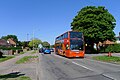
 First Leicester bus service 14 (geograph 7520448) (cropped).jpg 2,236 × 1,402; 782 KB
-
 First Leicester bus service 14 (geograph 7520448).jpg 3,568 × 2,381; 1.83 MB
-
 Forge inn glenfield.jpg 3,264 × 2,448; 2.52 MB
-
 Glenfield Premier Brick & Terracotta Co, Nigel Tout, 29.4.1967.jpg 900 × 606; 294 KB
-
 Glenfield Village - geograph.org.uk - 489786.jpg 640 × 402; 93 KB
-
 Glenfield Village - geograph.org.uk - 489792.jpg 640 × 531; 124 KB
-
 Glenfield.jpg 800 × 600; 175 KB
-
 Gynsills nature reserve.JPG 1,728 × 2,304; 1.49 MB
-
 Kirby Road, Glenfield - geograph.org.uk - 489802.jpg 640 × 568; 122 KB
-
 Main Street, Glenfield - geograph.org.uk - 489794.jpg 640 × 490; 96 KB
-
 The A563, New Parks Way - geograph.org.uk - 489749.jpg 640 × 506; 113 KB
-
 The A563, New Parks Way - geograph.org.uk - 489751.jpg 585 × 640; 150 KB
-
 Open space near Glenfield - geograph.org.uk - 5991489.jpg 1,024 × 768; 196 KB
-
 Park Rise in Western Park, Leicester - geograph.org.uk - 5518489.jpg 800 × 558; 96 KB
-
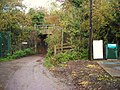 Railway bridge, West Street, Glenfield - geograph.org.uk - 2678455.jpg 2,048 × 1,536; 859 KB
-
 Sports Road, Glenfield, Leicester - geograph.org.uk - 75362.jpg 640 × 427; 88 KB
-

-
 The Forge Inn, Glenfield - geograph.org.uk - 489798.jpg 640 × 530; 95 KB
-
 The west portal of Glenfield Tunnel (2) Nigel Tout, 14.3.1967.jpg 900 × 598; 297 KB
-
 View from 6th floor.jpg 640 × 480; 202 KB
-
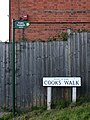 Walking along Cook's Walk, Glenfield (1) - geograph.org.uk - 788699.jpg 480 × 640; 105 KB
-
-
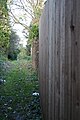
 Walking along Cook's Walk, Glenfield (3) - geograph.org.uk - 788704.jpg 640 × 427; 100 KB
-
 Welcome to Glenfield - geograph.org.uk - 489756.jpg 640 × 466; 86 KB
-
 Braunstone Frith, Leicester - geograph.org.uk - 141403.jpg 640 × 354; 100 KB
-

-
 Dominion Road in Glenfield, Leicester - geograph.org.uk - 489783.jpg 482 × 640; 107 KB
-
 Electricity pylon - geograph.org.uk - 489805.jpg 468 × 640; 93 KB
-

-
 Housing, Elm Tree Avenue - geograph.org.uk - 123242.jpg 640 × 480; 105 KB
-

-
 Park View, Leicester - geograph.org.uk - 489740.jpg 640 × 480; 94 KB
-
 Public footpath over A46 - geograph.org.uk - 123240.jpg 640 × 480; 106 KB
-
 Roundabout near Glenfield, Leicester - geograph.org.uk - 489816.jpg 640 × 396; 78 KB
-
 Tatlow Road sign - geograph.org.uk - 406659.jpg 640 × 480; 90 KB
-
 The Dominion - geograph.org.uk - 489781.jpg 640 × 503; 104 KB
-
 Tysoe Hill, Glenfield, Leicester - geograph.org.uk - 75402.jpg 640 × 427; 111 KB


_(cropped).jpg)
.jpg)


_Nigel_Tout,_14.3.1967.jpg)

_-_geograph.org.uk_-_788699.jpg)
_-_geograph.org.uk_-_788701.jpg)
_-_geograph.org.uk_-_788704.jpg)


