Category:Goatacre
Jump to navigation
Jump to search
village in Wiltshire, England, UK  | |||||
| Upload media | |||||
| Instance of | |||||
|---|---|---|---|---|---|
| Location | Hilmarton, Wiltshire, South West England, England | ||||
 | |||||
English: Goatacre is a village in the southwestern English county of Wiltshire situated 8 km (5 miles) north of Calne and 1 km south of Lyneham on the A3102 road. It is in the parish of Hilmarton and the closest major town is Swindon, some 19 km (12 miles) to the northeast. The adjacent hamlet, west of the main road, called New Zealand is considered part of Goatacre.
Media in category "Goatacre"
The following 19 files are in this category, out of 19 total.
-
 Bridleway to Catcomb - geograph.org.uk - 840328.jpg 640 × 480; 158 KB
-
 Combe Lane, Goatacre - geograph.org.uk - 840308.jpg 640 × 480; 129 KB
-
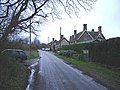
 Cottages in Goatacre Lane, Goatacre - geograph.org.uk - 840285.jpg 640 × 480; 112 KB
-
 Farmland near Goatacre - geograph.org.uk - 1187118.jpg 640 × 480; 185 KB
-
 Farmland, near Catcomb Farm, Catcomb - geograph.org.uk - 840351.jpg 640 × 480; 122 KB
-

-

-
 Goatacre Lane, Goatacre - geograph.org.uk - 840232.jpg 640 × 479; 143 KB
-
 Goatacre Lane, Goatacre - geograph.org.uk - 840259.jpg 640 × 480; 144 KB
-
 Goatacre Lane, Goatacre - geograph.org.uk - 840313.jpg 640 × 480; 171 KB
-

-
 Iles Court, Goatacre - geograph.org.uk - 840266.jpg 640 × 479; 119 KB
-
 Service houses near RAF Lyneham - geograph.org.uk - 339223.jpg 640 × 480; 63 KB
-
 Access road, Little Parl Close, Lyneham - geograph.org.uk - 1187073.jpg 640 × 480; 145 KB
-
 Charlcote farm - geograph.org.uk - 310015.jpg 640 × 462; 66 KB
-
 Charlcutt Hill - geograph.org.uk - 310018.jpg 640 × 480; 84 KB
-
 Goatacre - geograph.org.uk - 317387.jpg 640 × 480; 80 KB
-
 Leekshedge farm - geograph.org.uk - 310020.jpg 480 × 640; 71 KB
-


