Category:Godcakes (junction) in England
Jump to navigation
Jump to search
English: Godcake is a traditional name for the triangle of grass that occurs at a road junction on, mainly, minor roads created as the road splits to the left and right. The name originates from Warwickshire and is named after a puff pastry cake which originate from the city of Coventry.
Media in category "Godcakes (junction) in England"
The following 29 files are in this category, out of 29 total.
-
-2020-08-22 Gimingham animal pound, Gimingham, Norfolk (1).JPG 5,152 × 3,864; 6.33 MB
-
-2020-08-22 Gimingham animal pound, Gimingham, Norfolk (2).JPG 5,152 × 3,864; 6.16 MB
-
-2020-08-22 Gimingham animal pound, Gimingham, Norfolk (3).JPG 5,152 × 3,864; 5.4 MB
-
-2020-08-22 Gimingham animal pound, Gimingham, Norfolk (5).JPG 5,152 × 3,864; 8.03 MB
-
-2020-08-22 Plaque on Gimingham animal pound, Gimingham, Norfolk.JPG 5,152 × 3,864; 9.97 MB
-
-2020-09-16 Mill common road, Witton Bridge (2).JPG 5,152 × 3,864; 5.03 MB
-
-2020-11-20 Godcake junction, Gresham Road, Baconsthorpe, Norfolk.JPG 5,152 × 3,864; 7.66 MB
-
-2020-12-16 West Beckham Village Sign.JPG 3,864 × 5,152; 6.47 MB
-
-2021-03-07 Road Junction on Dilham Road, Honing.jpg 1,024 × 768; 317 KB
-
-2021-07-31 Copper Beech tree (Fagus sylvatica 'Purpurea'), Trunch, Norfolk, England.JPG 5,152 × 3,864; 4.78 MB
-
-2022-08-10 Common Road, Bradfield, Norfolk.JPG 5,152 × 3,864; 7.65 MB
-
19th century animal pound - geograph.org.uk - 1216451.jpg 640 × 480; 60 KB
-
Approaching 4-way junction - geograph.org.uk - 1216481.jpg 640 × 480; 89 KB
-
Country lane junction - geograph.org.uk - 139210.jpg 640 × 427; 118 KB
-
Donnington junction near Smallends Farm - geograph.org.uk - 26371.jpg 640 × 479; 129 KB
-
Grass triangle in Whissendine - geograph.org.uk - 687207.jpg 640 × 480; 86 KB
-
Grass triangle in Hawksworth Nottinghamshire.jpg 6,000 × 4,000; 8.92 MB
-
Road junction at Honing Common - geograph.org.uk - 425953.jpg 600 × 450; 61 KB
-
Junction to the B4047 on the A40 near Asthall - geograph.org.uk - 3577752.jpg 1,548 × 1,128; 720 KB
-
Lane junction near Ivybridge - geograph.org.uk - 1273508.jpg 640 × 480; 115 KB
-
Road Junction by The Firs - geograph.org.uk - 199701.jpg 640 × 418; 132 KB
-
The old pound - geograph.org.uk - 1216439.jpg 640 × 468; 54 KB
-
The old pound - geograph.org.uk - 1216456.jpg 640 × 480; 86 KB
-
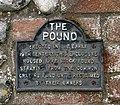
The old pound - sign - geograph.org.uk - 1216463.jpg 600 × 526; 146 KB
-
Village sign, West Beckham - geograph.org.uk - 1064785.jpg 640 × 428; 97 KB
-
West Beckham Village Sign.JPG 1,920 × 2,560; 1.18 MB
-
Minor road junction to Park Wood. - geograph.org.uk - 80902.jpg 640 × 480; 76 KB


