Category:Godley Hill
Jump to navigation
Jump to search
Media in category "Godley Hill"
The following 46 files are in this category, out of 46 total.
-
 Bench at Godley Hill War Memorial - geograph.org.uk - 4429213.jpg 1,000 × 750; 839 KB
-
 Bridge HAJ-43 - geograph.org.uk - 6388304.jpg 1,280 × 960; 1.16 MB
-
 Bridge ^43 - geograph.org.uk - 6388146.jpg 1,280 × 999; 1,002 KB
-
 Cottages at Godley Hill - geograph.org.uk - 1864989.jpg 3,797 × 2,508; 4.15 MB
-
 End of the Line - geograph.org.uk - 1800739.jpg 640 × 480; 186 KB
-
 Godley Hall Inn - geograph.org.uk - 6387707.jpg 1,280 × 960; 755 KB
-
 Godley Hall Inn - geograph.org.uk - 6387768.jpg 1,280 × 960; 921 KB
-
 Godley Hill - geograph.org.uk - 6387772.jpg 1,280 × 960; 959 KB
-
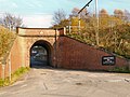 Godley Hill Arch - geograph.org.uk - 2702135.jpg 1,280 × 960; 958 KB
-
 Godley Hill Bench - geograph.org.uk - 1732582.jpg 640 × 617; 234 KB
-
 Godley Hill Footpath - geograph.org.uk - 2403093.jpg 640 × 480; 240 KB
-
 Godley Hill Road - geograph.org.uk - 1732609.jpg 640 × 480; 183 KB
-
 Godley Hill Road - geograph.org.uk - 4180804.jpg 1,000 × 750; 911 KB
-
 Godley Hill Road - geograph.org.uk - 4180813.jpg 1,000 × 750; 653 KB
-
 Godley Hill Road - geograph.org.uk - 4180829.jpg 1,000 × 750; 1,003 KB
-
 Godley Hill Road - geograph.org.uk - 4429154.jpg 1,000 × 750; 837 KB
-
 Godley Hill Road - geograph.org.uk - 4429161.jpg 1,000 × 750; 837 KB
-
 Godley Hill, cottages - geograph.org.uk - 1471850.jpg 640 × 480; 98 KB
-
 Godley Hill, food processing plant - geograph.org.uk - 1472169.jpg 640 × 480; 92 KB
-
 Godley Hill, office block - geograph.org.uk - 1472156.jpg 640 × 480; 70 KB
-
 Kerry Foods - geograph.org.uk - 6387790.jpg 1,280 × 960; 916 KB
-
 Kerry Foods plant from the air - geograph.org.uk - 5954945.jpg 1,024 × 757; 315 KB
-
 Kerry Way - geograph.org.uk - 3897629.jpg 1,000 × 783; 318 KB
-
 Kerry Way - geograph.org.uk - 3897631.jpg 1,000 × 750; 227 KB
-
 Longlands Lodge - geograph.org.uk - 3829202.jpg 1,000 × 750; 426 KB
-
 Longlands Wood - geograph.org.uk - 3829172.jpg 1,000 × 750; 564 KB
-
 Mending the wall - geograph.org.uk - 2404799.jpg 640 × 457; 201 KB
-
 Mottram Road - geograph.org.uk - 3829184.jpg 1,000 × 750; 393 KB
-
 Mottram Road - geograph.org.uk - 3829219.jpg 1,000 × 750; 319 KB
-
 Mottram Road - geograph.org.uk - 3897634.jpg 1,000 × 750; 228 KB
-
 Mottram Road - geograph.org.uk - 6386576.jpg 1,280 × 960; 1.04 MB
-
 Mottram Road - geograph.org.uk - 6386648.jpg 1,280 × 960; 961 KB
-
 New Road to Godley Hill - geograph.org.uk - 3367151.jpg 640 × 480; 236 KB
-
 Pennine View - geograph.org.uk - 3828177.jpg 1,370 × 1,000; 398 KB
-
 Shops and Post Office on Hattersley Road West - geograph.org.uk - 3828159.jpg 1,000 × 659; 189 KB
-
 Small clough between Pudding Lane and Mottram Road - geograph.org.uk - 1865024.jpg 3,872 × 2,499; 3.99 MB
-
 Station Road - geograph.org.uk - 6388300.jpg 1,280 × 985; 1.17 MB
-
 Steps to Godley Hall Inn - geograph.org.uk - 2403066.jpg 640 × 598; 266 KB
-
 Towards Longlands Wood - geograph.org.uk - 1036500.jpg 640 × 433; 116 KB
-
 Track Past Tetlowfold Farm - geograph.org.uk - 2702367.jpg 1,280 × 960; 795 KB
-
 Track to Godley Reservoir - geograph.org.uk - 3367164.jpg 640 × 480; 216 KB
-
 Two horses on Mottram Road - geograph.org.uk - 3897661.jpg 1,000 × 1,000; 436 KB
-
 Viners Way - geograph.org.uk - 3828210.jpg 1,000 × 748; 237 KB
-
 Viners Way - geograph.org.uk - 3828219.jpg 1,000 × 750; 217 KB
-
 Waterworks Lane (detail) - geograph.org.uk - 2702280.jpg 640 × 480; 801 KB
-
 Waterworks Lane - geograph.org.uk - 2702237.jpg 1,280 × 960; 1.02 MB


_-_geograph.org.uk_-_2702280.jpg)
