Category:Gold Mine Museum in Złoty Stok
Jump to navigation
Jump to search
| Object location | | View all coordinates using: OpenStreetMap |
|---|
 | |||||
| Upload media | |||||
| Instance of | |||||
|---|---|---|---|---|---|
| Location | Złoty Stok, Gmina Złoty Stok, Ząbkowice Śląskie County, Lower Silesian Voivodeship, Poland | ||||
| official website | |||||
 | |||||
Subcategories
This category has the following 5 subcategories, out of 5 total.
Media in category "Gold Mine Museum in Złoty Stok"
The following 80 files are in this category, out of 80 total.
-
 2016 Gnom w Muzeum Kopalni Złota w Złotym Stoku 1.jpg 2,743 × 2,668; 6.14 MB
-
 2016 Gnom w Muzeum Kopalni Złota w Złotym Stoku 2.jpg 2,466 × 2,696; 4.89 MB
-
 2016 Muzeum Kopalni Złota w Złotym Stoku, główny budynek 1.jpg 4,026 × 2,469; 8.92 MB
-
 2016 Muzeum Kopalni Złota w Złotym Stoku, główny budynek 2.jpg 4,710 × 2,951; 10.9 MB
-
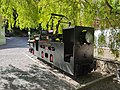
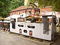
 2016 Muzeum Kopalni Złota w Złotym Stoku, kolejka 2.jpg 4,419 × 3,062; 9.54 MB
-
 2016 Muzeum Kopalni Złota w Złotym Stoku, restauracja 1.jpg 4,372 × 3,004; 11.64 MB
-
 2016 Muzeum Kopalni Złota w Złotym Stoku, restauracja 2.jpg 4,341 × 2,880; 11.81 MB
-
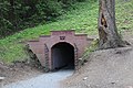
 2016 Muzeum Kopalni Złota w Złotym Stoku, tunel 1.jpg 3,272 × 2,366; 6.42 MB
-
 2016 Muzeum Kopalni Złota w Złotym Stoku, tunel 2.jpg 2,547 × 1,871; 3.82 MB
-
 5218viki Złoty Stok. Foto Barbara Maliszewska.jpg 2,000 × 1,339; 298 KB
-
 5219viki Złoty Stok. Kopalnia złota. Foto Barbara Maliszewska.jpg 2,000 × 1,339; 543 KB
-
 5224viki Złoty Stok. Sztolnie. Foto Barbara Maliszewska.jpg 2,000 × 1,339; 418 KB
-
 5225viki Złoty Stok. Kopalnia złota. Foto Barbara Maliszewska.jpg 2,000 × 1,339; 385 KB
-
 5231viki Złoty Stok. Sztolnie. Foto Barbara Maliszewska.jpg 2,000 × 1,339; 365 KB
-
 5236viki Złoty Stok. Foto Barbara Maliszewska.jpg 2,000 × 1,339; 535 KB
-
 5239vkiki Złoty Stok. Sztolnie. Foto Barbara Maliszewska.jpg 2,000 × 1,339; 541 KB
-
 5252viki Złoty Stok. Sztolnie kopalni złota. Foto Barbara Maliszewska.jpg 2,000 × 1,339; 289 KB
-
 5253viki Złoty Stok. Sztolnie kopalni złota. Foto Barbara Maliszewska.jpg 2,000 × 1,339; 259 KB
-
 5256vik Złoty Stok. Sztolnie kopalni złota. Foto Barbara Maliszewska.jpg 2,000 × 1,339; 249 KB
-
 5258viki Złoty Stok. Sztolnie kopalni złota. Foto Barbara Maliszewska.jpg 2,000 × 1,339; 351 KB
-
 5260viki Złoty Stok. Sztolnie kopalni złota. Foto Barbara Maliszewska.jpg 2,000 × 1,339; 176 KB
-
 5263viki Złoty Stok. Sztolnie kopalni złota. Foto Barbara Maliszewska.jpg 2,000 × 1,339; 293 KB
-
 5271vik Złoty Stok. Sztolnie kopalni złota. Foto Barbara Maliszewska.jpg 2,000 × 1,339; 198 KB
-
 5290viki Złoty Stok. Sztolnie kopalni złota. Foto Barbara Maliszewska.jpg 1,339 × 2,000; 261 KB
-
 5305viki Złoty Stok. Sztolnie kopalni złota. Foto Barbara Maliszewska.jpg 2,000 × 1,339; 304 KB
-
 5311viki Złoty Stok. Sztolnie kopalni złota. Foto Barbara Maliszewska.jpg 2,000 × 1,339; 289 KB
-
 5322viki Złoty Stok. Sztolnie kopalni złota. Foto Barbara Maliszewska.jpg 2,000 × 1,339; 293 KB
-
 5327viki Złoty Stok. Sztolnie kopalni złota. Foto Barbara Maliszewska.jpg 2,000 × 1,339; 288 KB
-
 5331viki Złoty Stok. Sztolnie kopalni złota. Foto Barbara Maliszewska.jpg 2,000 × 1,339; 314 KB
-
 5342Aviki Złoty Stok. Kopalnia złota. Foto Barbara Maliszewska.jpg 3,872 × 2,592; 3.33 MB
-
 Dawna kruszarnia w kopalni złota, Złoty Stok.jpg 4,998 × 3,332; 4.38 MB
-
 Gold (Zloty Stok).JPG 1,839 × 1,360; 908 KB
-
 Ignacy Domeyko plaque, Złoty Stok gold mine.jpg 3,872 × 2,592; 5.5 MB
-
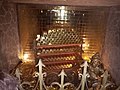
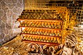
 Kostka wydobytego złota.jpg 5,436 × 3,058; 3.79 MB
-
 Lampa naftowa w Sztolni.jpg 4,000 × 6,000; 11.6 MB
-
 Ld1.jpg 4,000 × 3,000; 8.36 MB
-
 Makieta kopalni Złoty Stok 130153.jpg 3,968 × 2,976; 2.02 MB
-
 Makieta kopalni Złoty Stok 131311.jpg 3,968 × 2,976; 2.76 MB
-
 Muzeum Kopalni Złota w Złotym Stoku (1).jpg 4,160 × 3,120; 4.84 MB
-
 Muzeum Kopalni Złota w Złotym Stoku (10).jpg 3,120 × 4,160; 5.46 MB
-
 Muzeum Kopalni Złota w Złotym Stoku (11).jpg 4,160 × 3,120; 3.75 MB
-
 Muzeum Kopalni Złota w Złotym Stoku (2).jpg 4,160 × 3,120; 2.79 MB
-
 Muzeum Kopalni Złota w Złotym Stoku (3).jpg 4,160 × 3,120; 4.99 MB
-
 Muzeum Kopalni Złota w Złotym Stoku (6).jpg 4,160 × 3,120; 4.69 MB
-
 Muzeum Kopalni Złota w Złotym Stoku (7).jpg 3,120 × 4,160; 4.39 MB
-
 Muzeum Kopalni Złota w Złotym Stoku (8).jpg 4,160 × 3,120; 4.49 MB
-
 Muzeum Kopalni Złota w Złotym Stoku (9).jpg 4,160 × 3,120; 4.05 MB
-
 Muzeum Kopalni Złota w Złotym Stoku.jpg 3,264 × 2,448; 3.92 MB
-
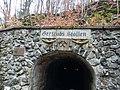
 Sztolnia Gertrudy.jpg 3,405 × 5,107; 8.22 MB
-
 Sztolnia książęca, ob. Muzeum Kopalnia złota w Złotym Stoku 01.jpg 3,264 × 2,448; 2.25 MB
-
 Sztolnia książęca, ob. Muzeum Kopalnia złota w Złotym Stoku 02.jpg 1,980 × 1,114; 769 KB
-
 Sztolnia książęca, ob. Muzeum Kopalnia złota w Złotym Stoku 04.jpg 3,264 × 2,448; 2.37 MB
-
 Sztolnia książęca, ob. Muzeum Kopalnia złota w Złotym Stoku 05.jpg 3,264 × 2,448; 2.12 MB
-
 Train of Gold Mine in Zloty Stok.JPG 2,048 × 1,360; 824 KB
-
 Wagonik złota wydobytego ze sztolni.jpg 2,449 × 1,633; 2.52 MB
-
 Zloty Stok kopalnia 10.jpg 6,000 × 4,000; 8.72 MB
-
 Zloty Stok kopalnia 11.jpg 6,000 × 4,000; 9.34 MB
-
 Zloty Stok kopalnia zlota 1.jpg 6,000 × 4,000; 10.04 MB
-
 Zloty Stok kopalnia zlota 2.jpg 6,000 × 4,000; 9.83 MB
-
 Zloty Stok kopalnia zlota 3.jpg 6,000 × 4,000; 8.76 MB
-
 Zloty Stok kopalnia zlota 4.jpg 6,000 × 4,000; 7.71 MB
-
 Zloty Stok kopalnia zlota 5.jpg 4,000 × 6,000; 9.83 MB
-
 Zloty Stok kopalnia zlota 6.jpg 6,000 × 4,000; 12.14 MB
-
 Zloty Stok kopalnia zlota 7.jpg 6,000 × 4,000; 11.01 MB
-
 Zloty Stok kopalnia zlota 8.jpg 6,000 × 4,000; 5.76 MB
-
 Zloty Stok kopalnia zlota 9.jpg 6,000 × 4,000; 9.55 MB
-
 Zloty Stok lokomotywa przed kopalnia zlota.jpg 1,920 × 1,440; 714 KB
-
 Zloty Stok Sztolnia Ochrowa 1.jpg 6,000 × 4,000; 11.81 MB
-
 Zloty Stok Sztolnia Ochrowa 2.jpg 6,000 × 4,000; 10.29 MB
-
 Zloty Stok, gold troll.JPG 1,428 × 1,360; 538 KB
-
 Zloty Stok, train of Gold Mine.JPG 1,974 × 1,283; 725 KB
-
 Zloty-Stok-zwrotnica-08070556.jpg 1,024 × 768; 243 KB
-
 ZRK RM111 141506.jpg 3,305 × 2,332; 1.36 MB
-
 ZRK RM111 141517.jpg 3,348 × 2,137; 1.15 MB
-
 Złoty Stok - Muzeum Kopalni Złota.JPG 2,576 × 1,932; 1.98 MB
-
 Złoty Stok muzeum P220721.jpg 3,968 × 2,976; 2.31 MB
-
 ZŁOTY STOK-KOPALNIA ZŁOTA - panoramio (1).jpg 3,648 × 2,056; 2.96 MB
-
 ZŁOTY STOK-KOPALNIA ZŁOTA - panoramio (2).jpg 3,648 × 2,056; 3.41 MB
-
 ZŁOTY STOK-KOPALNIA ZŁOTA - panoramio (3).jpg 3,648 × 2,056; 3.19 MB
-
 Źródło arsenowe Sztolnia Ochrowa Złoty Stok.jpg 3,000 × 4,000; 3.45 MB


.JPG)


.jpg)
.jpg)
.jpg)
.jpg)
.jpg)
.jpg)
.jpg)
.jpg)
.jpg)


.jpg)
.jpg)
.jpg)
