Category:Goodrich, Herefordshire
Jump to navigation
Jump to search
village and civil parish in Herefordshire, England  | |||||
| Upload media | |||||
| Instance of | |||||
|---|---|---|---|---|---|
| Location | Herefordshire, West Midlands, England | ||||
| Population |
| ||||
 | |||||
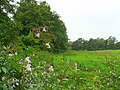
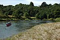
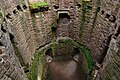
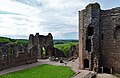
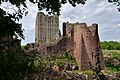
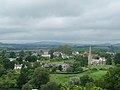
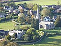
English: Goodrich is a village, in south Herefordshire, England which is very close to Gloucestershire and the Forest of Dean situated near the River Wye at and is famous for its old red sandstone Norman and medieval castle.Not strictly in the Forest of Dean but close enough to count (especially with tourists, and historically, invaders!) Goodrich is a small village that grew up next to Goodrich Castle, a fine 'Marcher Castle' which stands on a high spur of land commanding strategic position above a ford, an important ancient crossing point of the Wye. The castle was begun c1101 and from 1326 onwards was the family seat of the Earls of Shrewsbury, although by the 16th century it had passed into the hands of the Earls of Kent and was no longer inhabited on a permanent basis.

Subcategories
This category has the following 11 subcategories, out of 11 total.
C
- Coppet Hill (53 F)
F
- Flanesford Priory (29 F)
G
- Goodrich War Memorial (2 F)
H
- Huntsham Bridge (15 F)
K
- Kerne Bridge (bridge) (54 F)
N
- Newhouse Farm, Goodrich (2 F)
R
- Roads in Goodrich, Herefordshire (70 F)
S
Media in category "Goodrich, Herefordshire"
The following 200 files are in this category, out of 435 total.
(previous page) (next page)-

-
 Admiral Sir Hugo Lewis Pearson.jpg 1,421 × 1,733; 288 KB
-
 Air crash memorial window, Goodrich Castle - geograph.org.uk - 5648176.jpg 1,439 × 2,159; 500 KB
-
 Angler's hut by the Wye - geograph.org.uk - 3689507.jpg 3,264 × 2,448; 4.25 MB
-
 Another view of Mainoaks - geograph.org.uk - 4313525.jpg 3,872 × 2,592; 4.12 MB
-
 Approaching Symonds Yat East - geograph.org.uk - 4547116.jpg 2,592 × 1,944; 1.64 MB
-
 Arable land below Goodrich Castle - geograph.org.uk - 1436173.jpg 640 × 426; 98 KB
-
 Arch Cottage, Goodrich - geograph.org.uk - 3783228.jpg 800 × 638; 112 KB
-
 Asparagus crop by the Wye - geograph.org.uk - 980325.jpg 640 × 480; 193 KB
-
 At the end of the walk - geograph.org.uk - 2682254.jpg 2,432 × 2,177; 1.01 MB
-
 Autumn colours at Goodrich - geograph.org.uk - 1369650.jpg 640 × 409; 111 KB
-
 Autumn mist above the Wye - geograph.org.uk - 5944049.jpg 1,600 × 900; 670 KB
-

-
 Beeches near Goodrich - geograph.org.uk - 5503461.jpg 480 × 640; 245 KB
-
 Bishopswood from Coppett Hill - geograph.org.uk - 4316947.jpg 800 × 600; 320 KB
-
 Boat on the River Wye. - geograph.org.uk - 5044795.jpg 640 × 480; 79 KB
-
 Borage or starflower crop - geograph.org.uk - 478645.jpg 640 × 484; 419 KB
-

-
 Brelston Court - geograph.org.uk - 1206659.jpg 640 × 426; 83 KB
-
 Bridge near Goodrich - geograph.org.uk - 5503045.jpg 640 × 449; 232 KB
-
 Bridge over the Luke Brook - geograph.org.uk - 6017996.jpg 1,600 × 901; 872 KB
-
 Bryant's Court Cottage, Goodrich - geograph.org.uk - 3848105.jpg 800 × 550; 102 KB
-
 Building work been done on stone buildings - geograph.org.uk - 5101728.jpg 4,608 × 3,456; 5.47 MB
-
 By the Luke Brook 1 - geograph.org.uk - 976120.jpg 640 × 480; 113 KB
-
 By the Luke Brook 2 - geograph.org.uk - 976130.jpg 640 × 480; 87 KB
-
 By the Wye - geograph.org.uk - 980314.jpg 640 × 480; 198 KB
-
 Cannocks Wood - geograph.org.uk - 1250857.jpg 640 × 480; 186 KB
-
 Canoeing Down The Wye - geograph.org.uk - 4683821.jpg 1,600 × 1,039; 419 KB
-
 Canoeing on the River Wye - geograph.org.uk - 6164776.jpg 1,024 × 768; 273 KB
-
 Canoeists at Symonds Yat - geograph.org.uk - 4433621.jpg 2,079 × 2,048; 2.05 MB
-
 Canoeists on the Wye - geograph.org.uk - 1437617.jpg 640 × 426; 104 KB
-
 Canoeists on the Wye - geograph.org.uk - 5728019.jpg 4,525 × 3,162; 2.83 MB
-
 Canoes and cars, Symonds Yat East - geograph.org.uk - 4519953.jpg 800 × 595; 144 KB
-

-
 Canoes on the Wye, Symonds Yat East - geograph.org.uk - 4519986.jpg 800 × 739; 268 KB
-
 Car park for Goodrich Castle - geograph.org.uk - 6231713.jpg 3,024 × 1,701; 1.09 MB
-
 Cedar near Goodrich (1) - geograph.org.uk - 5503450.jpg 557 × 640; 276 KB
-
 Cedar near Goodrich (2) - geograph.org.uk - 5503453.jpg 640 × 502; 207 KB
-
 Charlton south of Goodrich - geograph.org.uk - 5252318.jpg 800 × 800; 205 KB
-
 Clearway for 5 miles sign, Pencraig - geograph.org.uk - 5027181.jpg 800 × 503; 127 KB
-
 Coldwell Rocks - geograph.org.uk - 4312721.jpg 2,592 × 3,872; 4.3 MB
-
 Coming into land at Symonds Yat - geograph.org.uk - 5786203.jpg 1,024 × 768; 376 KB
-

-
 Coppet Hill - geograph.org.uk - 6343104.jpg 1,024 × 768; 239 KB
-

-
 Copse near Baynhams - geograph.org.uk - 1181732.jpg 640 × 480; 206 KB
-
 Cottage, Goodrich - geograph.org.uk - 472674.jpg 640 × 528; 409 KB
-

-
 Courtfield Estate land - geograph.org.uk - 1181742.jpg 640 × 480; 217 KB
-
 Courtyard at Goodrich Castle - geograph.org.uk - 5084473.jpg 1,600 × 2,122; 676 KB
-
 Cross Keys Inn - geograph.org.uk - 4273997.jpg 640 × 480; 65 KB
-
 Cross Keys Inn - geograph.org.uk - 5500645.jpg 1,024 × 683; 188 KB
-
 Cross Keys Inn - geograph.org.uk - 5699837.jpg 6,032 × 4,014; 3.07 MB
-
 Cross Keys Inn, Goodrich - geograph.org.uk - 3848319.jpg 800 × 596; 96 KB
-
 Cross Keys Inn, Goodrich - geograph.org.uk - 980256.jpg 640 × 429; 118 KB
-
 Crowded car park at Symonds Yat (East) - geograph.org.uk - 6164770.jpg 1,024 × 768; 231 KB
-

-
 Damselfly, Banded Demoiselle - geograph.org.uk - 523914.jpg 640 × 478; 353 KB
-
 Direction signs in Goodrich - geograph.org.uk - 5022299.jpg 711 × 800; 171 KB
-
 Disappearing road signs - geograph.org.uk - 5699854.jpg 6,032 × 4,014; 5.56 MB
-
 Ducks Crossing sign, Symonds Yat East - geograph.org.uk - 4519894.jpg 800 × 763; 148 KB
-
 EIIR post box - geograph.org.uk - 5699848.jpg 4,014 × 6,032; 3.96 MB
-

-
-

-
 End of the 30 zone in Goodrich - geograph.org.uk - 5022282.jpg 800 × 686; 171 KB
-

-
 Entrance steps to Goodrich Tennis Club - geograph.org.uk - 3848076.jpg 703 × 800; 209 KB
-

-
 Entrance to Goodrich Castle - geograph.org.uk - 5162394.jpg 600 × 800; 125 KB
-
 Entrance to Goodrich Castle - geograph.org.uk - 6316809.jpg 1,024 × 768; 379 KB
-
 Entrance to Rocklands Farm - geograph.org.uk - 841786.jpg 640 × 480; 158 KB
-
 Farm building in Goodrich - geograph.org.uk - 3848092.jpg 800 × 577; 102 KB
-
 Farmland in the Wye Valley - geograph.org.uk - 1114056.jpg 640 × 439; 80 KB
-
 Farmland near Goodrich - geograph.org.uk - 4546616.jpg 2,592 × 1,944; 1.05 MB
-
 Farmland near Goodrich Castle - geograph.org.uk - 472681.jpg 480 × 640; 394 KB
-

-
 Ferry across the River Wye - 1983 - geograph.org.uk - 5201542.jpg 618 × 640; 115 KB
-
 Field edge, Goodrich - geograph.org.uk - 2678640.jpg 2,448 × 3,264; 2.55 MB
-
 Field of wheat near Goodrich. - geograph.org.uk - 507131.jpg 640 × 484; 458 KB
-

-
 Flowers of the Tansy plant - geograph.org.uk - 523912.jpg 640 × 471; 497 KB
-
 Flowers on the floodline - geograph.org.uk - 523908.jpg 640 × 480; 465 KB
-
 Flying the Flag at Goodrich Castle - geograph.org.uk - 4929541.jpg 800 × 600; 121 KB
-

-
-
 Former phonebox south of Goodrich - geograph.org.uk - 5252379.jpg 800 × 600; 195 KB
-

-
 Fungal golf balls - geograph.org.uk - 5953593.jpg 1,600 × 1,129; 750 KB
-
 Fungi in a wood - geograph.org.uk - 6315473.jpg 1,024 × 768; 183 KB
-
 Fungi in a wood - geograph.org.uk - 6315476.jpg 1,024 × 768; 197 KB
-
 Gap in the boundary wall - geograph.org.uk - 1048454.jpg 640 × 480; 206 KB
-
 Gate in a gate - geograph.org.uk - 3689573.jpg 3,264 × 2,448; 5.38 MB
-
 Gatehouse Lodge of Goodrich Court - geograph.org.uk - 4862183.jpg 2,451 × 2,451; 1.11 MB
-
 Gatehouse near Goodrich - geograph.org.uk - 5503032.jpg 640 × 516; 187 KB
-
 Gatehouse of Goodrich Castle - geograph.org.uk - 5162389.jpg 600 × 800; 151 KB
-
 George V postbox in Goodrich - geograph.org.uk - 3847976.jpg 343 × 800; 58 KB
-
 Get off my land^ - geograph.org.uk - 4312058.jpg 3,872 × 2,592; 4.02 MB
-
 Goodrich - geograph.org.uk - 465836.jpg 640 × 480; 144 KB
-
 Goodrich - White Hall (geograph 7438153).jpg 3,840 × 2,560; 2.6 MB
-

-
 Goodrich Castle - geograph.org.uk - 5044797.jpg 640 × 480; 82 KB
-
 Goodrich Castle - geograph.org.uk - 5084264.jpg 1,600 × 1,129; 390 KB
-
 Goodrich Castle - geograph.org.uk - 5162364.jpg 1,024 × 768; 228 KB
-
 Goodrich Castle - geograph.org.uk - 5162371.jpg 800 × 600; 144 KB
-
 Goodrich Castle - geograph.org.uk - 5162473.jpg 800 × 600; 150 KB
-
 Goodrich Castle - geograph.org.uk - 5162478.jpg 600 × 800; 150 KB
-
 Goodrich Castle - geograph.org.uk - 5178349.jpg 800 × 600; 544 KB
-
 Goodrich Castle - geograph.org.uk - 5443361.jpg 3,675 × 2,446; 4.97 MB
-
 Goodrich Castle - geograph.org.uk - 5443363.jpg 3,678 × 2,456; 5.18 MB
-
 Goodrich Castle - geograph.org.uk - 6316804.jpg 768 × 1,024; 320 KB
-

-
 Goodrich Castle direction sign - geograph.org.uk - 5022503.jpg 799 × 800; 249 KB
-
 Goodrich Castle site of the 17th century stables - geograph.org.uk - 5101991.jpg 3,456 × 4,608; 4.69 MB
-
 Goodrich Castle Southwest Tower and Great Hall - geograph.org.uk - 5101997.jpg 4,608 × 3,456; 3.86 MB
-
 Goodrich Castle, "Roaring Meg" - geograph.org.uk - 5443375.jpg 2,919 × 4,079; 6.78 MB
-

-
 Goodrich Castle, East Range building detail 1 - geograph.org.uk - 5444200.jpg 3,678 × 2,456; 5.86 MB
-

-
 Goodrich Castle, South East Tower interior - geograph.org.uk - 5444172.jpg 3,655 × 2,416; 4.26 MB
-
 Goodrich Castle, South East Tower interior - geograph.org.uk - 5444179.jpg 3,678 × 2,456; 5.36 MB
-
 Goodrich Castle, South Eastern aspect - geograph.org.uk - 5444227.jpg 5,011 × 3,079; 7.55 MB
-
 Goodrich Castle, The Barbican - geograph.org.uk - 5444210.jpg 4,767 × 2,832; 7.66 MB
-
 Goodrich Castle, The Chapel - geograph.org.uk - 5444222.jpg 5,026 × 3,222; 7.35 MB
-
 Goodrich Castle, The Garderobe Tower 1 - geograph.org.uk - 5444152.jpg 4,258 × 2,769; 6.48 MB
-
 Goodrich Castle, The Garderobe Tower 2 - geograph.org.uk - 5444156.jpg 3,678 × 2,456; 5.46 MB
-
 Goodrich Castle, The gatehouse - geograph.org.uk - 5444144.jpg 3,678 × 2,455; 4.58 MB
-
 Goodrich Castle, The Great Hall 1 - geograph.org.uk - 5444121.jpg 3,542 × 3,619; 5.11 MB
-
 Goodrich Castle, The Great Hall 2 - geograph.org.uk - 5444128.jpg 3,678 × 2,456; 4.67 MB
-
 Goodrich Castle, The Keep - geograph.org.uk - 5444136.jpg 4,866 × 3,211; 7.15 MB
-
 Goodrich Castle, The massive entrance - geograph.org.uk - 5443372.jpg 5,520 × 3,680; 6.65 MB
-
 Goodrich Castle, The Portcullis Chamber - geograph.org.uk - 5444208.jpg 3,670 × 2,433; 5.02 MB
-
 Goodrich Castle, The River Wye from the entrance - geograph.org.uk - 5443369.jpg 3,678 × 2,455; 6.69 MB
-
 Goodrich Castle, The Solar Block - geograph.org.uk - 5444102.jpg 5,177 × 3,282; 6.8 MB
-
 Goodrich Castle, The Solar Block - geograph.org.uk - 5444217.jpg 3,576 × 2,286; 4.82 MB
-
-
 Goodrich Castle, The South Eastern Tower and Keep - geograph.org.uk - 5444233.jpg 3,679 × 2,456; 5.57 MB
-
 Goodrich Castle, The South West Tower - geograph.org.uk - 5444230.jpg 3,432 × 3,607; 6.52 MB
-
 Goodrich church - geograph.org.uk - 3089853.jpg 640 × 480; 59 KB
-
 Goodrich Church - geograph.org.uk - 465638.jpg 640 × 480; 156 KB
-
 Goodrich CofE Primary School - geograph.org.uk - 507118.jpg 640 × 455; 266 KB
-
 Goodrich Court (Gatehouse) - geograph.org.uk - 5903366.jpg 960 × 720; 236 KB
-
 Goodrich from Coppet Hill 1 - geograph.org.uk - 1181698.jpg 640 × 640; 296 KB
-
 Goodrich from Coppet Hill 2 - geograph.org.uk - 1181706.jpg 640 × 480; 239 KB
-
 Goodrich Manor, Goodrich - geograph.org.uk - 5503446.jpg 640 × 512; 134 KB
-
 Goodrich Tennis Club pavilion - geograph.org.uk - 3848082.jpg 800 × 703; 138 KB
-
 Goodrich viewed from Coppet Hill - geograph.org.uk - 5161979.jpg 800 × 600; 147 KB
-
 Goodrich viewed from Coppet Hill - geograph.org.uk - 6315458.jpg 1,024 × 768; 284 KB
-
 Goodrich viewed from Yat Rock - geograph.org.uk - 3179263.jpg 1,024 × 680; 153 KB
-
 Goodrich Village - geograph.org.uk - 22713.jpg 640 × 436; 291 KB
-
 Goodrich Village Hall - geograph.org.uk - 1445901.jpg 640 × 426; 95 KB
-
 Goodrich Village Hall - geograph.org.uk - 3089392.jpg 640 × 480; 83 KB
-
 Goodrich Village Hall - geograph.org.uk - 3847995.jpg 800 × 503; 117 KB
-
 Goodrich Village Hall - geograph.org.uk - 472129.jpg 640 × 480; 450 KB
-
 Goodrich Village Hall - geograph.org.uk - 5027022.jpg 800 × 520; 110 KB
-
 Goodrich Village Hall name sign - geograph.org.uk - 5027027.jpg 800 × 441; 84 KB
-
 Goodrich Village Sewage Pumping Station - geograph.org.uk - 3848281.jpg 800 × 696; 190 KB
-
 Goodrich village shop - geograph.org.uk - 1904045.jpg 2,448 × 3,264; 1.6 MB
-

-
 Goodrich, winter sunset - geograph.org.uk - 2785170.jpg 1,600 × 1,066; 283 KB
-

-
 Grade II listed South Lodge, Goodrich - geograph.org.uk - 3848042.jpg 800 × 578; 142 KB
-
 Green trailer on Kerne Bridge - geograph.org.uk - 6121988.jpg 1,600 × 900; 439 KB
-
 Hand Ferry across the River Wye at Symonds Yat East - geograph.org.uk - 5101022.jpg 4,608 × 3,456; 3.91 MB
-
 Haymaking at Goodrich - geograph.org.uk - 1435821.jpg 426 × 640; 101 KB
-
 Haymaking at Goodrich - geograph.org.uk - 1435823.jpg 640 × 426; 110 KB
-
 Haymaking In The Bend Of The Wye - geograph.org.uk - 4683814.jpg 800 × 530; 66 KB
-
 High bridge in Goodrich - geograph.org.uk - 3678767.jpg 800 × 600; 146 KB
-
 Hillside footpath, Goodrich - geograph.org.uk - 1048735.jpg 640 × 480; 210 KB
-
 Holly Cottages, Goodrich.jpg 4,000 × 3,000; 1.26 MB
-
 Holly Tree Cottage, Goodrich - geograph.org.uk - 3848023.jpg 800 × 599; 120 KB
-
 Home Farm access road, Pencraig - geograph.org.uk - 5027177.jpg 800 × 776; 127 KB
-
 House on the hill - geograph.org.uk - 6121978.jpg 1,600 × 900; 510 KB
-
 Houses across the river - geograph.org.uk - 5407185.jpg 3,264 × 2,448; 4.04 MB
-
 Huntsham Bridge - geograph.org.uk - 4273993.jpg 640 × 480; 81 KB
-
 Huntsham Bridge - geograph.org.uk - 4312050.jpg 3,872 × 2,592; 4.31 MB
-
 Huntsham Bridge - geograph.org.uk - 4789879.jpg 640 × 480; 79 KB
-
 Huntsham Bridge - geograph.org.uk - 4957324.jpg 1,024 × 683; 422 KB
-
 Huntsham Cottage, Symonds Yat - geograph.org.uk - 4312739.jpg 2,592 × 3,872; 4.36 MB
-

-
 Islands in the Stream - geograph.org.uk - 5998089.jpg 1,600 × 899; 613 KB
-
 James Cottage, Goodrich - geograph.org.uk - 5027054.jpg 800 × 711; 142 KB
-
 Jolly's of Goodrich - geograph.org.uk - 3847975.jpg 800 × 727; 128 KB
-

-
 Kerne Bridge - geograph.org.uk - 5161985.jpg 800 × 600; 164 KB
-
 Kerne Bridge - geograph.org.uk - 5161988.jpg 800 × 600; 170 KB
-
 Kerne Bridge - geograph.org.uk - 5161989.jpg 800 × 600; 178 KB
-
 Kerne Bridge - geograph.org.uk - 6315482.jpg 1,024 × 768; 219 KB
-
 Kerne Bridge and the Wye Valley - geograph.org.uk - 5161986.jpg 800 × 600; 161 KB
-
 Kerne Bridge and the Wye, 1 - geograph.org.uk - 4316930.jpg 800 × 600; 306 KB
-
 Kerne Bridge and the Wye, 2 - geograph.org.uk - 4316936.jpg 800 × 451; 215 KB
-
 Knapp Close, Goodrich - geograph.org.uk - 5026996.jpg 800 × 756; 203 KB
-
 Late Georgian House (geograph 5699863).jpg 6,032 × 4,014; 4.07 MB
-
 Lodge near Goodrich - geograph.org.uk - 5503007.jpg 640 × 524; 198 KB
-
 Looking up the River Wye - geograph.org.uk - 3689502.jpg 3,264 × 2,448; 3.57 MB
-
 Low-lying fields near Huntsham Court - geograph.org.uk - 4547113.jpg 2,592 × 1,944; 1.68 MB
-
 Mainoaks - geograph.org.uk - 4312748.jpg 3,872 × 2,592; 4.02 MB
-
 Map Yuxton now Rocklands House Goodrich 1794.jpg 1,947 × 1,126; 426 KB
-
 Millennium Window, Goodrich Castle - geograph.org.uk - 5162411.jpg 600 × 800; 113 KB
-


_-_geograph.org.uk_-_5503450.jpg)
_-_geograph.org.uk_-_5503453.jpg)


_-_geograph.org.uk_-_6164770.jpg)


.jpg)


_-_geograph.org.uk_-_5903366.jpg)


.jpg)


