Category:Gooijerdijk 10, Driebergen-Rijsenburg
Jump to navigation
Jump to search
| Object location | | View all coordinates using: OpenStreetMap |
|---|
 | |||||
| Upload media | |||||
| Instance of | |||||
|---|---|---|---|---|---|
| Location | Driebergen-Rijsenburg, Utrecht, Netherlands | ||||
| Street address |
| ||||
| Located on street | |||||
| Heritage designation |
| ||||
 | |||||
|
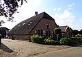
This is a category about rijksmonument number 14079
|
| Address |
|
Media in category "Gooijerdijk 10, Driebergen-Rijsenburg"
The following 6 files are in this category, out of 6 total.
-
 Bakhuis - Driebergen-Rijsenburg - 20002498 - RCE.jpg 1,183 × 1,200; 327 KB
-
 Bakhuis - Driebergen-Rijsenburg - 20002499 - RCE.jpg 1,187 × 1,200; 400 KB
-
 Driebergen RM Gooijerdijk 10.jpg 3,605 × 2,500; 3.86 MB
-
 Driebergen-Rijsenburg - Gooijerdijk 10 RM14079.JPG 4,608 × 2,410; 1.04 MB
-
 Gevels - Driebergen-Rijsenburg - 20063932 - RCE.jpg 1,200 × 958; 196 KB
-
 Voorgevel - Driebergen-Rijsenburg - 20063933 - RCE.jpg 1,200 × 856; 203 KB


