Category:Gosport
Jump to navigation
Jump to search
town in Hampshire, England  | |||||
| Upload media | |||||
| Instance of | |||||
|---|---|---|---|---|---|
| Location | Gosport, Hampshire, South East England, England | ||||
| Population |
| ||||
| Area |
| ||||
| official website | |||||
 | |||||
Subcategories
This category has the following 42 subcategories, out of 42 total.
A
- Ann's Hill Cemetery, Gosport (100 F)
B
- Bastion 1, Gosport (8 F)
C
D
E
- Fort Elson (1 F)
F
- John Fieldhouse (10 F)
- Fort Rowner (10 F)
- Forton Barracks (5 F)
- Forton Lake Millennium Bridge (33 F)
- RNAD Frater (2 F)
G
- Fort Gomer (1 F)
- Fort Grange (2 F)
H
- History of Gosport (36 F)
M
- Millennium Timespace (16 F)
P
R
- RAF Gosport (12 F)
V
- Views of Gosport (2 F)
W
- Walpole Park, Gosport (29 F)
Media in category "Gosport"
The following 200 files are in this category, out of 381 total.
(previous page) (next page)-
 "the Grove" - geograph.org.uk - 1372306.jpg 640 × 480; 100 KB
-
 'Island Flyer' - geograph.org.uk - 6155706.jpg 5,100 × 2,868; 7.77 MB
-
 17th Century coal forge.jpg 960 × 734; 96 KB
-
 A lot of allotments - geograph.org.uk - 1141596.jpg 640 × 480; 78 KB
-
 A misty Portsmouth Harbour (3) - geograph.org.uk - 2487119.jpg 640 × 428; 46 KB
-

-
-
 APL Portugal (ship, 2009) 001.jpg 4,486 × 1,494; 5.72 MB
-

-

-
-

-

-
-
 Army Cadets' base in Mumby Road - geograph.org.uk - 1327308.jpg 640 × 480; 85 KB
-

-
 Bay House School, main entrance.jpg 1,129 × 1,575; 292 KB
-
 Bend in Woodville Drive - geograph.org.uk - 1994947.jpg 640 × 480; 75 KB
-
 Black-headed Gull (5709101485).jpg 1,782 × 1,860; 885 KB
-
 Blount Road - geograph.org.uk - 1994944.jpg 640 × 480; 86 KB
-

-
 Bottle bank outside Gosport Waitrose - geograph.org.uk - 1374297.jpg 640 × 480; 44 KB
-
 Bower within "the Grove" - geograph.org.uk - 1372218.jpg 640 × 480; 87 KB
-

-
 Brockhurst Primary School.jpg 4,032 × 3,024; 3.25 MB
-
 Buildings at Haslar - geograph.org.uk - 5833771.jpg 640 × 480; 47 KB
-
 Buoy, The Solent - geograph.org.uk - 1838409.jpg 1,024 × 641; 197 KB
-
 Cannon outside No.2 Battery - geograph.org.uk - 1497575.jpg 640 × 428; 77 KB
-

-

-
 Care home in Western Way - geograph.org.uk - 1425591.jpg 640 × 480; 91 KB
-
 Cattery in Fareham Road - geograph.org.uk - 1741563.jpg 640 × 428; 64 KB
-
 Cautionary sign on the cycleway - geograph.org.uk - 1385317.jpg 640 × 480; 66 KB
-
-

-
 Circular mosaic in Haslar Road - geograph.org.uk - 1327086.jpg 640 × 480; 89 KB
-
 Clarence Road (1) - geograph.org.uk - 6029181.jpg 3,872 × 2,592; 4.73 MB
-
 Clarence Road (5) - geograph.org.uk - 6029201.jpg 3,872 × 2,592; 4.42 MB
-
 Connaught drill hall Gosport c1910.jpg 3,017 × 2,126; 1.81 MB
-
 Containers behind Gosport Town Hall - geograph.org.uk - 1385614.jpg 640 × 480; 78 KB
-

-
 Crescent Garden - geograph.org.uk - 1498194.jpg 640 × 428; 91 KB
-

-

-

-

-
 Day centre in Brockhurst Road - geograph.org.uk - 1380516.jpg 640 × 480; 66 KB
-
 Dinghy Pound -Stokes Bay - geograph.org.uk - 704907.jpg 640 × 402; 76 KB
-
 Early August in Pembroke Road - geograph.org.uk - 1994891.jpg 640 × 480; 71 KB
-

-

-
 Entrance to St Matthew's Court - geograph.org.uk - 1327281.jpg 640 × 480; 97 KB
-

-

-
 Fareham lines 1841.png 1,036 × 1,034; 76 KB
-
 Fareham lines 1848.png 1,036 × 1,034; 89 KB
-
 Fareham lines 1866.png 1,036 × 1,034; 99 KB
-
 Fareham lines 1894.png 1,036 × 1,034; 110 KB
-
 Fareham lines 1904.png 1,036 × 1,034; 117 KB
-
 Fishpond in Stanley Park - geograph.org.uk - 1079828.jpg 7,198 × 4,824; 4.39 MB
-
 Fleetlands Open Day - 1975 (1) - geograph.org.uk - 1553697.jpg 640 × 416; 51 KB
-
 Fleetlands Open Day - 1975 (2) - geograph.org.uk - 1553710.jpg 640 × 415; 53 KB
-
 Fleetlands Open Day - 1976 - geograph.org.uk - 1562902.jpg 640 × 419; 60 KB
-
 Flickr - ronsaunders47 - PORTSMOUTH ^ SOUTHSEA HARBOUR ENTRANCE.2.jpg 2,732 × 1,816; 745 KB
-
-
 Flowerbeds in Stanley Park - geograph.org.uk - 1079839.jpg 640 × 423; 63 KB
-
-
 Fort Brockhurst 01.jpg 6,000 × 4,000; 17.48 MB
-
 Fort Brockhurst 02.jpg 8,434 × 3,411; 20.91 MB
-
 Fortifications at Gosport - geograph.org.uk - 1272467.jpg 640 × 480; 72 KB
-
 Foster Gardens(1) - geograph.org.uk - 1093456.jpg 7,198 × 4,577; 3.85 MB
-
 Foster Gardens(2) - geograph.org.uk - 1093468.jpg 640 × 400; 74 KB
-
 Foster Gardens(3) - geograph.org.uk - 1093477.jpg 640 × 418; 73 KB
-
 Fountain (1) - geograph.org.uk - 1272560.jpg 640 × 480; 63 KB
-
 From Spit Sand Fort - geograph.org.uk - 806733.jpg 637 × 425; 45 KB
-
 Fuel jetty - Gosport - geograph.org.uk - 5833708.jpg 640 × 480; 46 KB
-
-
 Garages in Gwessin Terrace - geograph.org.uk - 1372413.jpg 640 × 480; 70 KB
-
-
 Georgian postbox - geograph.org.uk - 1388576.jpg 480 × 640; 97 KB
-
 Gilkicker Point - geograph.org.uk - 3564699.jpg 640 × 480; 183 KB
-
 Gilkicker point, view east - geograph.org.uk - 431361.jpg 640 × 480; 94 KB
-
 Gosport - Forton Lake Wreck - geograph.org.uk - 2991291.jpg 800 × 531; 134 KB
-
 Gosport - Forton Lake Wreck - geograph.org.uk - 2991320.jpg 800 × 531; 163 KB
-
 Gosport - High rise, Low Rise - geograph.org.uk - 877175.jpg 640 × 424; 103 KB
-
 Gosport - Marina - geograph.org.uk - 2991126.jpg 800 × 531; 100 KB
-
 Gosport - Pier - geograph.org.uk - 2991074.jpg 800 × 531; 93 KB
-
 Gosport - Pier - geograph.org.uk - 2991083.jpg 800 × 531; 95 KB
-
 Gosport - St Georges Barracks - geograph.org.uk - 2992633.jpg 800 × 600; 114 KB
-
 Gosport banner Fort Brockhurst.jpg 8,434 × 1,203; 9.23 MB
-
 Gosport Business Centre - geograph.org.uk - 1824821.jpg 640 × 428; 59 KB
-
 Gosport Cruising Club - geograph.org.uk - 2137992.jpg 640 × 427; 73 KB
-

-
 Gosport ferry.jpg 1,447 × 925; 220 KB
-
 Gosport from Gun Wharf Quay - geograph.org.uk - 808140.jpg 639 × 407; 48 KB
-
 Gosport from HMS Warrior at Sunset - geograph.org.uk - 1095221.jpg 640 × 480; 46 KB
-
 Gosport Ice Rink (1) - geograph.org.uk - 1141495.jpg 640 × 480; 57 KB
-
 Gosport Ice Rink (2) - geograph.org.uk - 1141509.jpg 640 × 480; 49 KB
-
 Gosport Lifeboat - geograph.org.uk - 2535706.jpg 640 × 428; 65 KB
-
 Gosport Marina - geograph.org.uk - 6484266.jpg 1,024 × 681; 82 KB
-
 Gosport Marina - geograph.org.uk - 6725608.jpg 1,024 × 684; 108 KB
-
 Gosport Marina and Fuel Jetty - geograph.org.uk - 3569888.jpg 640 × 427; 200 KB
-
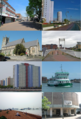 Gosport montage.png 544 × 801; 992 KB
-

-
 Gosport Sandwich - geograph.org.uk - 1497653.jpg 640 × 428; 46 KB
-
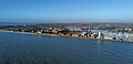
 Gosport Skyline.jpg 4,000 × 1,894; 7.6 MB
-
 Gosport Town Centre - 53731808849.jpg 4,000 × 3,000; 5.31 MB
-
 Gosport UK ward map 2022.svg 680 × 687; 134 KB
-
 Gosport UK ward map 2024.svg 725 × 733; 131 KB
-
 Gosport Welcome-Farewell sign - geograph.org.uk - 1164241.jpg 640 × 480; 77 KB
-
 Gosport, fishing - geograph.org.uk - 644535.jpg 640 × 429; 64 KB
-
 Gosport, Hants - geograph.org.uk - 169.jpg 640 × 427; 27 KB
-
 Grahamarty1.jpg 1,184 × 1,776; 1.43 MB
-
 Hanging baskets on the one-way system - geograph.org.uk - 1396898.jpg 640 × 477; 107 KB
-
 Harlequin Court - geograph.org.uk - 3178229.jpg 640 × 425; 292 KB
-
 Haslar Footbridge - geograph.org.uk - 1327194.jpg 640 × 480; 91 KB
-
 Haslar Sea Wall - geograph.org.uk - 3350881.jpg 960 × 720; 89 KB
-
 Haslar Sea Wall and The Solent - geograph.org.uk - 3484074.jpg 1,798 × 1,182; 2.12 MB
-
 Haslar Skyline.jpg 4,000 × 1,923; 7.75 MB
-
-
 HMS Sultan Caledonian Gate (geograph 3875349).jpg 640 × 480; 93 KB
-
 Houses at the end of Chilworth Grove - geograph.org.uk - 1376193.jpg 640 × 458; 48 KB
-

-
 Houses in St Nicholas's Street - geograph.org.uk - 1994854.jpg 640 × 480; 91 KB
-
 Information board within "the Grove" - geograph.org.uk - 1372206.jpg 640 × 480; 70 KB
-
 Information map of Gosport sign - geograph.org.uk - 1308596.jpg 640 × 480; 71 KB
-
 International Fleet Review from Gosport.jpg 2,592 × 1,944; 2.18 MB
-
 Jacana Court - geograph.org.uk - 1424091.jpg 640 × 362; 159 KB
-
 Jessie Road-Newlands Avenue alley - geograph.org.uk - 1235008.jpg 640 × 480; 63 KB
-
 Jetty, Gosport - geograph.org.uk - 6484264.jpg 1,024 × 681; 66 KB
-

-

-

-

-
 Leaving Portsmouth - geograph.org.uk - 1985532.jpg 3,872 × 2,176; 3.19 MB
-
 Lee-solent-rly.png 1,513 × 995; 67 KB
-
 Leesland Conservation Area - geograph.org.uk - 1385285.jpg 640 × 480; 84 KB
-
 Leesland Park - geograph.org.uk - 1234944.jpg 640 × 480; 82 KB
-
 Leesland skateboard park - geograph.org.uk - 886394.jpg 640 × 480; 77 KB
-
 Lingfield Court, Pembroke Road - geograph.org.uk - 1994935.jpg 480 × 640; 65 KB
-
 Little Chilworth - geograph.org.uk - 1376185.jpg 640 × 435; 70 KB
-
 Lodge Gardens - geograph.org.uk - 1426216.jpg 640 × 480; 93 KB
-

-

-

-

-
 Looking across to Gosport - geograph.org.uk - 816152.jpg 640 × 480; 44 KB
-

-

-
-

-

-

-

-

-
-

-

-
-

-

-

-
-

-

-

-
-

-

-

-

-

-

-

-

-

-

-

-

-

-
-

-

-

-
 Looking towards Haslar Lake - geograph.org.uk - 1038436.jpg 640 × 418; 62 KB
-

-

-

-

-
 Mid section of Woodville Drive - geograph.org.uk - 1994950.jpg 640 × 480; 75 KB
-

-

-
 MOD sports field in Gosport - geograph.org.uk - 1435571.jpg 640 × 480; 52 KB
-
 MOD sports ground - geograph.org.uk - 877512.jpg 640 × 379; 80 KB
-
 Nat Gonella Square - geograph.org.uk - 1370695.jpg 640 × 480; 91 KB
-
 Nat Gonella Tribute.jpg 2,592 × 3,888; 3.99 MB
-
 New Ferry Pontoon - Gosport - geograph.org.uk - 2483842.jpg 640 × 427; 46 KB
-

-
 North, South, East and West - geograph.org.uk - 1397024.jpg 640 × 480; 95 KB
-


_-_geograph.org.uk_-_2487119.jpg)


.jpg)


_School_-_View_of_Portsmouth_Harbour_with_Admiral_Anson_Returning_with_the_Captured_French_Fleet_-_1271110_-_National_Trust.jpg)


_-_geograph.org.uk_-_6029181.jpg)
_-_geograph.org.uk_-_6029201.jpg)


_-_geograph.org.uk_-_1553697.jpg)
_-_geograph.org.uk_-_1553710.jpg)


_-_geograph.org.uk_-_1093456.jpg)
_-_geograph.org.uk_-_1093468.jpg)
_-_geograph.org.uk_-_1093477.jpg)
_-_geograph.org.uk_-_1272560.jpg)


_-_geograph.org.uk_-_1141495.jpg)
_-_geograph.org.uk_-_1141509.jpg)


.jpg)


_001.jpg)