Category:Gotherington
Jump to navigation
Jump to search
village in the United Kingdom  | |||||
| Upload media | |||||
| Instance of | |||||
|---|---|---|---|---|---|
| Location | Tewkesbury, Gloucestershire, South West England, England | ||||
| Said to be the same as | Gotherington (Wikimedia duplicated page, civil parish) | ||||
 | |||||
 | |||||


Subcategories
This category has the following 5 subcategories, out of 5 total.
G
- Gotherington War Memorial (2 F)
- Gotherington Free Church (3 F)
N
- Nottingham Hill (19 F)
R
- Gotherington railway station (46 F)
Media in category "Gotherington"
The following 160 files are in this category, out of 160 total.
-
 A435 Cheltenham Road - geograph.org.uk - 2785354.jpg 1,024 × 577; 293 KB
-

-
 Approaching Gotherington at Dusk - II - geograph.org.uk - 6011939.jpg 1,604 × 1,058; 308 KB
-
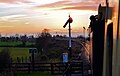 Approaching Gotherington on the last train of the day, GWSR - geograph.org.uk - 6011923.jpg 1,758 × 1,112; 1.75 MB
-
 Arable land near Gotherington - geograph.org.uk - 1613113.jpg 640 × 426; 99 KB
-
 Arable landscape around Woolstone Hill - geograph.org.uk - 5830336.jpg 4,651 × 2,775; 2.61 MB
-

-
 Bridleway on Nottingham Hill - geograph.org.uk - 2821477.jpg 3,264 × 2,448; 3.5 MB
-
 Bridleway to Woolstone Hill Farm - geograph.org.uk - 2976555.jpg 640 × 480; 85 KB
-
 Bridleway track - geograph.org.uk - 2244894.jpg 640 × 480; 79 KB
-
 Cattle on Nottingham Hill - geograph.org.uk - 5152718.jpg 2,000 × 1,333; 1.4 MB
-
 Cereal field, east of Homelands Farm - geograph.org.uk - 6212716.jpg 1,600 × 1,200; 326 KB
-
 Cleeve Road in Gotherington - geograph.org.uk - 775577.jpg 640 × 426; 90 KB
-
 Clump of young and old trees - geograph.org.uk - 2522584.jpg 1,024 × 768; 174 KB
-
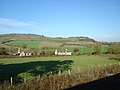 Cottages at Gotherington - geograph.org.uk - 2691971.jpg 640 × 480; 61 KB
-
 Cottages in Gotherington - geograph.org.uk - 1009635.jpg 640 × 426; 77 KB
-
 Dead tree - geograph.org.uk - 5404727.jpg 1,024 × 768; 213 KB
-
 Diesel Leaving Gotherington - geograph.org.uk - 6271885.jpg 800 × 600; 820 KB
-
 Drink Camp at Gotherington - geograph.org.uk - 5301424.jpg 3,024 × 2,394; 1.25 MB
-
 Fallen tree by the bridleway - geograph.org.uk - 5152689.jpg 2,000 × 1,333; 1.33 MB
-
 Farmland by the railway - geograph.org.uk - 4664413.jpg 2,000 × 1,289; 1.3 MB
-
 Farmland near Gotherington - geograph.org.uk - 5279765.jpg 1,024 × 768; 262 KB
-
 Farmland Near Gotherington - geograph.org.uk - 5575146.jpg 640 × 412; 63 KB
-
 Farmland south of Truman's Farm - geograph.org.uk - 6213301.jpg 1,600 × 1,200; 325 KB
-
 Field bounded by Tirle Brook and its tributary - geograph.org.uk - 6213321.jpg 1,600 × 1,200; 514 KB
-
 Field entrance near Gotherington - geograph.org.uk - 3575181.jpg 4,000 × 3,000; 4.09 MB
-
 Fields and houses near Gotherington Station - geograph.org.uk - 1940054.jpg 1,024 × 768; 140 KB
-
 Fields beside the Railway - geograph.org.uk - 6053842.jpg 5,184 × 3,456; 1.74 MB
-
 Fields by the GWR - geograph.org.uk - 3721916.jpg 640 × 480; 69 KB
-
 Footbridge, formerly used as bridleway - geograph.org.uk - 2976558.jpg 640 × 480; 143 KB
-
 Footpath alongside the railway, Gotherington - geograph.org.uk - 1940051.jpg 1,024 × 768; 151 KB
-
 Footpath junction by Gretton Road - geograph.org.uk - 3781561.jpg 1,024 × 575; 226 KB
-
 Footpath off Woolstone Lane - geograph.org.uk - 5830210.jpg 4,598 × 3,266; 3.92 MB
-
 Gloucestershire Warwickshire Railway near Manor Lane bridge - geograph.org.uk - 3480735.jpg 2,714 × 2,797; 2.96 MB
-
 Gloucestershire Warwickshire Railway track - geograph.org.uk - 5152906.jpg 2,000 × 1,284; 1.34 MB
-

-
 Gotherington Farmland View - geograph.org.uk - 5575151.jpg 640 × 404; 91 KB
-
 Gotherington Fields - geograph.org.uk - 2785342.jpg 1,024 × 577; 305 KB
-
 Gotherington Fields - geograph.org.uk - 2785350.jpg 1,024 × 577; 282 KB
-
 Gotherington Fields Lane - geograph.org.uk - 2778491.jpg 1,024 × 577; 292 KB
-
 Gotherington Fields Lane - geograph.org.uk - 2778497.jpg 1,024 × 577; 323 KB
-
 Gotherington Halt - geograph.org.uk - 4666789.jpg 2,000 × 1,384; 1.36 MB
-
 Gotherington Halt - geograph.org.uk - 5152920.jpg 2,000 × 1,333; 1.24 MB
-
 Gotherington Halt - geograph.org.uk - 5575141.jpg 640 × 439; 128 KB
-
 Gotherington MMB 01 5619.jpg 2,140 × 1,491; 1.94 MB
-
 Gotherington MMB 02.jpg 2,400 × 1,600; 2.97 MB
-
 Gotherington private station - geograph.org.uk - 6220452.jpg 640 × 480; 85 KB
-
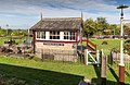 Gotherington Signal Box - geograph.org.uk - 4664351.jpg 2,000 × 1,294; 1.34 MB
-
 Gotherington Station - geograph.org.uk - 3721919.jpg 640 × 480; 101 KB
-
 Gotherington Station - geograph.org.uk - 4463612.jpg 640 × 480; 96 KB
-
 Gotherington Station - geograph.org.uk - 5301433.jpg 3,888 × 2,592; 1.58 MB
-
 Gotherington Station - geograph.org.uk - 5404280.jpg 1,024 × 768; 292 KB
-
 Gotherington Station - geograph.org.uk - 6271889.jpg 800 × 600; 894 KB
-
 Gotherington Station Buildings - geograph.org.uk - 5575142.jpg 640 × 441; 111 KB
-
 Gotherington Station house - geograph.org.uk - 6220451.jpg 640 × 480; 119 KB
-
 Gotherington Village Hall - geograph.org.uk - 5578056.jpg 640 × 426; 86 KB
-
 Gotherington Village Hall.JPG 4,469 × 2,968; 5.83 MB
-
 Gotherington Village Sign - geograph.org.uk - 4971718.jpg 640 × 476; 92 KB
-
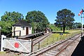 Gotherington West - geograph.org.uk - 6053834.jpg 5,184 × 3,456; 2.92 MB
-

-
 Gotherington West Ground Frame - geograph.org.uk - 6271892.jpg 800 × 601; 932 KB
-
 Gotherington West Station - geograph.org.uk - 6271893.jpg 800 × 601; 796 KB
-
 Grassland by the Railway - geograph.org.uk - 6054982.jpg 1,600 × 1,001; 380 KB
-
 Green Arrow near Gotherington - geograph.org.uk - 3001399.jpg 1,200 × 816; 1.16 MB
-
 Gretton Road - geograph.org.uk - 3787864.jpg 800 × 450; 206 KB
-
 Gretton Road - geograph.org.uk - 6272012.jpg 800 × 601; 921 KB
-
 Gretton Road, Gotherington - geograph.org.uk - 3781570.jpg 1,600 × 899; 844 KB
-
 GWR bridge over Granna Lane - geograph.org.uk - 3787875.jpg 800 × 800; 415 KB
-
 GWR railway bridge in Gotherington - geograph.org.uk - 1843184.jpg 3,008 × 2,000; 1.53 MB
-
 GWSR Gotherington Station - geograph.org.uk - 6271887.jpg 800 × 601; 681 KB
-
 GWSR South of Gotherington Station - geograph.org.uk - 6271881.jpg 800 × 601; 675 KB
-
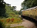 GWSR Train crossing Gretton Road Bridge - geograph.org.uk - 6272015.jpg 800 × 601; 769 KB
-
 Haymaking near Gotherington Station - geograph.org.uk - 1939862.jpg 1,024 × 768; 206 KB
-
 Hedgerow South of Gotherington - geograph.org.uk - 6271875.jpg 800 × 601; 803 KB
-
 Hedgerow with trees - geograph.org.uk - 2522581.jpg 1,024 × 768; 165 KB
-
 Homelands Farm - geograph.org.uk - 4666732.jpg 2,000 × 2,000; 1.18 MB
-
 House on Gretton Road, near Gotherington - geograph.org.uk - 6213311.jpg 1,535 × 1,151; 373 KB
-
 Large wheatfield south of Gotherington - geograph.org.uk - 2522589.jpg 1,024 × 768; 140 KB
-
 Looking down the bridleway from Prescott Hill - geograph.org.uk - 2821238.jpg 3,264 × 2,448; 3.75 MB
-
 Looking towards Bushcombe Lane from Nottingham Hill - geograph.org.uk - 2821491.jpg 3,264 × 2,448; 3.66 MB
-
 Looking west from Granna Lane - geograph.org.uk - 3781548.jpg 1,024 × 575; 237 KB
-
 Low level power lines near Gotherington - geograph.org.uk - 2821080.jpg 3,264 × 2,448; 2.85 MB
-
 Malvern Hills in the distance - geograph.org.uk - 5830231.jpg 1,600 × 1,003; 492 KB
-
 Manor Farm, Gotherington - geograph.org.uk - 6271895.jpg 800 × 601; 774 KB
-
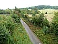 Manor Lane - geograph.org.uk - 2522590.jpg 1,024 × 768; 156 KB
-
 Manor Lane, Gotherington - geograph.org.uk - 6271896.jpg 800 × 601; 974 KB
-
 Manure heap in a stubble field - geograph.org.uk - 4666628.jpg 2,000 × 1,212; 1.59 MB
-
 Memorial and Chapel, Gotherington - geograph.org.uk - 5829321.jpg 4,825 × 2,930; 2.54 MB
-
 Name Sign and Shop, Gotherington - geograph.org.uk - 5829366.jpg 4,445 × 3,450; 3.44 MB
-
 Near Homelands Farm - geograph.org.uk - 5577991.jpg 640 × 426; 120 KB
-
 Odd depression in a field near Manor Farm - geograph.org.uk - 2522597.jpg 1,024 × 768; 137 KB
-
 Oxenton Hill - geograph.org.uk - 1613119.jpg 640 × 426; 94 KB
-
 Path through hedge gap near caravan park - geograph.org.uk - 2976563.jpg 640 × 480; 143 KB
-

-
 Railway bridge in torrential rain - geograph.org.uk - 1843179.jpg 3,008 × 2,000; 1.41 MB
-
 Rainbow over the footpath to Gotherington - geograph.org.uk - 5152913.jpg 2,000 × 1,333; 1.41 MB
-
 Road to Gotherington - geograph.org.uk - 1006095.jpg 640 × 426; 127 KB
-
 Run down hay storage at Greenway Farm - geograph.org.uk - 2821228.jpg 3,264 × 2,448; 3.59 MB
-
 Safe for now - geograph.org.uk - 2244879.jpg 640 × 480; 120 KB
-
 Signal by a Bridge - geograph.org.uk - 5830322.jpg 4,278 × 2,993; 2.67 MB
-
 Silage bales by the bridleway - geograph.org.uk - 5152710.jpg 2,000 × 1,264; 1.36 MB
-
 Straw bales in a field near Gotherington - geograph.org.uk - 1008171.jpg 640 × 426; 115 KB
-
 Stubble field east of Gotherington - geograph.org.uk - 5886715.jpg 1,024 × 768; 192 KB
-
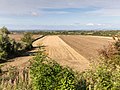 Stubble fields - geograph.org.uk - 4666639.jpg 2,000 × 1,492; 1.37 MB
-
 Thatched cottage in Gotherington - geograph.org.uk - 1009644.jpg 640 × 426; 77 KB
-
 Thatched cottage in Gotherington - geograph.org.uk - 2821088.jpg 3,264 × 2,448; 2.67 MB
-
 Thatched House in Gotherington - geograph.org.uk - 5578059.jpg 640 × 403; 71 KB
-
 The Avon Vale from Nottingham Hill - geograph.org.uk - 2821442.jpg 3,264 × 2,448; 3.04 MB
-
 The Farmers Arms Bishop's Cleeve - geograph.org.uk - 4264852.jpg 640 × 477; 48 KB
-
 The Folly (geograph 7378181).jpg 1,600 × 1,069; 563 KB
-
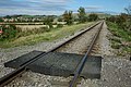
-
 The Gloucestershire ^ Warwickshire Railway - geograph.org.uk - 2522604.jpg 1,024 × 768; 170 KB
-
 The Lawns, Gotherington - geograph.org.uk - 5829347.jpg 4,780 × 2,795; 2.01 MB
-
 The Old Bakery, Gothington - geograph.org.uk - 1009639.jpg 640 × 426; 71 KB
-
 The road to Winchcombe - geograph.org.uk - 1940056.jpg 1,024 × 768; 266 KB
-
 The Severn Vale from Nottingham Hill - geograph.org.uk - 2821461.jpg 3,264 × 2,448; 2.57 MB
-

-
 The Shutters at Gotherington - geograph.org.uk - 1006109.jpg 640 × 426; 71 KB
-
 The Shutters At Gotherington - geograph.org.uk - 5578049.jpg 640 × 423; 83 KB
-
 The Shutters Pub. - geograph.org.uk - 1826380.jpg 640 × 360; 89 KB
-
 The Shutters public house, Gotherington - geograph.org.uk - 4012189.jpg 1,600 × 1,064; 468 KB
-
 Towards Nottingham Wood - geograph.org.uk - 5577993.jpg 640 × 407; 73 KB
-
 Towards The Knolls - geograph.org.uk - 5575132.jpg 640 × 415; 74 KB
-
 Towards Woolstone Hill - geograph.org.uk - 5830303.jpg 3,746 × 3,054; 3.16 MB
-
 Track from Truman's Farm to Gretton Road - geograph.org.uk - 6213308.jpg 1,600 × 1,200; 475 KB
-
 Track to farmland near Gotherington - geograph.org.uk - 1006089.jpg 640 × 426; 90 KB
-
 Trackside view - geograph.org.uk - 4664384.jpg 2,000 × 2,000; 1.35 MB
-
 Train at Gotherington Station - geograph.org.uk - 5301656.jpg 928 × 1,334; 203 KB
-
 Train Leaving Gotherington Station - geograph.org.uk - 5830343.jpg 4,824 × 3,134; 2.6 MB
-
 Tree in a hedgerow - geograph.org.uk - 1611734.jpg 426 × 640; 101 KB
-
 Truman's Farm, Gotherington - geograph.org.uk - 6271879.jpg 800 × 533; 627 KB
-

-

-
 View over Gotherington towards the Malvern Hills - geograph.org.uk - 5886172.jpg 1,024 × 768; 193 KB
-
 View to Dixton Hill - geograph.org.uk - 5279787.jpg 1,024 × 576; 194 KB
-
 View to Gotherington Wood - geograph.org.uk - 2244887.jpg 640 × 480; 57 KB
-
 View to Oxenton - geograph.org.uk - 1611737.jpg 640 × 426; 96 KB
-
 View towards Dixton Hill - geograph.org.uk - 3787869.jpg 800 × 450; 197 KB
-
 View west from Gotherington Fields - geograph.org.uk - 2778486.jpg 1,024 × 577; 270 KB
-
 Wall repaired - geograph.org.uk - 2244906.jpg 480 × 640; 139 KB
-
 War Memorial in Gotherington - geograph.org.uk - 4012196.jpg 1,600 × 1,064; 395 KB
-
 Wavey fields near Gotherington - geograph.org.uk - 1021895.jpg 640 × 480; 176 KB
-
 Weather-damaged cereal crop, south of Gotherington - geograph.org.uk - 6213299.jpg 1,600 × 1,200; 405 KB
-
 Winchcombe Way - geograph.org.uk - 5152682.jpg 2,000 × 1,333; 1.58 MB
-
 Winchcombe Way - geograph.org.uk - 5152931.jpg 2,000 × 1,333; 1.48 MB
-
 Winchcombe Way passes over Nottingham Hill - geograph.org.uk - 5152219.jpg 2,000 × 1,333; 1.2 MB
-
 Winchcombe Way passes over Nottingham Hill - geograph.org.uk - 5152695.jpg 2,000 × 1,333; 1.4 MB
-
 Winchcombe Way passes over Nottingham Hill - geograph.org.uk - 5152714.jpg 2,000 × 1,281; 1.42 MB
-
 Winter woodland - geograph.org.uk - 2778478.jpg 1,024 × 577; 307 KB
-
 Woolstone Hill - geograph.org.uk - 5279783.jpg 1,024 × 768; 241 KB
-
 Woolstone Hill from the south - geograph.org.uk - 2821114.jpg 3,264 × 2,448; 2.95 MB
-
 Woolstone Lane - geograph.org.uk - 5578047.jpg 640 × 397; 121 KB
-

-
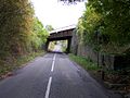 G.W.R. Bridge - geograph.org.uk - 64793.jpg 640 × 479; 113 KB
-

-

-
 Looking up Prescott Hill - geograph.org.uk - 248077.jpg 640 × 480; 60 KB
-
 The Shutters - geograph.org.uk - 248066.jpg 640 × 480; 93 KB
-
 View from Nottingham Hill - geograph.org.uk - 294265.jpg 640 × 480; 88 KB
-
 West End of Gotherington Village - geograph.org.uk - 76635.jpg 640 × 479; 84 KB


.jpg)


