Category:Gottmadingen
Jump to navigation
Jump to search
municipality in Germany    | |||||
| Upload media | |||||
| Instance of |
| ||||
|---|---|---|---|---|---|
| Location |
| ||||
| Population |
| ||||
| Area |
| ||||
| Elevation above sea level |
| ||||
| official website | |||||
 | |||||
Subcategories
This category has the following 10 subcategories, out of 10 total.
- Wayside crosses in Gottmadingen (29 F)
D
F
- Fasnet in Gottmadingen (6 F)
G
- Gottmadingen station (1 F)
L
N
- Naturschutzgebiet Gras-Seen (2 F)
R
- Jüdischer Friedhof Randegg (2 F)
W
- War memorial in Gottmadingen (2 F)
Media in category "Gottmadingen"
The following 37 files are in this category, out of 37 total.
-
 DEU Gottmadingen COA.svg 701 × 742; 113 KB
-
 Wappen Gottmadingen.png 231 × 241; 33 KB
-

-

-
-

-
-

-

-
 2006-10-30 10-26-13 Switzerland Zurich Waldhof.jpg 2,048 × 1,536; 3.2 MB
-
 2006-10-30 10-26-49 Switzerland Schaffhausen Riet.jpg 2,048 × 1,536; 3.11 MB
-

-

-

-
 6. Station des Kreuzweges in der Nähe der kath. Kirche von Gottmadingen.jpg 3,024 × 4,032; 8.29 MB
-
-
 78244-Gottmadingen.jpg 1,600 × 1,200; 836 KB
-

-

-
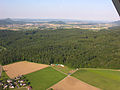 Aerial View from Dörflingen direction Gottmadingen 15.07.2008 16-47-58.JPG 2,048 × 1,536; 1.18 MB
-
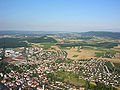
 Aerial View of Gottmadingen 15.07.2008 17-01-29.JPG 2,048 × 1,536; 1.46 MB
-
 Aerial View of Gottmadingen 15.07.2008 17-01-36.JPG 2,048 × 1,536; 1.27 MB
-
 Aerial View of Gottmadingen 15.07.2008 17-01-44.JPG 1,536 × 2,048; 1.26 MB
-
 Aerial View of Gottmadingen 15.07.2008 17-01-52.JPG 2,048 × 1,536; 1.36 MB
-
 Aerials BW 16.06.2006 13-54-20.jpg 1,941 × 1,455; 2 MB
-
 Bildstock als Flurbereinigungsdenkmal südl. der A81 und Ebringen.jpg 720 × 1,280; 235 KB
-
 Denkmal an die alte Kirche von Gottmadingen beim Kreuzweg.jpg 3,024 × 4,032; 6.07 MB
-
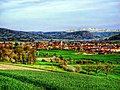
 Felder und Wiesen - geo.hlipp.de - 39282.jpg 640 × 480; 62 KB
-
 Flagge Gottmadingen.svg 600 × 1,500; 63 KB
-
 Gottmadingen Hardtsee.jpg 4,416 × 3,310; 3.99 MB
-
 Gottmadingen in KN.svg 577 × 413; 547 KB
-
 Hebelschule Gottmadingen.jpg 3,968 × 2,976; 5.2 MB
-
 Kreuz am kath. Gemeindehaus von Gottmadingen bei der kath. Kirche.jpg 3,024 × 4,032; 4.68 MB
-
 Landappbw 883156 1824 Synagogenplatz Randegg Gutmadingen.jpg 3,033 × 1,976; 1.54 MB
-
 Landappbw 883157 1824 Synagogenplatz Randegg Gutmadingen.jpg 3,185 × 1,883; 1.55 MB
-

-
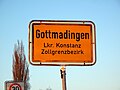 Zollgrenzbezirk Gottmadingen.JPG 4,416 × 3,312; 4.15 MB


