Category:Govan
Jump to navigation
Jump to search
district and former burgh in the City of Glasgow, Scotland, UK  | |||||
| Upload media | |||||
| Instance of | |||||
|---|---|---|---|---|---|
| Location |
| ||||
| Area |
| ||||
| Different from | |||||
 | |||||
Govan (Scottish Gaelic: Baile a' Ghobhainn) is a district and former burgh now part of southwest City of Glasgow, Scotland. It is situated 2.5 miles (4.0 km) west of Glasgow city centre, on the south bank of the River Clyde, opposite the mouth of the River Kelvin and the district of Partick.
Subcategories
This category has the following 42 subcategories, out of 42 total.
A
B
- British Linen Bank, Govan (13 F)
- Broomloan Road School (5 F)
C
- Cardell Halls, Govan (14 F)
D
- Drinking fountain, Govan Cross (18 F)
- Drumoyne Primary School (3 F)
E
F
- Former Govan Police Building (11 F)
- Former Hill's Trust School (2 F)
G
- Govan (civil parish) (1558 F)
- Govan Bus Station (6 F)
- Govan Docks (47 F)
- Govan New Parish Church (36 F)
- Govan Shipyards (39 F)
- Govan Subway station (26 F)
- Govan Town Hall (36 F)
- Govan-Partick Bridge (38 F)
- Greenfield School, Govan (1 F)
I
K
L
- Lyceum Cinema, Govan (5 F)
P
- Pearce Institute (22 F)
R
S
- Statue of William Pearce (12 F)
T
Media in category "Govan"
The following 200 files are in this category, out of 233 total.
(previous page) (next page)-
 'Clyde Clipper' at Riverside - geograph.org.uk - 5431983.jpg 3,264 × 2,448; 3.21 MB
-
 A and J Inglis Shipyard in 1930.jpg 1,000 × 756; 321 KB
-
 A BP garage on Shieldhall Road - geograph.org.uk - 3629117.jpg 1,024 × 768; 161 KB
-
 A Clyde View - geograph.org.uk - 6282617.jpg 800 × 600; 486 KB
-
 A KFC, a Pizza Hut - geograph.org.uk - 1092483.jpg 640 × 480; 101 KB
-
 A view of the banks of the Clyde taken from York Hill.jpg 546 × 434; 161 KB
-
 Apartment building on Govan Road - geograph.org.uk - 5926212.jpg 1,024 × 548; 204 KB
-
 Approach to the Clyde Tunnel northbound - geograph.org.uk - 5688205.jpg 1,024 × 697; 102 KB
-
 Asda Govan (geograph 1817324).jpg 2,272 × 1,704; 873 KB
-
 Asda, Govan - geograph.org.uk - 629991.jpg 640 × 480; 73 KB
-
 B ^ M Stores, Govan - geograph.org.uk - 5755623.jpg 640 × 235; 66 KB
-
 Bakers, Drymoyne - geograph.org.uk - 2358568.jpg 3,240 × 2,328; 3.08 MB
-
 Beam Me Up - geograph.org.uk - 563910.jpg 640 × 480; 51 KB
-
 Bowsprit and figurehead, SV Glenlee - geograph.org.uk - 4795505.jpg 1,024 × 682; 105 KB
-
 Brighton Street (geograph 3438794).jpg 640 × 480; 256 KB
-
 Brighton Street - geograph.org.uk - 3437788.jpg 640 × 480; 253 KB
-
 Briton Street - geograph.org.uk - 5928387.jpg 1,024 × 700; 267 KB
-
 Briton Street - geograph.org.uk - 5928390.jpg 1,024 × 497; 147 KB
-
 Briton Street - geograph.org.uk - 5928391.jpg 1,024 × 538; 166 KB
-
 Briton Street - geograph.org.uk - 5928393.jpg 1,024 × 701; 237 KB
-
 Broomloan Crescent - geograph.org.uk - 6053155.jpg 1,024 × 616; 220 KB
-
 Broomloan Road - geograph.org.uk - 5927926.jpg 1,024 × 441; 156 KB
-
 Broomloan Road - geograph.org.uk - 6125308.jpg 1,024 × 683; 491 KB
-
 Business premises, Broomloan Road, Glasgow - geograph.org.uk - 3582000.jpg 5,184 × 3,456; 7.25 MB
-
 Car park at Asda, Govan - geograph.org.uk - 629998.jpg 640 × 480; 63 KB
-
 Clachan Drive - geograph.org.uk - 2089812.jpg 640 × 421; 129 KB
-
 Clyde Tunnel approach (geograph 6196623).jpg 1,280 × 885; 259 KB
-
 Clyde tunnel signs - geograph.org.uk - 4784152.jpg 640 × 480; 99 KB
-
 Clyde tunnel signs - geograph.org.uk - 4784159.jpg 640 × 480; 104 KB
-
 Clyde tunnel south entrance - geograph.org.uk - 3474153.jpg 640 × 569; 74 KB
-
 Clyde Tunnel South Entrance - geograph.org.uk - 3583061.jpg 5,184 × 3,456; 6.49 MB
-

-
 Clyde Tunnel Southern Entrance - geograph.org.uk - 2793463.jpg 640 × 481; 67 KB
-
 Clyde Tunnel ventilation shaft - geograph.org.uk - 3961920.jpg 3,264 × 2,448; 4.09 MB
-
 Commonwealth Legacy Sculpture- No. 3 Rugby (geograph 7532656).jpg 1,234 × 1,600; 477 KB
-
 Corner of Aboukir Street ^ Govan Road, Glasgow - geograph.org.uk - 3583050.jpg 5,184 × 3,456; 7.18 MB
-
 Corner of Brighton Place ^ Copland Road, Glasgow - geograph.org.uk - 3582035.jpg 5,184 × 3,456; 7.15 MB
-
 Corner of Cressy Street ^ Govan Road, Glasgow - geograph.org.uk - 3583053.jpg 5,184 × 3,456; 6.96 MB
-
 Corner of Howat Street ^ Govan Road, Govan - geograph.org.uk - 3582982.jpg 5,184 × 3,456; 7.26 MB
-
 Cossar Building detail - geograph.org.uk - 1435310.jpg 640 × 265; 40 KB
-
 Craigton Road - geograph.org.uk - 1092479.jpg 640 × 480; 117 KB
-
 Derelict dockland - geograph.org.uk - 2515729.jpg 640 × 274; 60 KB
-

-
 Dkbkpl34.jpg 1,165 × 699; 183 KB
-

-
 Drumoyne, Superstore carpark - geograph.org.uk - 5468844.jpg 1,024 × 682; 144 KB
-

-
 Edmiston Drive railway bridge - geograph.org.uk - 5756226.jpg 640 × 343; 80 KB
-
 Edmiston Drive railway bridge - geograph.org.uk - 5756234.jpg 640 × 291; 61 KB
-
 Edmiston Drive railway bridge - geograph.org.uk - 5768776.jpg 640 × 480; 173 KB
-
 Elder Park Primary School - geograph.org.uk - 734453.jpg 480 × 640; 52 KB
-

-
 Fairley Street, Govan - geograph.org.uk - 1764509.jpg 1,000 × 664; 219 KB
-
 Fast boat on the Clyde - geograph.org.uk - 3417345.jpg 640 × 480; 152 KB
-

-
 Ferry No.8 at Kelvinhaugh - geograph.org.uk - 6196670.jpg 1,280 × 960; 436 KB
-
 Figurehead, SV Glenlee - geograph.org.uk - 6282612.jpg 800 × 600; 581 KB
-
 Flats on Harmony Square (geograph 7135559).jpg 1,600 × 1,200; 346 KB
-
 Flats on Napier Terrace - geograph.org.uk - 5575471.jpg 1,600 × 1,260; 371 KB
-
 Former Elder Cottage Hospital - geograph.org.uk - 734464.jpg 640 × 480; 59 KB
-

-
 Gangway to the ferry to Govan - geograph.org.uk - 4569578.jpg 3,504 × 2,336; 2.95 MB
-
 Glasgow Albion Greyhound Stadium c.1950.png 936 × 729; 1.04 MB
-
 Glasgow attractions (geograph 2354506) (cropped).jpg 526 × 395; 77 KB
-
 Glasgow attractions (geograph 2354506).jpg 640 × 480; 101 KB
-
 Glasgow City - Govan, Glasgow, Govan Road, Govan War Memorial - 20231202180348.jpg 2,702 × 2,027; 2.35 MB
-
 Glasgow Garden Festival (geograph 5729583).jpg 3,666 × 2,390; 1.49 MB
-
 Glasgow Govan ScottishParliamentConstituency.PNG 162 × 136; 3 KB
-
 Glasgow Govan ScottishParliamentConstituency.svg 162 × 143; 19 KB
-
 Glasgow river scene - geograph.org.uk - 2617138.jpg 640 × 396; 113 KB
-
 Glasgow Townscape , Up Periscope^ - geograph.org.uk - 3699066.jpg 1,600 × 1,200; 419 KB
-
 Glasgow wards 2017 no05 Govan.png 2,000 × 2,040; 504 KB
-
 Glasgow's new Transport Museum - geograph.org.uk - 1091564.jpg 640 × 480; 108 KB
-
 Glenlee at Riverside Museum - geograph.org.uk - 2458062.jpg 1,024 × 768; 145 KB
-
 Glenlee bow - geograph.org.uk - 4390923.jpg 533 × 800; 125 KB
-
 Glenlee on the River Clyde - geograph.org.uk - 6444376.jpg 2,700 × 2,025; 492 KB
-
 Golspie Street, Govan (geograph 3582994).jpg 5,184 × 3,456; 5.96 MB
-
 Golspie Street, Govan - geograph.org.uk - 6215996.jpg 1,600 × 1,121; 312 KB
-
 Golspie Street, Govan - geograph.org.uk - 6219050.jpg 1,600 × 1,134; 333 KB
-
 Govan across the Clyde - geograph.org.uk - 6125099.jpg 1,024 × 683; 315 KB
-

-
 Govan Bargain Shop - geograph.org.uk - 6218994.jpg 1,600 × 1,106; 311 KB
-
 Govan bus garage, 1965 - geograph.org.uk - 6196722.jpg 1,280 × 839; 244 KB
-
 Govan Community Fire Station - geograph.org.uk - 5926259.jpg 1,024 × 433; 114 KB
-
 Govan Cross - geograph.org.uk - 3582452.jpg 5,184 × 3,456; 7.68 MB
-
 Govan Cross Shopping Centre - geograph.org.uk - 2617357.jpg 640 × 480; 144 KB
-
 Govan Cross Shopping Centre - geograph.org.uk - 3582461.jpg 1,600 × 1,067; 462 KB
-
 Govan Ferry - geograph.org.uk - 6216870.jpg 1,600 × 1,200; 445 KB
-
 Govan from Yorkhill - geograph.org.uk - 1109483.jpg 640 × 426; 85 KB
-
 Govan Glasgow 1904.jpg 768 × 542; 106 KB
-
 Govan Pier - geograph.org.uk - 6283202.jpg 800 × 601; 731 KB
-
 Govan Pier on the River Clyde - geograph.org.uk - 6444371.jpg 2,700 × 2,025; 459 KB
-
 Govan Police Office (geograph 4641243).jpg 1,320 × 990; 678 KB
-
 Govan Road - geograph.org.uk - 1444285.jpg 640 × 480; 79 KB
-
 Govan Road - geograph.org.uk - 5926105.jpg 1,024 × 768; 225 KB
-
 Govan Road at Burghead Place, Glasgow - geograph.org.uk - 3583070.jpg 5,184 × 3,456; 6.78 MB
-
 Govan Shipbuilders - geograph.org.uk - 465159.jpg 640 × 485; 74 KB
-
 Govan Shipbuilders House Flag.gif 324 × 216; 2 KB
-
 Govan shipyard - geograph.org.uk - 3417339.jpg 640 × 480; 112 KB
-
 Govan shipyard - geograph.org.uk - 3418013.jpg 640 × 480; 113 KB
-
 Govan Shipyard at Elder Street - geograph.org.uk - 734346.jpg 640 × 480; 40 KB
-
 Govan tenements - geograph.org.uk - 904020.jpg 640 × 480; 142 KB
-
 Govan War Memorial - geograph.org.uk - 3582533.jpg 800 × 1,200; 318 KB
-
 Govan.jpg 2,848 × 2,136; 1.63 MB
-
 Harland ^ Wolff basin Govan - geograph.org.uk - 4042653.jpg 640 × 427; 79 KB
-
 Harley Street, Govan, Glasgow.jpg 4,956 × 2,913; 4.48 MB
-
 Harmony Row Pharmacy - geograph.org.uk - 6219063.jpg 1,351 × 1,600; 350 KB
-
 Helen Street - geograph.org.uk - 1444332.jpg 640 × 480; 57 KB
-
 Helen Street - geograph.org.uk - 3435559.jpg 640 × 480; 227 KB
-
 Helen Street - geograph.org.uk - 574048.jpg 640 × 480; 96 KB
-
 Helen Street - geograph.org.uk - 6053141.jpg 1,024 × 456; 149 KB
-
 Helen Street gas holder (geograph 5768765).jpg 640 × 348; 97 KB
-
 Helen Street gas holder - geograph.org.uk - 5755608.jpg 640 × 480; 228 KB
-
 Helen Street roundabout - geograph.org.uk - 1444333.jpg 640 × 288; 36 KB
-
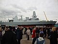 HMS Defender (D36).jpg 4,000 × 3,000; 3.67 MB
-
 Honeycombs sculpture, Govan Riverside - geograph.org.uk - 5926231.jpg 1,024 × 697; 276 KB
-
 Honeycombs sculpture, Govan Riverside - geograph.org.uk - 5926233.jpg 1,024 × 650; 256 KB
-
 Ibrox Stadium - geograph.org.uk - 2354509 (cropped).jpg 444 × 333; 54 KB
-
 Ibrox Stadium - geograph.org.uk - 2354509.jpg 640 × 480; 101 KB
-
 Iona Court, Govan - geograph.org.uk - 3582019.jpg 5,184 × 3,456; 7.07 MB
-
 Kintra Street - geograph.org.uk - 5928356.jpg 1,024 × 704; 330 KB
-
 Kintra Street - geograph.org.uk - 5928359.jpg 1,024 × 768; 317 KB
-
 Langlands Road (geograph 5974251).jpg 1,600 × 1,145; 370 KB
-
 Langlands Road shops - geograph.org.uk - 1092458.jpg 640 × 480; 132 KB
-
 Lidl supermarket, Govan - geograph.org.uk - 4634865.jpg 3,504 × 2,336; 3.45 MB
-
 Linthouse Buildings Old and New - geograph.org.uk - 734433.jpg 640 × 480; 46 KB
-
 Linthouse Road, Govan - geograph.org.uk - 2358695.jpg 3,192 × 1,980; 1.87 MB
-
 Linthouse Sub Power Station - geograph.org.uk - 734429.jpg 640 × 469; 32 KB
-
 Linthouse, Mansion House, 1869.jpg 1,000 × 748; 582 KB
-
 Looking west along Govan Road - geograph.org.uk - 1091557.jpg 640 × 480; 117 KB
-
 Luss Road - geograph.org.uk - 3435548.jpg 640 × 480; 274 KB
-
 M8 westbound towards junction 24 (geograph 5211606).jpg 1,600 × 1,015; 447 KB
-
 Mansion House of Linthouse, 1869.jpg 1,000 × 748; 591 KB
-
 Mary Barbour Monument, A Proposal.jpg 850 × 474; 292 KB
-
 Meiklewood Road - geograph.org.uk - 4836548.jpg 2,048 × 1,536; 611 KB
-
 Mooring bollard, Glasgow - geograph.org.uk - 3463316.jpg 594 × 640; 130 KB
-
 Mooring bollard, Glasgow - geograph.org.uk - 3463319.jpg 640 × 525; 161 KB
-
 Moss Road - geograph.org.uk - 2089817.jpg 640 × 345; 115 KB
-
 Moss Road at Govan (geograph 3961833).jpg 3,264 × 2,448; 3.95 MB
-
 Mouth of the River Kelvin, Glasgow - geograph.org.uk - 6620455.jpg 980 × 1,024; 1.53 MB
-
 Mural on Govan Road (geograph 7531422).jpg 1,600 × 1,116; 251 KB
-
 Mural on Govan tenement - geograph.org.uk - 904022.jpg 640 × 480; 120 KB
-
 Murals - geograph.org.uk - 401390.jpg 640 × 480; 61 KB
-

-
 New school campus - geograph.org.uk - 1435295.jpg 640 × 480; 64 KB
-

-
 Old poster, Glasgow - geograph.org.uk - 3463303.jpg 640 × 640; 171 KB
-
 Ople Make Glasgow - geograph.org.uk - 6196614.jpg 1,280 × 749; 287 KB
-
 Orkney Place - geograph.org.uk - 5927396.jpg 1,024 × 619; 192 KB
-
 Orkney Street - geograph.org.uk - 5927392.jpg 1,024 × 901; 282 KB
-
 Pizza Hut, Helen Street (geograph 5755622).jpg 640 × 272; 75 KB
-
 Police office - geograph.org.uk - 573899.jpg 640 × 444; 58 KB
-
 Police Scotland radio communications centre (geograph 5755621).jpg 640 × 480; 104 KB
-
 Post box on Summertown Road - geograph.org.uk - 956924.jpg 284 × 640; 29 KB
-
 Properties on Holmfauldhead Drive (geograph 5974259).jpg 1,600 × 941; 251 KB
-
 Reflections in the Clyde - geograph.org.uk - 5575460.jpg 1,600 × 1,151; 204 KB
-
 Reflections on the Clyde - geograph.org.uk - 5297172.jpg 1,600 × 1,029; 249 KB
-
 Renfrew Road - geograph.org.uk - 2089827.jpg 640 × 480; 112 KB
-
 Renfrew Road - geograph.org.uk - 2089830.jpg 640 × 480; 102 KB
-
 Renfrew Road - geograph.org.uk - 2089833.jpg 640 × 480; 114 KB
-
 Renfrew Road - geograph.org.uk - 2089858.jpg 640 × 334; 97 KB
-
 Renfrew Road, Shieldhall - geograph.org.uk - 6196631.jpg 1,280 × 960; 324 KB
-
 RHIB on the Clyde - geograph.org.uk - 2617130.jpg 640 × 480; 200 KB
-
 Rib on the River Clyde at Govan - geograph.org.uk - 5485075.jpg 1,600 × 1,200; 700 KB
-
 River Clyde at Glasgow - geograph.org.uk - 3012592.jpg 640 × 480; 108 KB
-
 River Clyde from Glenlee - geograph.org.uk - 6283192.jpg 800 × 600; 507 KB
-
 River Clyde towards Central Glasgow - geograph.org.uk - 6282620.jpg 800 × 600; 473 KB
-

-
 Riverside Museum and Tall Ship, Glasgow - geograph.org.uk - 6618734.jpg 1,024 × 768; 1,000 KB
-
 Road junction - geograph.org.uk - 4391463.jpg 800 × 533; 199 KB
-
 Setting Up at Govan Market. - geograph.org.uk - 734295.jpg 640 × 480; 39 KB
-
 Shaw Street, Govan - geograph.org.uk - 6394949.jpg 1,331 × 1,600; 395 KB
-
 Sheildhall Road, Ibrox - geograph.org.uk - 1092480.jpg 640 × 480; 104 KB
-
 Shieldhall Road (geograph 4836510).jpg 1,874 × 1,198; 450 KB
-
 Shieldhall Road (geograph 4836527).jpg 1,776 × 1,287; 481 KB
-
 Shipbuilding during the First World War Q20004.jpg 594 × 800; 62 KB
-
 Shipyard mural, Elder Street, Govan - geograph.org.uk - 3583006.jpg 1,600 × 1,067; 530 KB
-
 Southcroft Street - geograph.org.uk - 1435299.jpg 640 × 480; 90 KB
-
 Southcroft Street taken from Govan Road - geograph.org.uk - 1764491.jpg 1,000 × 664; 217 KB
-
 Southcroft Street, Govan - geograph.org.uk - 1764499.jpg 1,000 × 664; 200 KB
-
 Southern entrance-exit, Clyde Tunnel - geograph.org.uk - 3574329.jpg 4,608 × 3,456; 5.89 MB
-
 Sunny Govan shopfront.jpg 1,549 × 825; 315 KB
-
 Sunrise in Glasgow, 25 April 2017.jpg 4,874 × 3,297; 4.97 MB
-

-

-

-

-

-

-

-

-

-

-

-

-

-

-
 Tasty Chicken - geograph.org.uk - 734492.jpg 640 × 480; 33 KB
-
 The bow mooring of SV Glenlee museum ship - geograph.org.uk - 6743244.jpg 4,032 × 3,024; 1.55 MB
-
 The Clyde Tunnel (geograph 3961869).jpg 3,264 × 2,448; 3.57 MB


.jpg)


.jpg)


.jpg)


.jpg)


.jpg)


.jpg)


_(cropped).jpg)
.jpg)

.jpg)


.jpg)


.jpg)


.jpg)


.jpg)


.jpg)


.jpg)


.jpg)


.jpg)

.jpg)


.jpg)

.jpg)

.jpg)


.jpg)
.jpg)


.jpg)
.jpg)
.jpg)
.jpg)
.jpg)
.jpg)
.jpg)
.jpg)
.jpg)
.jpg)
.jpg)
.jpg)


.jpg)