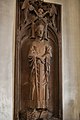
Category:Grabplatte Engelbert II (Bonner Münster)
Jump to navigation
Jump to search
| Camera location | | View all coordinates using: OpenStreetMap |
|---|
Media in category "Grabplatte Engelbert II (Bonner Münster)"
The following 3 files are in this category, out of 3 total.
-
 2016-09-26-bonn-muensterbasilika-innenansicht-engelbert-der-ii-01.jpg 3,456 × 5,184; 5.64 MB
-
 2017-09-24-Bonn-Münsterbasilika-Innenansicht-Engelbert-II-01.jpg 3,456 × 5,184; 6.85 MB
-
 BOMUE3.jpg 541 × 960; 189 KB


