Category:Grade II listed buildings in South Kesteven District
Jump to navigation
Jump to search
Subcategories
This category has the following 33 subcategories, out of 33 total.
B
- Bede House, Belton (4 F)
- The Coach House, Belton (3 F)
- Belton Old School (7 F)
- Belton Pump and Milestone (9 F)
- Bridge Cottages, Greatford (7 F)
C
- Caythorpe Churchyard Cross (2 F)
- Corner House, Allington (2 F)
- Allington Village Cross (4 F)
F
G
- Greatford Hall (3 F)
- The Gregory Arms, Harlaxton (4 F)
H
- Harlaxton Village Cross (7 F)
- The Houblon Inn, Oasby (8 F)
I
- Ivy Lodge, Manthorpe (2 F)
K
- Kenulph's stone (3 F)
M
- May Tree House, Harlaxton (2 F)
N
- Normanton pump and milestone (3 F)
O
- The Old School, Manthorpe (2 F)
P
- Pump House, Manthorpe (3 F)
S
W
- Westgate Hall, Grantham (6 F)
Media in category "Grade II listed buildings in South Kesteven District"
The following 56 files are in this category, out of 56 total.
-
 Ancaster cross and Launde House.jpg 1,280 × 938; 298 KB
-
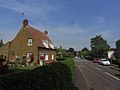
 Estate cottage at Belton, near Grantham (geograph 2161618).jpg 1,024 × 768; 169 KB
-
 Belton - Dial Cottage (geograph 2422455).jpg 1,600 × 1,200; 669 KB
-
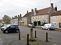
 Belton Estate village houses - geograph.org.uk - 130254.jpg 640 × 427; 78 KB
-
 Belton Forge - geograph.org.uk - 123004.jpg 600 × 450; 124 KB
-
 Belton House Dutch garden steps.JPG 5,184 × 3,456; 10.69 MB
-
 Belton House ha ha.jpeg 4,608 × 2,592; 5.66 MB
-
 Belton village estate cottage - geograph.org.uk - 130258.jpg 640 × 427; 91 KB
-
 Churchyard cross - geograph.org.uk - 904725.jpg 427 × 640; 108 KB
-
 Caythorpe - former school (geograph 4056235).jpg 1,600 × 1,212; 568 KB
-
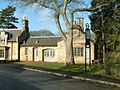
 Caythorpe - South Lodge (geograph 4061502).jpg 640 × 480; 128 KB
-
 CAYTHORPE COURT.jpg 3,952 × 2,653; 6.55 MB
-
 Church Farmhouse (geograph 4422949).jpg 1,024 × 683; 344 KB
-
 Conduit house in Belton Park.jpg 4,608 × 2,592; 5.81 MB
-
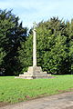
 The market cross at Corby Glen, near Bourne, Lincolnshire (geograph 4560065).jpg 1,783 × 1,180; 779 KB
-
 Cottage, Church St, Denton, Lincs (geograph 4282232).jpg 1,024 × 768; 135 KB
-
 Cottages in Church Lane, Caythorpe (geograph 2445848).jpg 1,024 × 768; 218 KB
-
 Court Leys Farm (geograph 4422956).jpg 1,024 × 683; 238 KB
-
 Denton churchyard cross.JPG 5,184 × 3,456; 8.83 MB
-
 Dial Cottage - geograph.org.uk - 1886332.jpg 640 × 426; 89 KB
-
 Dial House, Belton, Lincs. - geograph.org.uk - 4775423.jpg 3,949 × 2,294; 1.74 MB
-
 Dogs memorial in Belton House gardens.jpg 4,608 × 2,592; 6.24 MB
-
 Geograph-937243-Remains-Of-Cross-In-Edenham-Churchyard-by-Mark-Hurn.jpg 640 × 480; 110 KB
-
 Old stone cross at Edenham, near Bourne, Lincolnshire (geograph 4428635).jpg 2,551 × 1,732; 1.9 MB
-
 Elizabethan gateway - geograph.org.uk - 335362.jpg 640 × 427; 125 KB
-
 Fulbeck village cross.JPG 3,456 × 5,184; 10.21 MB
-
 Ancient Cross - geograph.org.uk - 166840.jpg 640 × 427; 105 KB
-
 Grand bus shelter - geograph.org.uk - 479746.jpg 640 × 427; 105 KB
-
 Heydour House - geograph.org.uk - 139860.jpg 640 × 427; 109 KB
-
 Holly Farmhouse, Pinfold Lane, Marston (geograph 3958354).jpg 1,024 × 768; 179 KB
-
 Hough on the Hill Schoolhouse - geograph.org.uk - 1400557.jpg 640 × 426; 100 KB
-
 Hough-on-the-Hill 10.JPG 2,592 × 1,944; 1.61 MB
-
 House on Washdyke Lane, Belton - geograph.org.uk - 3210297.jpg 2,892 × 1,980; 3.49 MB
-
 Little Ponton Hall (geograph 5024784).jpg 3,872 × 2,592; 5.49 MB
-
 Londonthorpe estate cottages - geograph.org.uk - 130331.jpg 640 × 427; 81 KB
-
 Long Bennington churchyard cross.JPG 5,184 × 3,456; 10.75 MB
-
 Main Street, Belton, Lincs. - geograph.org.uk - 4775517.jpg 4,002 × 2,158; 1.59 MB
-
 Market Cross - geograph.org.uk - 675715.jpg 480 × 640; 121 KB
-
 Marston churchyard sundial.JPG 3,456 × 5,184; 7.87 MB
-
 Marston Thorold's Charity Church Of England School.jpg 640 × 480; 158 KB
-
 Oasby House - geograph.org.uk - 139878.jpg 640 × 427; 79 KB
-
 Overgrown gates at Denton Manor (geograph 2170806).jpg 1,024 × 768; 396 KB
-
 Tithe Barn, Sempringham Abbey Churchyard - geograph.org.uk - 549940.jpg 628 × 465; 109 KB
-
 St.Gilbert's well - geograph.org.uk - 528617.jpg 640 × 427; 94 KB
-
 St.Mary's church - geograph.org.uk - 1209759.jpg 640 × 426; 65 KB
-
 Stamford-Castle-by-Richard-Croft.jpg 640 × 427; 95 KB
-
 Stoke Rochford Park bridge.JPG 4,608 × 3,456; 3.37 MB
-
 Stoke Rochford village pump.JPG 3,456 × 4,608; 3.44 MB
-
 The Blue Lion - geograph.org.uk - 280308.jpg 640 × 427; 50 KB
-
 The Brownlow Arms, Hough-on-the-Hill (geograph 2906801).jpg 640 × 480; 68 KB
-
 The gates and lodge to Caythorpe Court - geograph.org.uk - 2442941.jpg 1,024 × 768; 188 KB
-
 The Grange - geograph.org.uk - 479735.jpg 640 × 427; 99 KB
-
 The Waggon and Horses, Caythorpe - geograph.org.uk - 758044.jpg 640 × 480; 99 KB
-
 Washdyke Lane, Belton, Lincs. - geograph.org.uk - 4775439.jpg 3,404 × 2,700; 1.95 MB
-
 Washdyke Lane, Belton, Lincs. - geograph.org.uk - 4775484.jpg 3,066 × 2,467; 1.39 MB
-
 Well head in Belton Park.jpg 4,608 × 2,592; 5.7 MB

.jpg)
.jpg)


.jpg)
.jpg)

.jpg)

.jpg)
.jpg)
.jpg)
.jpg)


.jpg)


.jpg)


.jpg)


.jpg)


.jpg)


